Sheltowee Trace Challenge 2019
Hike 1- Northern Terminus to Morehead

One of the thousands of turtle blazes on the Sheltowee Trace.
Saturday, January 12, 2019
I was up early and headed to Morehead in the snow to hike the Sheltowee Trace. I left Jackson about 6:45 with the roads covered. The roads were in pretty good shape until I got to Rowan County. They had not been scraped and worked, but I saw a state snowplow sitting beside the roadway in Rowan County. The broken-down truck combined with greater snowfall the farther north I traveled helped explain the rough roads.
I made it to the Morehead Convention Center and parked and then finalized my pack by clipping my inReach mini communicator and GPS to the strap and loaded the backpack into a vehicle for the ride out to the Northern Trailhead. We left Morehead at 8:27 a.m. The trip took about 35 minutes because the road out there was in even worse shape than the main roads.
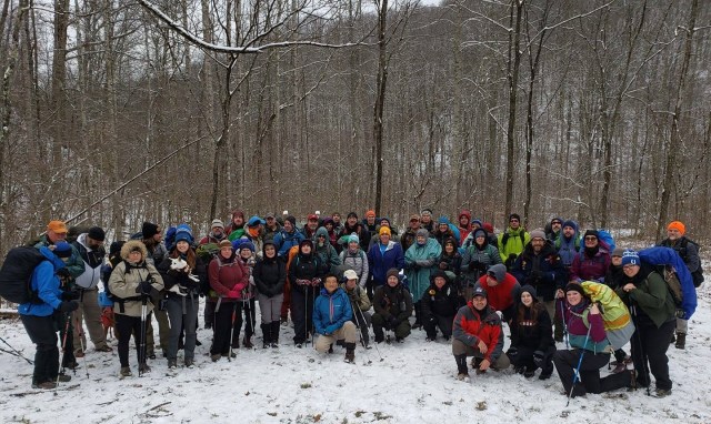
Alpha Team preparing to leave the Northern Terminus.
We arrived at the trailhead at 8:59 a.m. and waited until all of the hikers and vehicles arrived. By the time everyone got there and we went through our orientation and sexual harassment training (sad but true), we left the trailhead at 9:28 a.m., crossed the creek, and hiked up the hill to the ridge line above. The sun was no where to be found and those low, snow-bringing clouds hung overhead. The temperature was in the upper 20s, but there was very little wind.
I walked through the day with different people but worked my way forward of the pack. I was surprised to see that my pace was quite a bit faster than others. I took advantage of those stopping to take off jackets, get a drink or snack, or more often to rest along the way. I walked all day and did not stop for a lunch, snack, or rest.
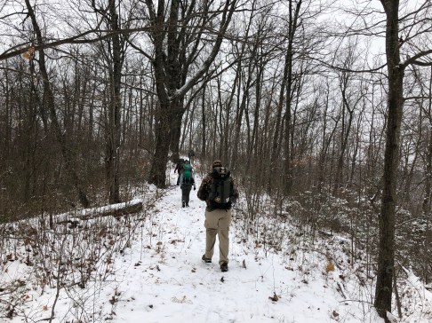
A snowy ridge walk to our Dry Fork camp spot.
I arrived at the Clark family farm at Dry Fork at 12:40 p.m. having covered nearly ten miles. It snowed, rained, and sleeted during the day and occasionally did all at the same time. The weather was not bad as the temperature rose to around 32-33 late in the day but started down again once the sun dropped below the hills.
We actually out walked Steve Barbour who was driving and when we arrived there was no firewood and no fire. He was supposed to be at the Clark Family Park shelter to start a fire and have it going when we arrived. His schedule, however, is totally reliant on the pace and condition of the hikers participating in the challenge. He could be called away by a lost hiker, an injured hiker, and a myriad of other reasons. He made it to the shelter about a half an hour after we got there but quickly had a roaring fire. The firewood was scrap from a kennel in Frankfort that he was helping to build named the Tin Woof.
We stood around the fire and ate cookies and snacks while we drank hot chocolate until well into the night. We laughed and told stories and had a very enjoyable night. It snowed hard and fast for several periods during the night and we got an additional inch or so of snow. I enjoyed the time talking with people that I met and they were from a varied places, occupations, and pasts. I really enjoyed talking and laughing with Troy Hutchinson with whom I had reenacted more than 20 years ago.
The Sheltowee Trace Association provided some soup and drinks for us but I did not eat and vegetable soup or any of the things they brought except some hot chocolate, Oreos, and some tortilla chips. In all a very enjoyable day and an enjoyable night around the fire.
I needed to slow my hike pace down to better enjoy the trip, but I had already hiked this section several times and just chose to roll on. I waited until about 9:00 p.m. to put up my tent because I did not want the snow to cover it. I finally climbed into my sleeping bag about 9:24 p.m. and was comfortable for most of the night. It snowed and occasionally poured rain and sleet during the night. I did wake up around 4:00 a.m. and just decided to stayed up until I was ready to pack up and leave.
Sunday, January 13, 2019
I was up and packing about 6:45. I got dressed and walked over to stand around the fire to warm up a little bit. I talked a little bit and ate a bagel from my pack. I was ready to go about 7:10 a.m. or so, but it was still very dark, wet, and slick. I waited until 7:34 a.m. before I left. Troy walked with me up the hill and across the top of the ridge and down to Holly Creek.
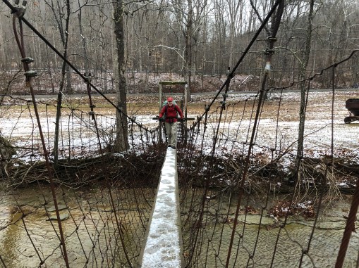
Troy crossing a icy swinging bridge over Holly Fork.
We crossed a snow-covered road and ventured over an ice-covered swinging bridge to the creek bottoms on the other side. We separated, and I continued on from there. The trail turned left at the end of the field, and I started the steepest portion of this section of the weekend’s hike. The Trace dips into and out of a usually dry stream bed as it snakes its way to the base of a steep and very slick rise that appears to have been a forest service access road at one time. A final dip into the creek, brings the hiker to a half-a-mile of enjoyment for the uphillers until you reach a graveled road near the top of the mountain.
There was a bit of joy when I realized that the climb was nearly over when, as I neared the top, I could hear the noise of passing vehicles on Interstate 64. The gravel road parallels the interstate and after a relatively flat hike. A left turn onto a paved roadway took us over I-64, one of the first major milestones in the Sheltowee Challenge.
I crossed the bridge and immediately turned right onto a gravel service road and walked (or trudged) for a long, 6-mile road walk. At the end of the walk, the trail started a series of into the woods and out of the words jaunts that kept us always near the road but on the ridge tops. Near the end of the graveled roadway, a turn into the woods left that unpleasant walk behind and the Challenge reentered the woods.
The terrain gets no better, as this section brings you closer to Morehead, but you will pay for every step with energy and stamina as the trail enters a seemingly never-ending set of ups and downs. There is hope that come with some early glimpses of a body of water in the distance through the trees. Down to the trail to Eagle Lake brings one a nice little wetland study area and a shaded hike around the lake and onto the campus of Morehead State University. The last time I hiked this trail it was very hot and difficult with temperatures in the mid to upper 90s. This weather is much better.
White turtles painted on the sidewalk and street guide the hiker through the campus and onto Main Street near Dairy Queen. I walked down Main Street and the last little bit with a hiker who was a cancer researcher from the Markey Cancer Center in Lexington. We both finished the hike first and walked into the parking lot at the same time.
I had a great weekend and really enjoyed the trail. I was reminded how easy and pleasant the walk in the first portion of the trail is. Then I was reminded that the challenge portion of this section is the second half from Holly Creek to Morehead due to the elevation change.
I was very hungry and decided to drive down to Dairy Queen to get something to drink and wait for my wife and kids. The rain had switched back to snow by then and it was windy and cold. The kids were moving back into their Morehead dorms, and I waited for them to drive over. We dropped the kid’s stuff off at the dorms and headed to Cracker Barrel for dinner. We dropped them off and headed home.
I had a great time and really enjoyed the Sheltowee Trace Challenge and the people. I am looking forward to the hike in February. There were no worries or stresses this weekend and all was quiet. The peace makes the hike well worth the time and effort.
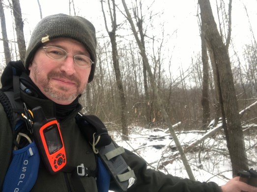
Bookie on the Sheltowee National Recreation Trail somewhere between the Northern Terminus and Dry Fork.
Find out more about the trail and the Sheltowee Trace Association here: Sheltowee Trace Association.