
By Stephen D. Bowling
Thanks to a falling tree, our schedule for 2023 has slightly changed. We have skipped the hike through the Red River Gorge for now, but we will return when the bridge over the river is repaired.
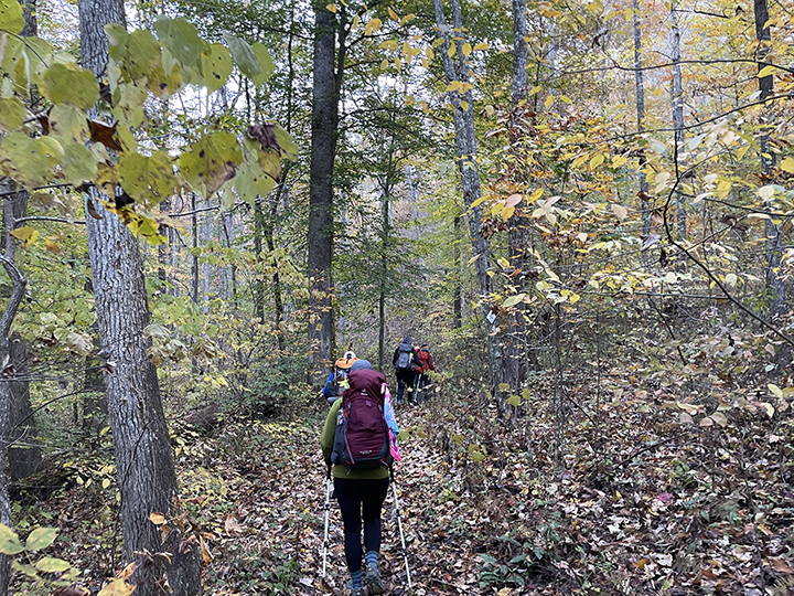
Our hike in May will feature miles of forest trail or single-track hiking, especially as we wind our way around Cave Run Lake. We will camp at Stoney Cove near the end of the dam at Cave Run, and then it’s up and over the hill into Morehead. As we hike through this section, there are plenty of sites to see (including the beautiful Furnace Ach).
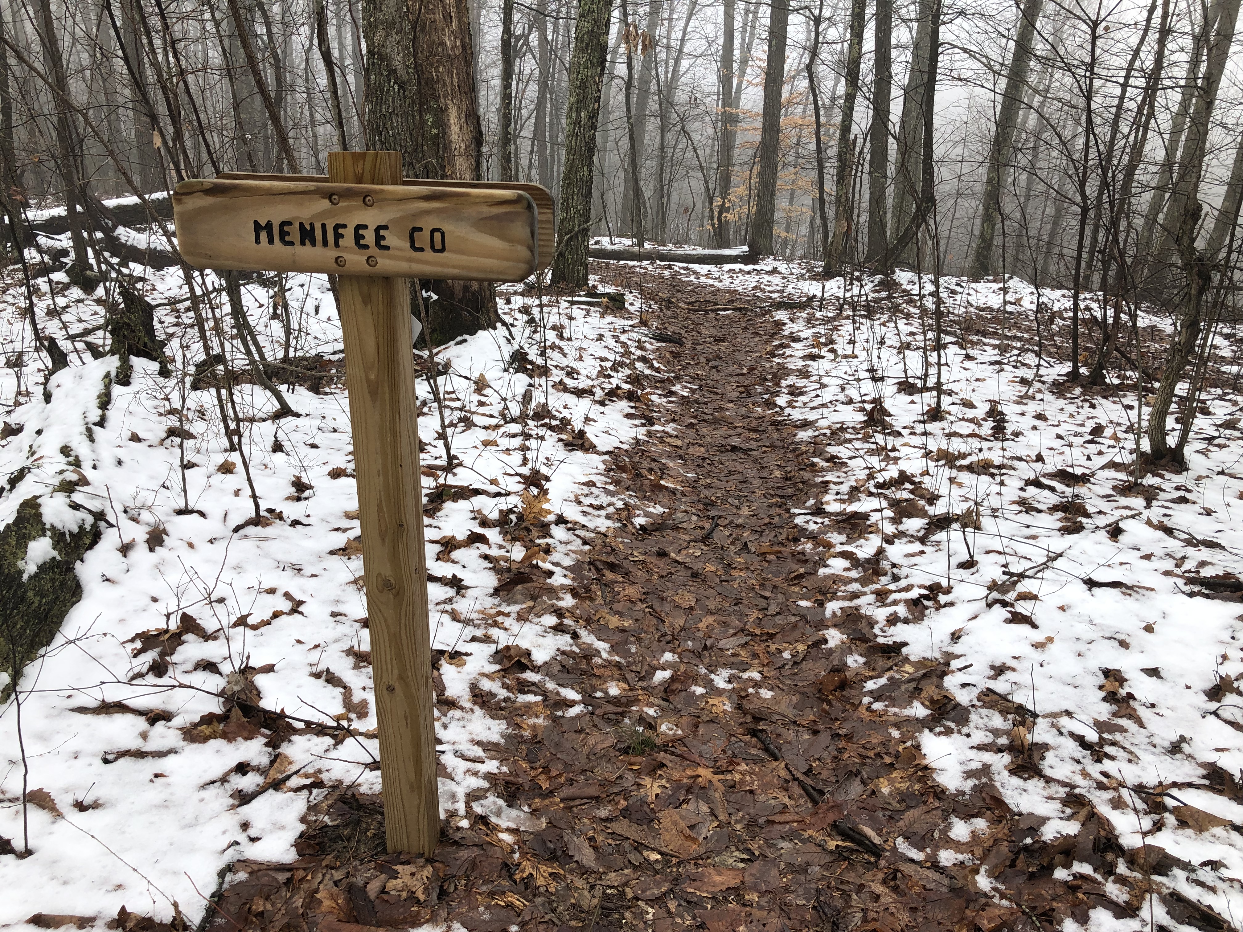
Menifee County

Our hike begins in Menifee County as we skip the Red Rover Gorge section. Menifee County was created by an act of the Kentucky State Legislature on May 29, 1869. Named in honor of Congressman Richard Hickman Menefee, the county’s spelling was slightly changed due to an error by a state legislator.
Menifee County covers 206 square miles, of which 2.3 square miles are water, and remains one of the remaining Kentucky Counties where alcohol sales are prohibited. Frenchburg serves as the county seat and was founded in 1869.
Menifee County is home to 6,113 residents, according to the 2020 United States Census.

The city was once the home of the Frenchburg School. Opened in 1909 by the United Presbyterian Church as a mission school, the sprawling campus (six primary buildings on 12 acres) once housed children and orphans. The campus included a gymnasium, dormitories, a hospital, an industrial training center, and other buildings. A college operated here for a short time. The beautiful Colonial, Classical Revival, and Georgian Revival Buildings have been abandoned and are now falling to the ravages of time and a recent arsonist.
Beaver Creek and the Red Barn
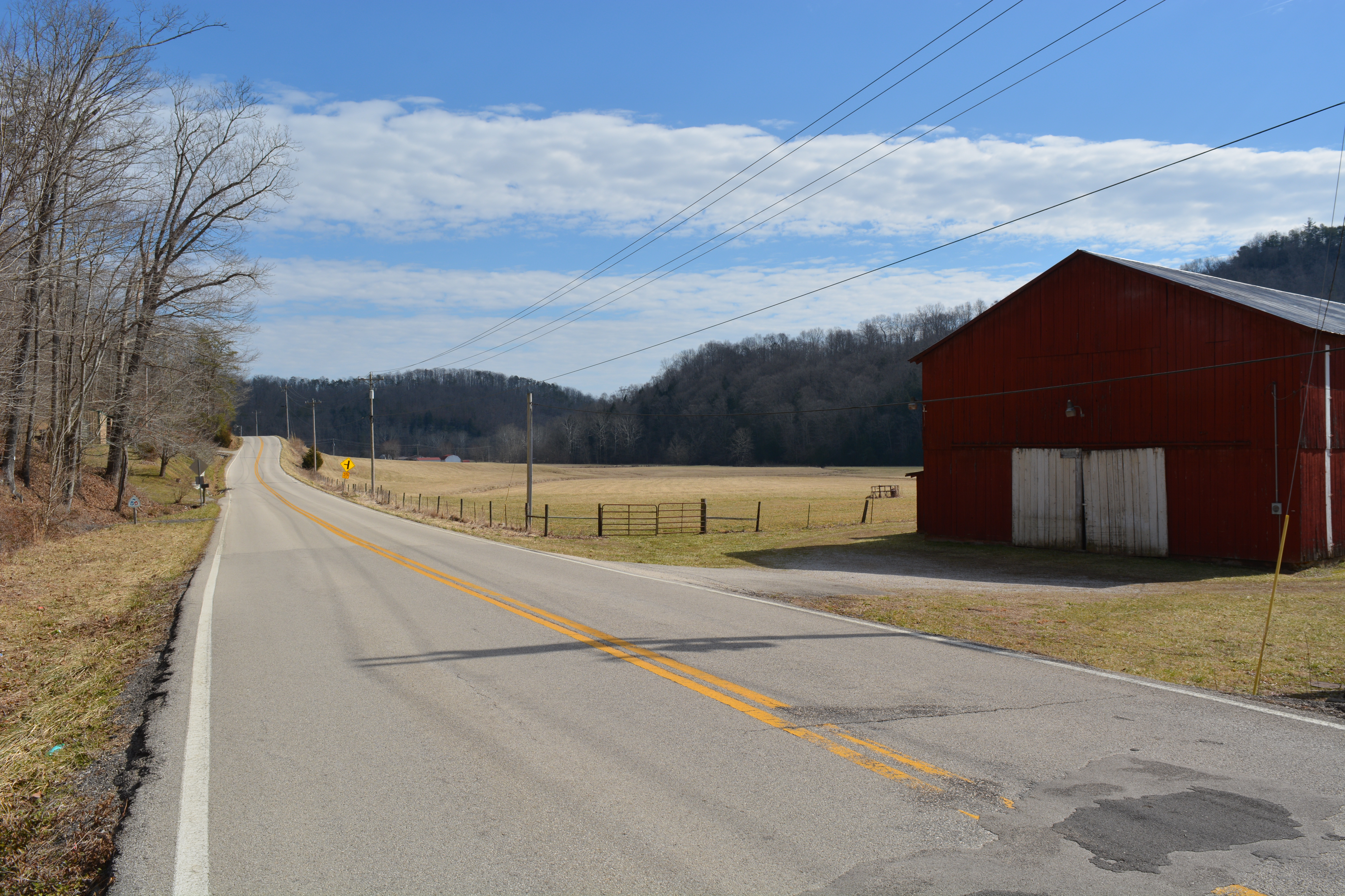
Our May hike begins at the famous Red Barn on Highway 1274. From this point, we will climb up Halfway Branch and move north across a 9.1-mile ridge walk hike to Clear Creek. The Red Barn on Highway 1274 is located on the banks of Beaver Creek. Beaver Creek drains a large portion of the Menifee County watershed and empties into the Licking River near the corner of Bath, Menifee, and Rowan Counties. The Trace south from this point follows the roadway for 1.4 miles before it turns onto Clifton Road. Heading west for .79 miles, the hiker enters the city of Frenchburg, county seat of Menifee County. A major resupply point for through hikers is the local IGA (1.25 miles from the Red Barn) in Frenchburg.

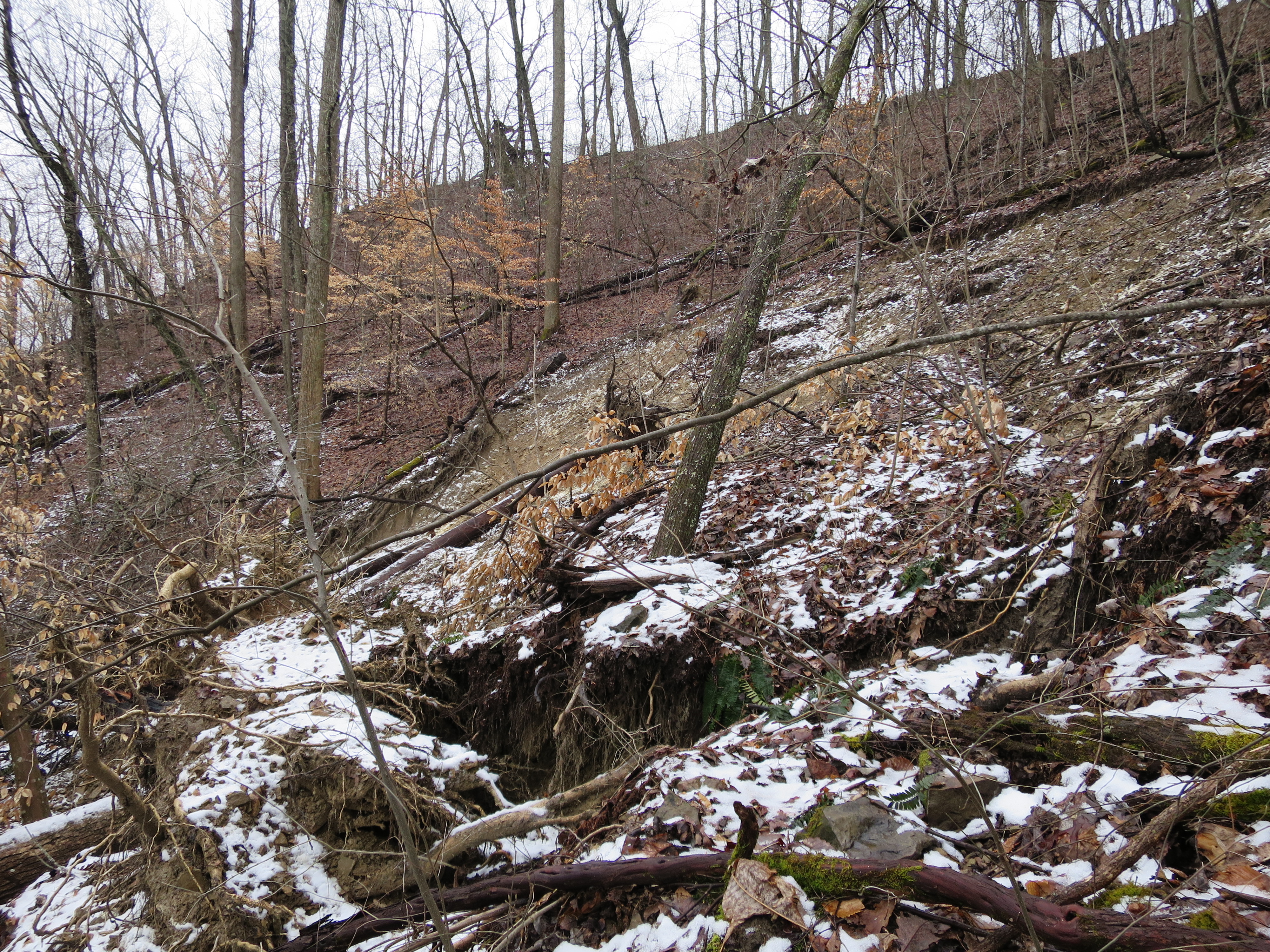
Gravel Pit
Near the head of Stonequarry Branch and Halfway Branch, hikers will cross an area of exposed pinkish-red stone known as the Gravel Pit. In the early decades of the 20th Century, stone and gravel were hand-quarried from this area by hand for use on local roadways.
As late as 2020, gravel and materials were being taken from the valley below on Stone Quarry Branch. A large lake, created by the stone quarry operation has come under some scrutiny in the last two years as some local residents worry about the dangers of the impounded water. Some area residents have been working to remove the lake, but it remains as part of the visible signs of the huge stone quarry that operated here.
James T. Mullins Farm
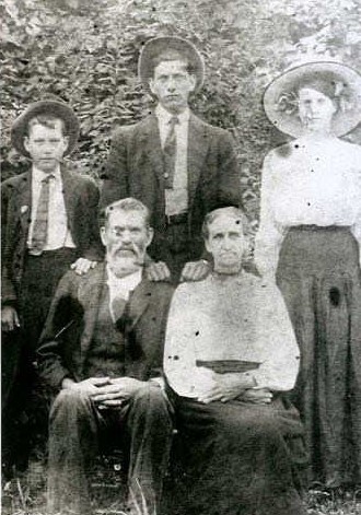
It is important to remember the people who owned the land before the Daniel Boone Forest was established or who own the land privately and all those who allow hikers to cross their property. After a few small climbs and walking across a ridgeline, hikers will drop over the hillside onto the former property of James T. Mullins.
As we hike down the hill to the gravel road on Richardson (formerly Ratliff) Branch, we cross the property that he owned during the Civil War. James Mullins was born in Menifee County in 1849. The steep hillsides that you hiked down were once covered in a large cornfield and were pastures for his horses. A veteran of the Confederate Army, he raised his children on this farm which is still owned by Mullins’ descendants.
Mullins married Mary Ann Lawson and lived on this farm until his death in 1912. He is buried about 100 yards from the trail near the fallen chimney and rotting remains of this home.
The family owns the bulk of the farm and graciously permits the Sheltowee Trace to cross the land. Please respect these private landowners who support the STA and the National Forest Service efforts.

Bath to Menifee
After leaving Richardson Branch Road, the Trail climbs uphill for .64 miles and leaves Menifee County, crossing into Bath County. A small wooden sign welcomes hikers to the county.
Legislators approved the creation of Bath County in 1811. In 2020, the county had a population of 11,591. The county was named for the natural salt springs that were used as medicinal baths from the early days of settlement.
The three largest communities in Bath County are its county seat, Owensville, and the communities of Salt Lick and Sharpsburg.
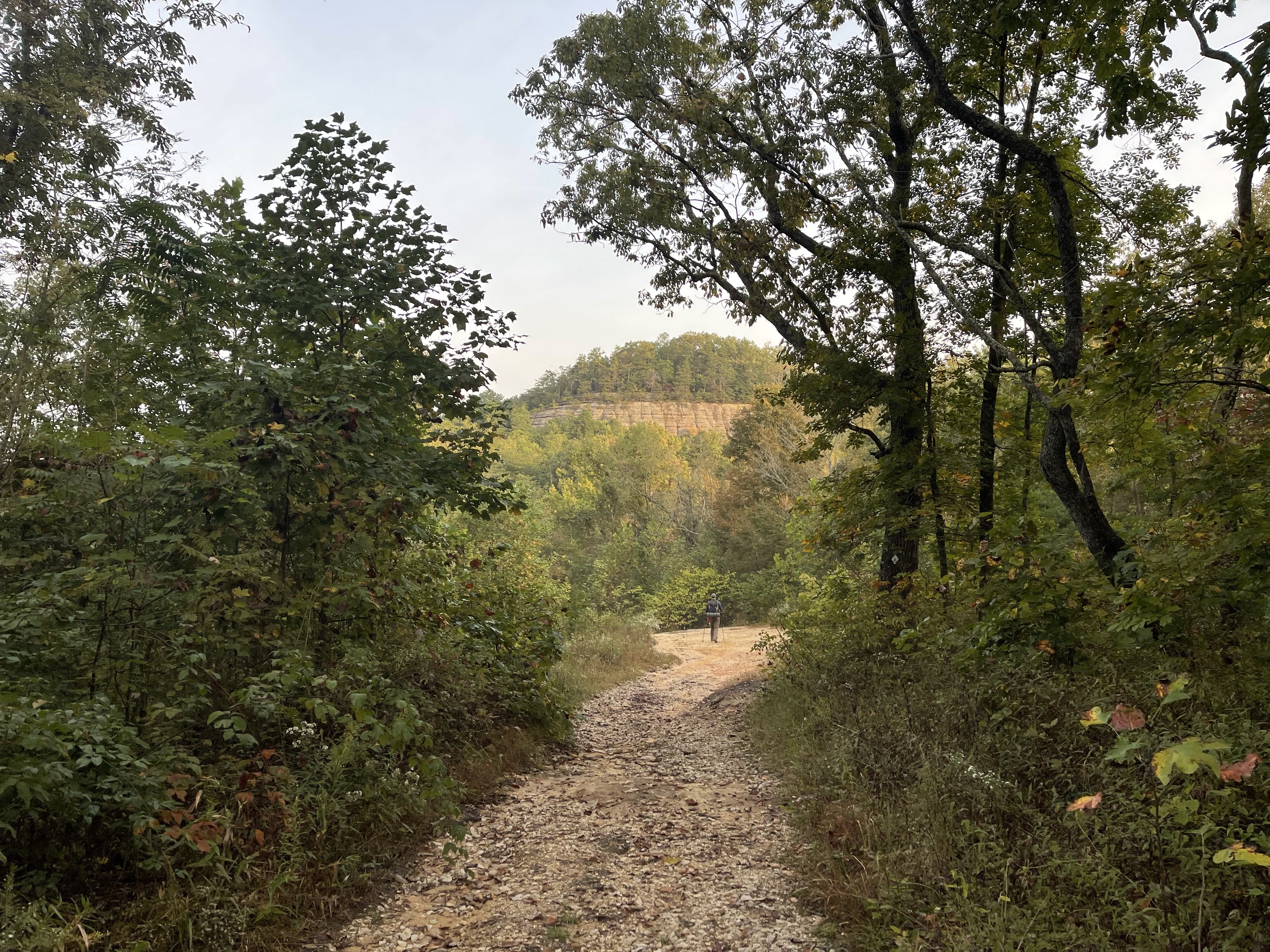
Furnace Arch
Furnace Arch is a natural opening just 20 yards off the Sheltowee Trace between Clear Creek and Highway 1274. The fifty-foot opening in the low gap between McDale Branch and Glady Hollow is one of the largest arches hikers will pass during the 2023 Hiker Challenge.

The opening was created long ago as wind and moisture on this ridge weathered away and joined two rock shelters to create this large opening in the red sandstone. Take the time to climb the 20 yards up to Furnace Arch and enjoy one of the most beautiful spots along the northern section of the trail. If you are hot from climbing the hill, a cool breeze usually blows through this opening to cool you down.
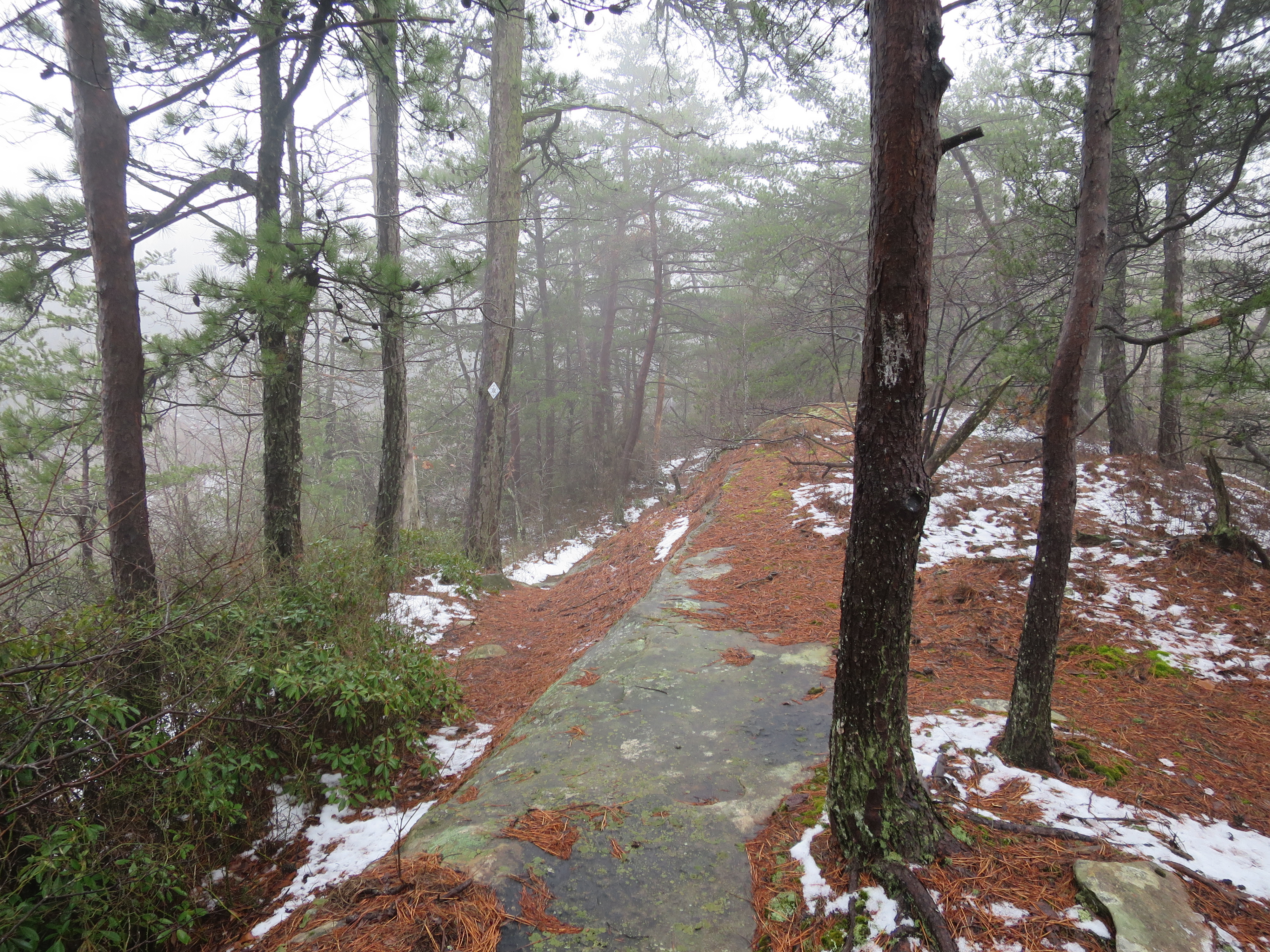
Mount Misery
On February 28, 2019, the United States Forest Service closed and rerouted a large section of the Sheltowee Trace. A landslide destroyed much of the trail from Clear Creek to the ridge near the Carrington Rock Trail. An emergency bypass was created that routed the Trace around the slide and near the Clear Creek Shooting Range. With the approval of the National Forest Service and several months of work by the members of the Cave Run Chapter of the Sheltowee Trace Association, a new path was cleared up the mountain to connect with the old trail.
The new path created a steep and challenging climb with an elevation gain of nearly 500 feet in half a mile if you are headed south. Luckily for the 2023 Challenge hikers, we are headed North and will go down rather than up. The new section of trail has been given the loving moniker of “Mount Misery” by many southbound hikers who have made it to the top. Although we are headed down this hill, use extreme caution if it is wet. Take your time and climb down slowly. Think about how beautiful Furnace Arch was; everything will be much better. Remember- this is the Sheltowee Trace Hiker’s Challenge.
Clear Creek Campground

At the foot of Mount Misery, a shallow creek crossing lies ahead. After crossing the creek, hikers enter the Clear Creek Campground. The campground operates between the 3rd Friday in March and December 31 each year. Camping sites can accommodate tent camping and RVs and are available on a “first come, first serve” basis.

The Trace passes through the Clear Creek Campground, crosses the Clear Creek Road (also known as the Zilpo Road), and reenters the woods.
Clear Creek Furnace
After crossing the creek at the foot of Mount Misery and walking through the Clear Creek Campground, the ruins of the Clear Creek Furnace are located a short walk to the left. Beginning in the late 1700s, Kentucky was one of the leaders in iron production in the United States. Several small furnaces on Clear Creek produced a limited quantity and quality of iron until production ceased in 1857 and remained closed during several economic downturns and the Civil War. In 1873, the furnace was rebuilt and renamed Bath Furnace.
William S. Allen and W. A. Lane operated the furnace from 1873 until its last “blast” in 1875. In 1874, Bath Furnace smelted 1,339 tons of pig iron. Like numerous other Kentucky furnaces, Clear Creek Furnace used charcoal for fuel and was purposefully constructed on a stream to take advantage of steam power.
Limonite, an abundant iron ore found in Kentucky, was frequently mined and used at this location. This specific ore was ideal as it produced an extremely durable iron. The Bath (Clear Creek) Furnace processed ore that was eventually turned into wagon wheels and railroad car wheels. The Clear Creek or Bath Furnace still stands today and is one of the best-preserved nineteenth-century Kentucky iron furnaces.
Buck Branch Trail
Leaving the campground and crossing Clear Creek Road, the Sheltowee Trace joins the Buck Branch Trail. The Sheltowee Trace and the Buck Branch Trail share 1.6 miles of trail tread as you ascend from the peaceful valley filled with beautiful moss and huge trees to the ridgetop above. This area is named for Buck Creek Hill, a high peak that stands nearby at 1,188 feet above sea level. Gunshots are often heard in this section of the trail as the Clear Creek Shooting Range is less than a mile and a half away.
The Buck Creek Trail #118 (not to be confused with the Buck Branch Trail) begins at Clear Creek Campground and spurs off the Buck Branch Tail. After a long climb up the mountain, it crosses the Zilpo National Forest Scenic Byway before connecting with Cave Run Lake Trail #116.
White Tail Management
The Kentucky deer population was at an all-time low in the early 1900s. Several efforts were made to increase the population, including the establishment of “buck only” hunting seasons and the failed effort to introduce non-native red deer. In 1946, the Kentucky Division of Game and Fish initiated a whitetail deer repopulation effort which included trapping, relocation, habitat improvement, and the creation of deer refuges. By the 1950s, the first significant rise in state-wide numbers was reported. Over the next five decades, the Commonwealth became one of the top 5 in total deer production and harvesting states.

The Kentucky Department for Fish and Wildlife and the Corps of Engineers established a series of wildlife study areas in their “working forest” to gauge the impact of the reintroduction of deer to the Clear Creek area. Over the decades since the 1960s, most of these study areas have been removed, but several remain near the Sheltowee Trace along the old Cedar Cliffs Trail. At least one of the wire-fenced study areas still remains, and one of the original signs can be seen beside the trail.
Cedar Cliffs and the Trail

Cedar Cliffs is an area of large limestone outcrops on the top of the hill overlooking Trough Lick Branch, Wolfpen Hollow, and Buck Branch. These limestone pillars contain several smaller arches that are visible from the Sheltowee Trace. This area sits on the Menifee and Bath County border and was used by early settlers as a crossing point from the Clear Creek area to the Lewis Church community.
The National Forest Service created a system of trails along this ridge, including the Cedar Cliffs Trail, Buck Branch Trail, and the Cross Over Trail. The Sheltowee runs concurrently with the old Cedar Cliffs Trail for more than a mile before dropping over onto the Buck Branch Trail.
Caney Creek and Sulphur Branch
There are two major creek crossings on the hike near the headwaters of Cave Run Lake. Hikers will first encounter Sulphur Branch. This normally shallow crossing may require hikers to remove their shoes or get wet feet. A half-mile trail leads to White Sulphur Horse Camp and leaves the Sheltowee Trace between Caney Creek and Sulfur Branch. Do not take this trail but continue north on the Sheltowee Trace and away from any more major water crossings on this hike.

After crossing Sulphur Branch, Caney Creek, the second creek crossing, is less than 0.32 miles from Sulphur. Before the lake was constructed, Caney Creek had three major tributaries: Trough Lick Branch, Hickory Branch, and Sulphur Branch.

Although it is usually shallow, crossing Caney Creek can be difficult during times of high water. The crossing can be chest high with backwater from Cave Run Lake. Hikers are encouraged to find an alternate crossing upstream.
Lake Shore Hike
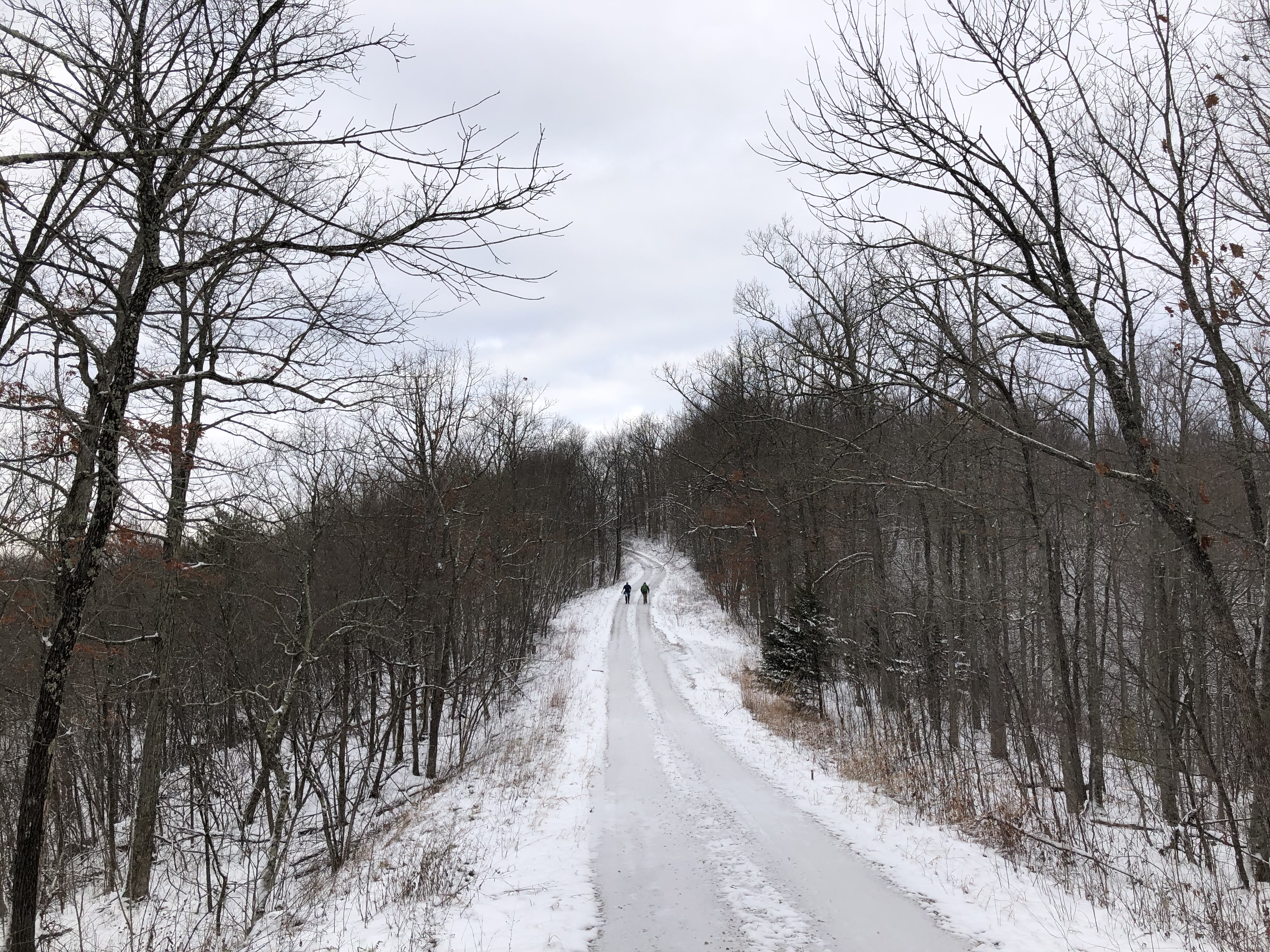
The Sheltowee Trace follows the “ins and outs” of every embayment and tributary that flows into the south side of Cave Run Lake until it reaches Caney Creek. The six miles are only a small portion of the 166 miles of shoreline that the lake has at its summer pool.

The hike offers a variety of beautiful views and lots of wildlife viewing opportunities. Sunrises along the old Caney Loop Trail (now the Sheltowee Trace) are particularly beautiful in the late winter and early spring. This multi-use trail can present mud, ice, rocks, and numerous other hiking challenges, but it is a nice hike. The lakeshore hike passes many culturally significant places, including the site of the old Caney School, which served the children of the area until it was consolidated into the Rowan County School system. Be prepared for some mud and to share this trail with horses and their riders.
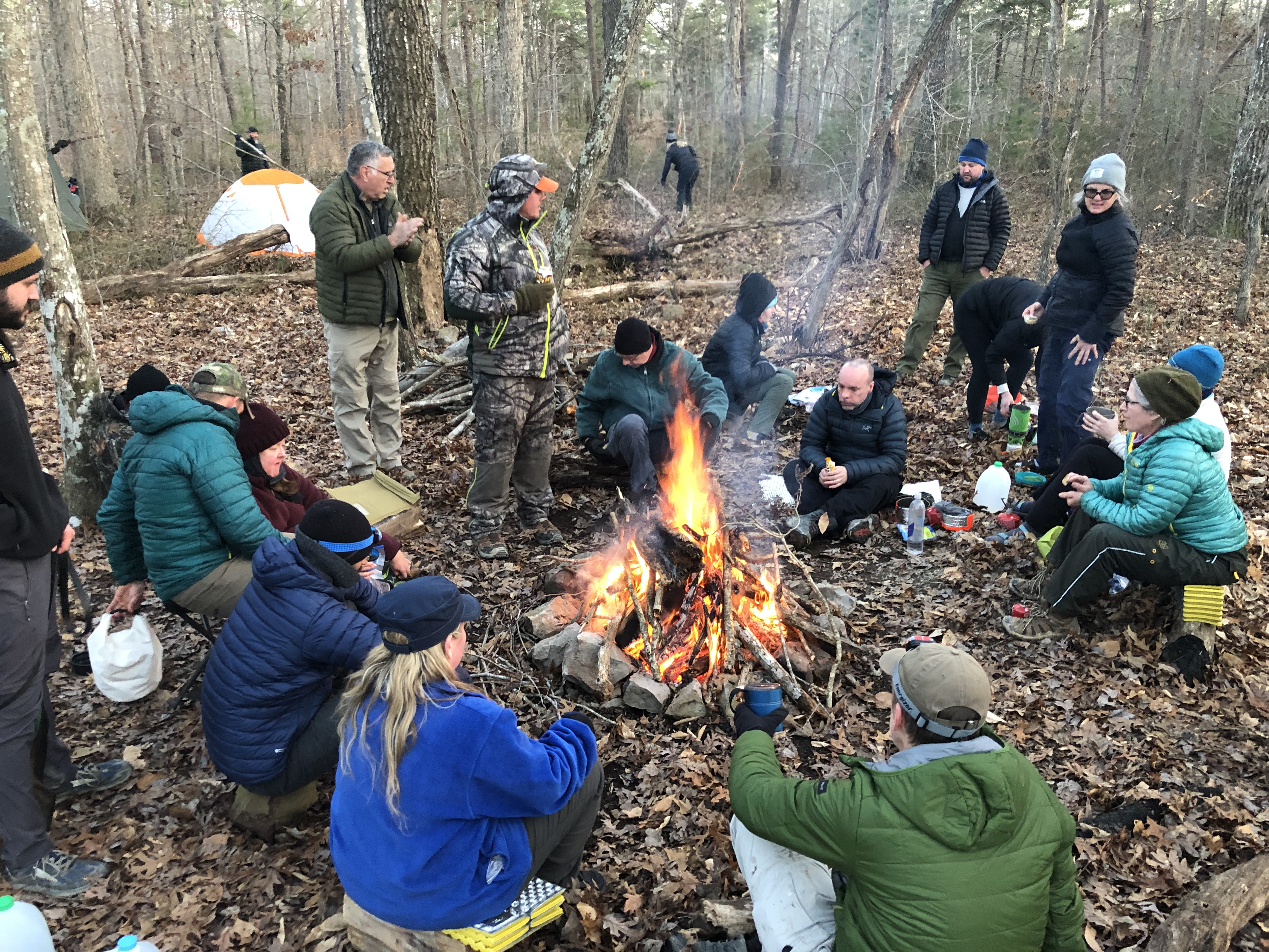
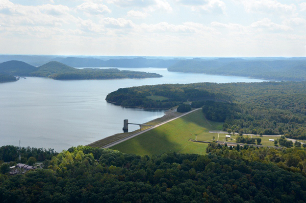
Stoney Cove
At the south end of Cave Run Dam once set the community of Lewis Church. The homes and church were purchased and removed during the building of the lake in 1974. The Corps of Engineers constructed the Stoney Cove boat ramp and picnic area on the shore. The area on the flat at the top of the hill will be our camping spot for the 2023 Hike 5. This relatively flat area drains into Hog Hollow and was a pasture. A large barn once sat near our campsite.
The trailhead at Stoney Cove parking area is accessed by the roadway at the end of the dam. From this trailhead, the Sheltowee Trace National Recreation Trail and the Caney Loop Trail trail both venture into the woods but come together again a few miles from the White Sulphur Horse Camp Trail. From Stoney Cove, the Sheltowee Trace crosses the Cave Run Dam and northward to Morehead.
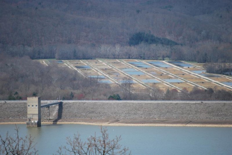
Clark Fish Hatchery

In the distance below the spillway of the Cave Run Dam, the Minor E. Clark Fish Hatchery is home to more than 100 freshwater ponds and comprises more than 300 acres. The hatchery opened in 1972 and is operated by the Kentucky Department of Fish and Wildlife. The complex is the largest “warm-water” hatchery in the United States and produces more than 4 million fingerlings in its 124 acres of water. These small fish are released into streams across the state. The hatchery also focuses on native mussel protection and production.
The large pools are home to largemouth, smallmouth, muskie, walleye, and several other varieties of fish. The pools of fish often make easy targets for predatory and shore-wading birds. Bald eagles are frequent visitors to the area and can be seen circling the pools or in trees along Cave Run Lake. Blue herons, egrets, osprey, and various ducks use these shallow pools to feed. The Clark Hatchery also presents educational programming and offers tours of the facilities. The hatchery grounds are open year-round from dawn to dusk.
Cave Run Lake
The United States Army Corps of Engineers operates Cave Run Lake as a recreational and flood control impoundment. The restrained waters of the Licking River created this 8,270-acre lake. During normal operations, the spillway released more than 8,000 gallons of water per minute.

The Cave Run Dam project was completed in 1974 for $83 million. The dam is 173.6 miles upstream of the mouth of the Licking River, which empties into the Ohio River near Covington. The project flooded and forced the relocation of several communities, including Lewis Pond, Zilpo, Warix, Yale, and New Alfrey.
Cave Run Lake is 8,270 acres and 48.1 miles long at the summer pool. The winter draw-down is approximately 6-8 feet cropping the lake level to 724 feet. During the winter months, the lake has 7,390 surface acres of water. There are 166 miles of shoreline when at summer pool and more than 50 miles of navigable water.
Cave Run Lake has two public marinas: one at Scott Creek and the second at Longbow. Both are open year-round and offer a variety of amenities. The Corps of Engineers provides lake access and boat launching via 11 boat launching ramps on the lake and one in the tailwaters.
Various fish are found in these waters, including sunfish, largemouth bass, smallmouth bass, stripers, catfish, and especially muskellunge. Cave Run Lake is known as the “Muskie Capital of the South.”
Rowan-Bath County Line
Twenty feet from the North end of the Cave Run Dam, hikers leave Bath County and enter Rowan County). The transition is without fanfare, and most hikers are too mesmerized by the beautiful views to pay any attention to the sign marking the municipal boundary change.
Rowan County was created by the Kentucky Legislature in 1856 from parts of Fleming and Morgan Counties. Named for Senator John Rowan, the county is home to 24,662 as of 2020. Rowan County is considered “moist” in a state that permits local option votes to determine the legality of alcohol sales. The City of Morehead permits alcohol sales within its boundaries, but the county does not allow sales in any form. Thirty-five of Kentucky’s 120 counties are considered moist.
Rowan County is one of the fastest growing counties in the state thanks to the Morehead State University and its proximity to Interstate 64.
Cumberland Ranger District Office
The Sheltowee Trace National Recreation Trail now passes beside the Cumberland Ranger District office just before crossing Highway 801 since the trail was rerouted several years ago. The office and field staff of the Cumberland District oversee the operations of the northern section of the Daniel Boone National Forest, including The Red River Gorge, the Clifty Wilderness, and Cave Run Lake.

The office has an interpretive center where hikers can learn more about the mission of the National Forest Service and enjoy the exhibits about the land they manage. They also have restrooms- indoor restrooms when they are open.
Amburgey Rocks

By taking a quick 0.3-mile hike on a side trail from the Sheltowee Trace and Forest Road 964, Challenge hikers can climb to the top of Amburgey Rocks to view the area. To access the top, follow the unmarked user trail to the back of the rock and make your way up the separation of the rock via a moderate trail. The top of the Amburgey Rocks is approximately 1,004 above sea level. The large crevice on the side of the rock is the only way to climb to the top of this large sandstone monolith. From this vantage point, Morehead, Becky Branch, and the Triplett Creek Valley can be seen in the distance through the trees.

Another path to the right after leaving the Sheltowee Trace takes visitors to a better view of the valley a hundred yards at the end of a point, but it is on private property. While not as popular as the nearby Lockege Rock, the Amburgey Rocks are free of the garbage and graffiti from years of abuse at Lockege Rock. Take a few minutes to climb to the top and enjoy the view during the early spring or late fall when the leaves are not on the trees. This sandstone pillar is one of the escarpments that comprise the Amburgey Rocks. Four additional outcrops crown the long ridgetop that runs from here northeast toward Morehead.
Limestone Knob
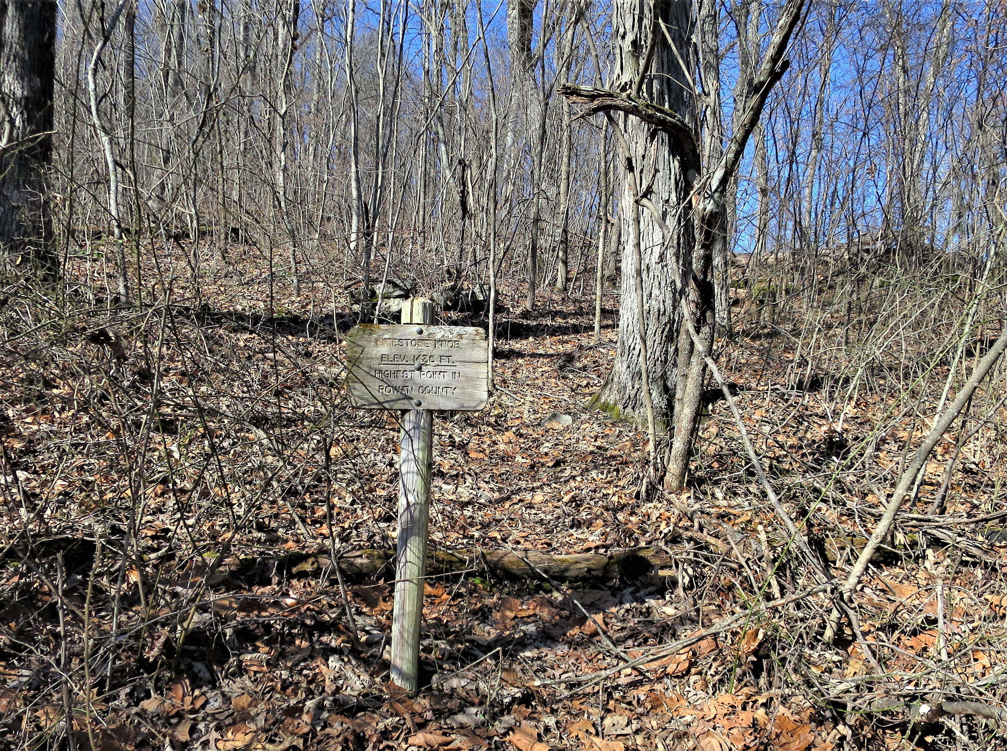
The Sheltowee Trace will pass just below the peak of Limestone Knob. A short side trail leads to the top of this “small rise.” At 1,435 feet (434 meters), Limestone Knob is the highest point in Rowan County. The viewless summit is accessible via a short trail that is maintained by the Cave Run Chapter of the Sheltowee Trace Association. Cranston Mountain, nearly 1.8 miles away, comes in second in Rowan County at 1,420 feet above sea level.
Two-Wheeled Hikers
After leaving Amburgey Rocks, the Trace uses and parallels the gravel Forest Service Road known as Lokeegee Road. This section is also known as the Limestone Bike Trail #109. A series of side trails labeled #109A and #109B will leave the Sheltowee Trace and head off into the woods. Do not take these side trails unless you want to add 5-6 miles to your hike. Be aware of bikers and yield the right of way to them, especially on long climbs.
Clearfield, Kentucky, 41303
Clearfield, Kentucky, is a small town that has nearly been absorbed into the city limits of Morehead. The small community, which sits on the banks of Dry Creek and Mill Branch, boasts a post office and a new Dollar General store. In time, this small city was a thriving industrial center with several manufacturers and a population of nearly 1,000.
Dixon Clack established a sawmill in this area in the mid-1800s and employed hundreds in his mill. By 1905, a large timber company from Pennsylvania purchased the area and laid train tracks into the countryside to bring logs to the large mill at this site. The Post Office was established in 1908.
The Clearfield Lumber Company operated at several mills here from 1905 until 1925 and sold coal and sawn lumber. When larger hardwood trees became harder to find, Clearfield Lumber sold the property, and a new company changed the production from lumber to bricks, tiles, pipes, and other clay products.
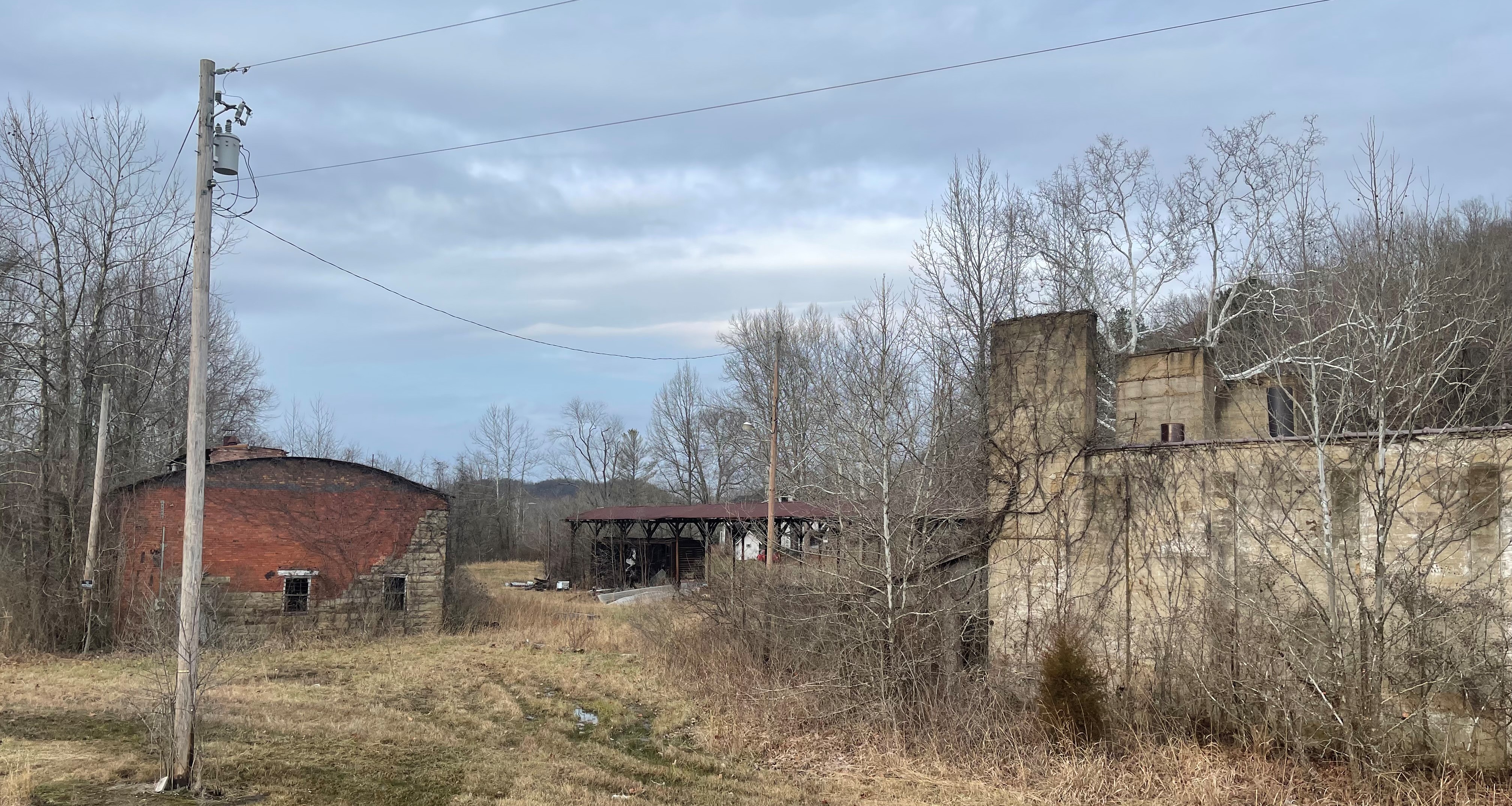
The Lee Clay Products Company operated here until it closed in 1970. The old buildings that you can still see on the other side of the roadway are the remnants of the Clearfield Lumber Company and the Lee Clay Products building. A closer look reveals several old Morehead and North Fork Railroad train cars, which brought logs and coal to the mill from 1905 until 1973. Enjoy these historic buildings from afar- your trek will take you back into the woods when you exit Mill Branch.
Brady
After hiking down Mill Branch and through the city of Clearfield, the Sheltoweet Trace makes a left turn near the Post Office onto Highway 519. The Trace follows Highway 519 and crosses US 60 at the red light. This community is known as Brady. After crossing US 60, make a right onto Main Street and make your way .58 miles to US 32. Cross Highway 32, and your car is just ahead in the Morehead Convention Center parking lot.
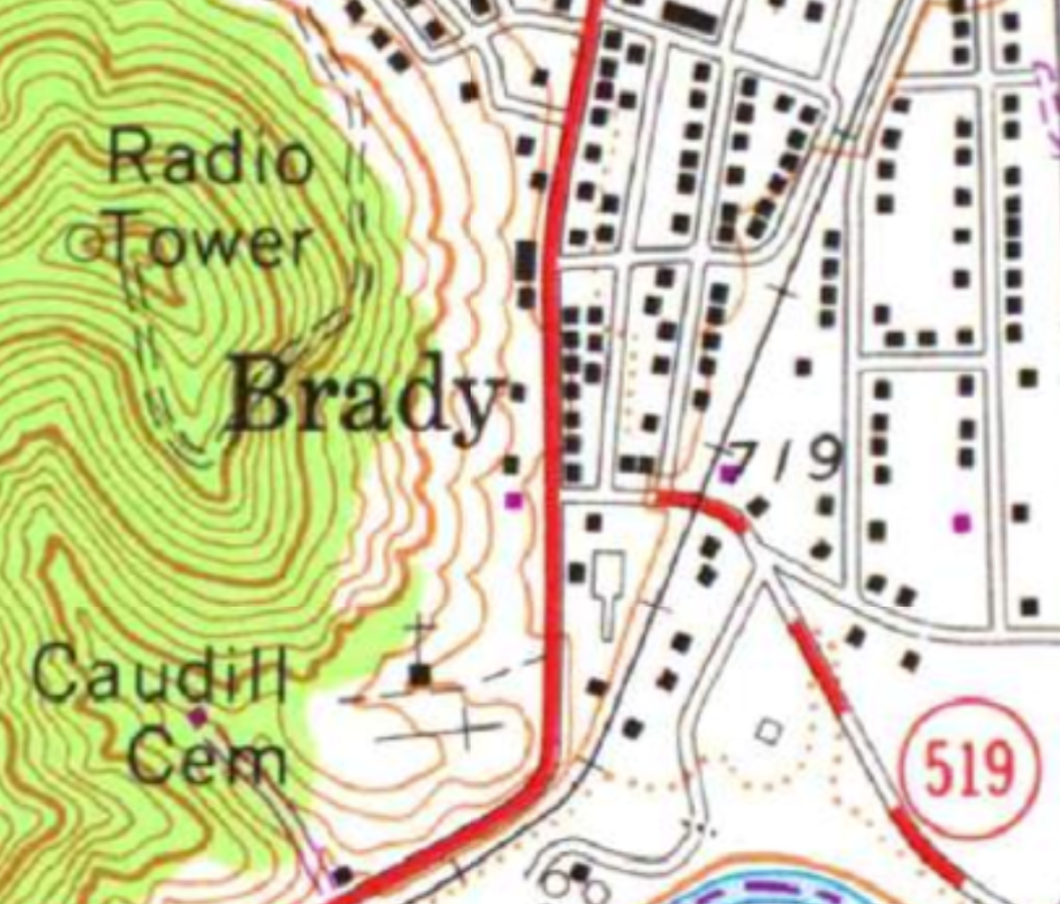
Brady was one of the first suburbs of Morehead to develop as the city grew and expanded. Workers and tradesmen from the city and the nearby lumber yards built modest homes beginning in the early 1900s in this quiet and peaceful addition. Many of the older homes still remain.
Brady has since been absorbed into the city of Morehead and is home to the new Rowan County Judicial Center and the County Courthouse. You will pass the newly constructed building on the left as you head toward the end of Main Street. There are few mentions of Brady today except the continued listing of the small community on many old maps.
Well, we did it again. We just completed Section 5 of the 2023 Sheltowee Trace Challenge. Find a nice restaurant and get something to eat. Head home and get some rest. Remember, the June hike will be here before you know it.
© 2023 Stephen D. Bowling

Thanks for sharing this! I’ve been trying to find things to do outside with the family since we’ve been pretty busy over the last few months with home renovations. But now that we finally finished the last thing on our to-do list, cleaning our carpets, I think it’s about time we take a break and head outside! Thank you for sharing, I think we’ll definitely be checking this out!
LikeLike