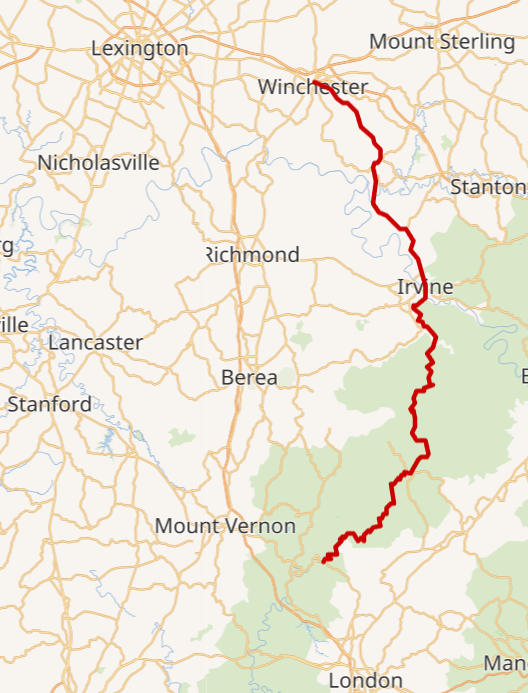
S-Tree Road to 49er Diner
Researched by Stephen D. Bowling
We survived Hike One and now on to Hike Two.
Hike two is a little better as far as elevation change and many will find it easier. We have switched the direction to accommodate parking for the number of hikers. As noted on the STA page, we will park at 49er Diner, as we did in January, and shuttle north to S-Tree Road to begin our hike. We will hike back to the end at 49er Diner.
The Trace Notes have been posted and will help you as you make your way through this 27.4-mile section.
S-Tree Campground Road
S-Tree Campground is located in Jackson County, just a few miles from McKee, Kentucky, and provides access to numerous trails for both hikers and horseback riders. Located on the ridge above Horse Lick Creek, the S-Tree is operated as a fee site by the United States Forest Service and provides 20 campsites on two loops.

The picnic shelter at the site is one of the few remaining buildings in the area constructed by the Civilian Conservation Corps in the 1930s. There are no facilities for water or electricity at this campground.
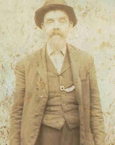
S-Tree is named for the large oak tree that once stood near the fire tower with a large “S” scratched into the bark. The tree and the letter marked the boundary of property owned by Sidney “Big Sid” Martin. The tree was often a reference point for people in the area who referred to it as the S-Tree and the name stuck.
S-Tree Look Fire Out Tower
S-Tree Fire Lookout Tower once stood at the high point near the entrance to the campground. According to the Forest Service, towers like S-Tree were important tools in detecting and fighting devastating forest fires. Fire towers were also home to the lookouts who ran them.
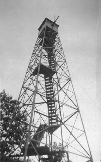
A tower cab at the top of the stairs was just big enough for a wood stove, two cots, a cabinet, a storage box, a small table, and a stool. The all-important alidade, or fire finder, stood in the middle of the room. By the mid-1970s, firefighters used airplanes and helicopters for fire detection.

Horse Lick Creek Watershed

Horse Lick Creek is created by the union of Little Clover Creek and Clover Bottom Creeks near the Rockcastle and Jackson County Line. The stream travels from north to south for more than 20 miles and takes in water from Laurel Branch, White Oak Creek, Wolf Pen Branch, Raccoon Creek, Dry Fork, and many other small tributaries. The stream flows into the Rockcastle River at an old bridge at the intersection of Jackson, Laurel, and Rockcastle Counties and near where hikers begin their walk on Highway 89. It flows through the communities of Loam and Dango.

Raccoon Creek
Leaving S-Tree Road, 2022 Sheltowee Trace Challengers will walk down a gravel road to Raccoon Creek. Approximately 1.86 miles into the morning hike, Raccoon Creek presents our first challenge. This deep and often swift-moving creek will require hikers to remove their shoes or get wet feet.

Concrete has been placed in the creek to help hold the roadway, but it is no help to keep your feet dry. One more creek crossing awaits at the foot of the hill before you get to Horse Lick Creek. The Horse Lick Creek crossing is 5.14 miles away and is an unavoidable wet crossing.
Raccoon Falls
A little more than two miles down the hill from S-Tree Road, the sounds of falling water can be heard on the left side of the roadway. Fifty yards to the left, through a large open camping area, Racoon Creek drops 3-5 feet over a firm rock layer creating Racoon Creek Falls. The ledge is 55 feet across and is a split falls for most of the year when water flow is lower.
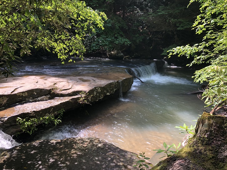
The area is a very popular camping spot during warm months as ATVs, horses, motorbikes, and hiking enthusiasts fill this area. If you want to camp here in the future, you had better get there early to save your place. It is best to just stop by on a long hike to get cool water or to cool your feet and then keep moving- this close to the roadway, it does get noisy at night
Dango, Kentucky
Once located just downstream from the confluence of Raccoon Creek and Horse Lick Creek, the town of Dango no longer exists. The small community that thrived on the banks of the creek in the edge of Jackson County was abandoned after logging activities slowed and the creation of the Daniel Boone National Forest cleared the area in the 1940s.
All that remains is the site of the Carpenter School located high on the hillside across Horse Lick Creek from the Sheltowee Trace. The Dango Post Office opened on January 24, 1906, with William Ledbetter as Postmaster. It was discontinued in 1909 but reestablished on May 31, 1910. The Dango Post office closed for the final time in 1927.
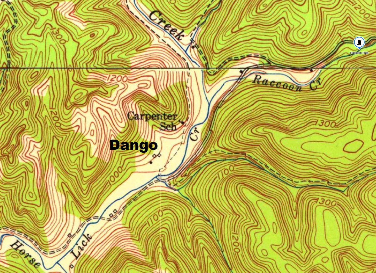
Dango, which is often described as a Kentucky “ghost town,” is one of the areas in the Daniel Boone Forest where private ownership of the property remains. Although many families left the area, they retained ownership of the land. Much of the Sheltowee Trace in this area passes through these privately owned areas thanks to many individual landowners. Several roadways off Forest Road 431 permit the owners of the land to visit and maintain these open fields along Horse Lick Creek.
Horse Lick Creek Crossing
Approximately 5.09 miles after passing Raccoon Falls, hikers will have their first real river crossing on the Sheltowee Trace. The crossing can be impassible during times of high water as the swift current and lots of debris make this area dangerous.

Be sure to check river levels and conditions prior to crossing Horse Lick Creek. A “more shallow” crossing can be found upstream and another downstream, but this wild river should not be attempted if there is any major current. Be smart and use an alternative route if needed.
Rockcastle County, Kentucky
Established by the Kentucky Legislature in 1810, Rockcastle County is named for the Rockcastle River which runs primarily through Rockcastle and Laurel Counties in southern Kentucky. The county, which is 318 square miles in area, is home to 16,037 residents according to the 2020 Federal Census. The county seat is Mount Vernon, named in honor of the home of George Washington in Virginia.

as “Rockcastle aster” and can be found along
the bank of Horse lick Creek.
Dr. Thomas Walker is credited as the first European to “discover” the river during his 1750 exploration of the area for the Loyal Land Company. The river was first named the “Lawless River” but was changed because the towering sandstone rock formations that stand on the hillside above the river resembled castle turrets. The river, which is 57.8 miles long, drains thousands of square miles into the Cumberland River.
The waters of the river are home to 65 fish species, 38 mussels, and 10 different crayfish. The banks of the river are home to the eurybia saxicastelli, a rare flowering plant that is only found along the Rockcastle River and in the Big South Fork National Park.
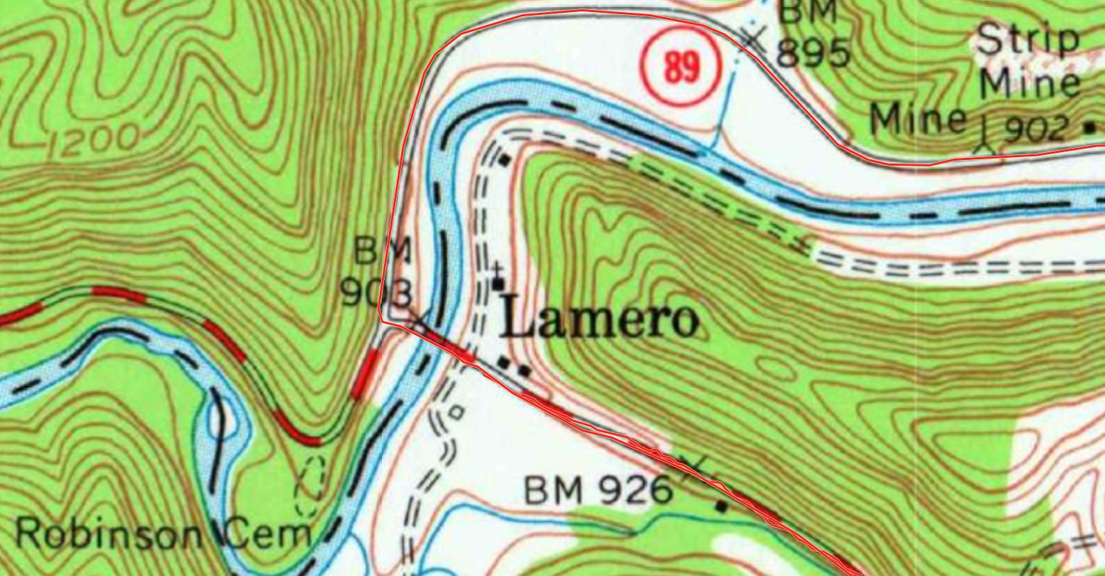
Lamero, Kentucky 40341
Lamero, Kentucky is a small unincorporated community located on the banks of the Rockcastle River in Rockcastle County. On September 3, 1925, the Lamero Post Office was established and named for its first Postmaster Charlotte (Yost) Lamoreaux. The name was created as a variation of the family name for Charlotte and her husband, Clarence Sterling Lamoreaux, who operated a small store on the Laurel County side of the river.
Mrs. Lamoreaux served as postmaster for the community until her retirement on April 30, 1942. The Post Office was moved across the river to Rockcastle County on May 12, 1942, and Nora Coldiron was named Postmaster. Several other Postmasters, including Myrtle M. Gillum, would have charge of the office there before it was closed on April 6, 1996, as part of the Postal Services’ efforts to streamline service and be more efficient.
Mrs. Charlotte Lamoreaux moved to Ohio and died in Washington County on May 22, 1945. She is buried there in the East Lawn Memorial Park, more than 300 miles from the community that still bears her name.
Laurel County, Kentucky

At the middle of the Lamero Bridge, hikers will step into a new county- Laurel County. The county was named for the 42-mile-long Laurel River that flows through the county and for the dense concentration of mountain laurel that glows on the banks of the stream. As of the 2020 Federal Census, Laurel County is home to a population of 62,613 residents.
The county seat is London and is home to 8,053 “Londonians” as of 2020.
Laurel County was the 80th county in order of creation and was established on December 21, 1825, by the Kentucky Legislature. In January 2016, London voters approved an initiative to make the city wet, making Laurel County one of the “moist’ counties in the state. Laurel County is the home of famed author Silas House, the annual World Chicken Festival, and Laurel River Lake.
In 1930, Harlan Sanders started selling fried chicken and ham out of the back of his Sanders Court Shell Station in North Corbin, Kentucky in Laurel County. He was commissioned an honorary Kentucky Colonel in 1935 and became known as Colonel Sanders. The business later grew into Kentucky Fried Chicken.
Kentucky Highway 89
through four Kentucky counties.
Kentucky Highway 89 is a two-lane roadway maintained by the Kentucky Department of Transportation. The roadway begins at the bridge at Lamero and ends 73.355 miles away in Winchester in Clark County.

The roadway was a major connector in the area and passes through the cities of McKee and Irvine and four Kentucky Counties. The roadway was constructed over many years and was funded by more than 20 Legislative sessions.
The original route of Highway 89 was partially constructed on side trails and animal paths that diverged from the Wilderness Road as it passed through the area. Several Native American sites can be found along Highway 89, which passes through three of Kentucky’s distinct geologic sections.

Lamero Bridge
Spanning several hundred feet across the Rockcastle River, the Lamero Bridge was constructed in 1922 and is a Pennsylvania (Petit) Truss design. The bridge was planned as part of the eastern branch of the Dixie Highway. The Dixie Highway, planned in 1914, was the first automobile route organized to connect the northern tip of Michigan with the South down to Miami, Florida.

The brainchild of Carl G. Fisher, the Dixie Highway was later slightly rerouted and designated as Highway 25. Much of the traffic that once crowded the roadway has migrated away with the opening of Interstate 75 (maybe someday they will complete it).
Following a comprehensive review by the Kentucky Department of Transportation in 2009-2010, the Highway Department completed a total restoration of the Lamero Bridge in 2011 to repair several rust and corrosion issues found during the inspection of the bridge.
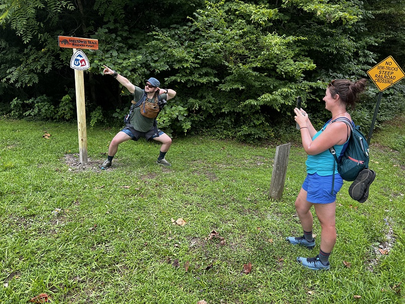
Old Half-Way Point

Since it opened for foot traffic in 1979, the Sheltowee Trace National Recreation Trail has evolved. Changes to the trail include numerous reroutes, improvements to creek crossings, road walk changes, and several extensions. The current trail is 343.3 miles. Work is currently underway to move the Southern Terminus of the Sheltowee more than 10 miles south from Burnt Mill Bridge to Rugby, Tennessee making the 2022 trail approximately 354 miles.
In anticipation of the completion of the extension to Rugby, the official Halfway Point moved several miles to the south. The old point was located 1.46 miles from the Lamero Bridge and just after crossing Parker Branch. The graffitied sign covered with hundreds of signatures and drawings will be removed since the new one was installed at the new halfway point located on Highway 25 at the turn to Highway 909. If you did not see it- too late you have already passed it.
The old wooden post and green sign that stood here marked the midpoint until 2022.
Symbol, Kentucky 40764
As hikers walk along Highway 490 and Winding Blade Road, they pass through an area of Laurel County that was once served by the post office of the community of Symbol. Established by Postmaster Elijah T. Cornett on March 26, 1929, the community of Symbol served a very rural population of subsistence farmers who were isolated by the rough terrain and long distances from London. Farmers in this region sustained themselves on the family farm and ventured to town only occasionally. There they visited and “traded” with local merchants for items they could not produce on their own, including sugar, clothing, and other “store-bought” goods.

of Symbol with 16 houses and one church.
The construction of the Dixie Highway and the Lamero Bridge helped end the subsistence lifestyle as motorized travel was more convenient and the level of required self-reliance decreased. The Symbol Post Office served a vital role in this rural community as many items could be ordered for delivery from catalogs, like J. C. Penney, Sears, and Montgomery Ward. The population in the area decreased with a downturn in the economy and many from the area traveled north to Ohio in search of employment. The Post Office was discontinued on December 31, 1988.
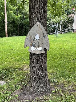
Winding Blade Road
Hikers emerge from the woods and walk along a section of Winding Blade Road. The trail follows Winding Blade for .52 miles before the Sheltowee Trace makes a sharp right turn. A homemade trail marker, complete with an old arrowhead design, helps mark the way and the turn off of Winding Blade Road.
A small, white turtle and an arrow on a tree help mark the route on Winding Blade Road for hikers. The arrowhead will be used in several locations to help designate old sections of the Sheltowee Trace. Many old arrowhead markers can be found in the Big South Fork.
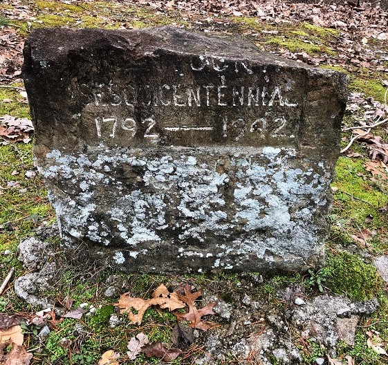
Located a mile or so away on Winding Stair Road is one of the oldest historical markers in the area. This stone, a roadside marker, was erected in 1942 to mark the route of Boone’s Trace, Mershon’s Crossing, and the Battle of Wildcat Mountain. The effort was part of the 50th anniversary (sesquicentennial) of the founding of Kentucky in 1792. Another of these historical markers is at the Camp Wildcat National Battlefield but has been damaged significantly over the years.
Working Forest (Clear Cutting)
According to the Daniel Boone National Forest, timber management involves “growing and harvesting timber and other forest products for the purpose of marketing these products to maintain or improve forest resources.” The National Forest Service uses selective harvest techniques to enhance wildlife habitat and to provide jobs for local communities.
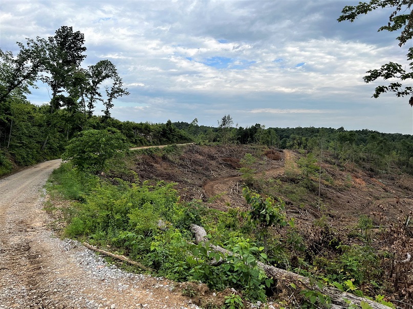
After you walk a short distance on Wildcat Road, hikers will enter a section of private property that has been clearcut of trees, the timber hauled away and sold between 2016-2018. By 2021, some regrowth was visible with new trees sprouting. The Daniel Boone National Forest land managers practice harvesting to decrease stocking density, promote uneven-aged stands, reduce fuel loadings, and preserve ecosystems. Planned and managed timber harvests are usually conducted on a 30-50-year cycle allowing regrowth to recover with time.
Wildcat Road
17th Ohio Volunteer Infantry
As you leave the Camp Wildcat Battlefield area, hikers will follow Wildcat Road, the path used and guarded by the 17th Ohio Volunteer Infantry during the battle here on October 21, 1861. Portions of the road have changed since 1861, but it roughly follows the original trail through the woods.
The 17th Ohio guarded the left flank of General Theophilus T. Garrard’s position high on the hill near the Camp Wildcat Monument. Under the command of Colonel John McNeill Connell (1829-1881), the 17th Ohio was originally organized in Lancaster in August 1861 with each soldier signing up for three months of service. The regiment was reorganized with three-year enlistments in August 1861 at Camp Dennison near Cincinnati.
The 17th Ohio did not see direct combat during the Battle of Camp Wildcat. The regiment did serve a vital role in protecting the regiments that were moving down the old Wilderness Road into the battle including the 1st & 2nd Tennessee and 38th Ohio. The men of the 17th Ohio participated in the Battles of Perryville, Corinth (Shiloh), Stones River, Chickamauga, and nearly every major battle in the Western Theatre from 1862 to 1865, including Sherman’s March to the Sea. As you walk along this route, imagine the excitement and terror that young recruits experienced marching into the area hearing the sounds of cannons, musket fire, and the screams of wounded men.
Eversole-Simpson Cemetery
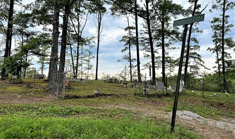
Along Wildcat Road sits the Eversole-Simpson Cemetery. This small family cemetery contains 17 graves and was started in 1919 with the burial of Christine Eversole. The cemetery is the final resting place of members of the Eversole, Grimes, Potter, and Simpson families.
Camp Wildcat Battlefield Monument

visit the Camp Wildcat Battlefield Monument.
After walking through the clear-cut area and down the approach road to Wildcat Battlefield, hikers will pass the Camp Wildcat Battlefield Monument. One of the oldest Civil War monuments in the area, the site has three new granite markers with the names of regiments who fought in the battle, two modern historical interpretive signs, and a memorial marker installed in 1942.
placed in the memory of those who fought here and
the 150th Anniversary of Kentucky was damaged
by a falling tree and vandals.
On May 26, 1994, a group of local Civil War historians and community leaders created the Camp Wildcat Preservation Foundation, Inc. The current membership consists of approximately fifty enthusiasts who are interested “in preserving, protecting, and interpreting the Camp Wildcat Battlefield.” They support and maintain efforts to build trails and preserve battlefield trenches at the site.
Camp Wildcat Battlefield

eyewitness Alfred E. Mathews of the 31st Ohio Infantry on Hoosier Ridge.
Fought on October 21, 1861, the Battle of Wildcat was an important early Civil War battle fought over control of the Wilderness Road and access to central Kentucky. Generals Albin F. Schoepf’s (Union) and Felix K. Zollicoffer’s (Confederate) armies fought a fierce battle near Wildcat Mountain in Laurel County. Moving north from Tennessee, General Felix Zollicoffer’s command moved up the Wilderness Road and encountered the soldiers under General Albin Schoepf entrenched on the ridge lines above.
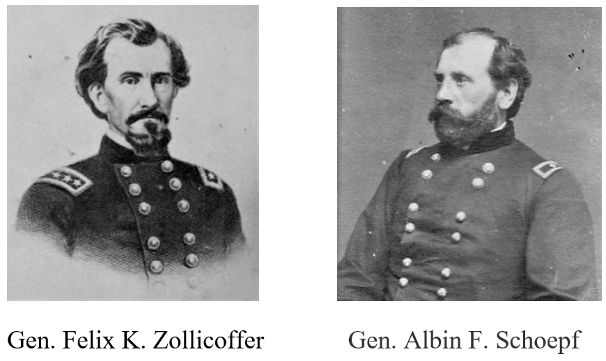
The Confederates withdrew southward after sustaining several casualties providing the first Union victory of the Civil War and helping block the Confederate advance into central Kentucky via the Wilderness Road.
Hazel Patch Cemetery

Near the bottom of the hill on Hazel Patch Road and just prior to the railroad tracks, a large and old cemetery sits in the small grove of pine trees on the left side of the roadway. This is the Hazel Patch Cemetery. The cemetery was established in the 1850s and is the final resting place of the descendants of many early settlers along the Wilderness Road in Laurel County.
The majority of the graves in the Hazel Patch Cemetery are marked only with sandstone rocks which was a mountain custom.
One of the marked burials is for Richard E. Woodall. Woodall was born on June 9, 1844. in Pulaski County, Kentucky. He served as a Private in Company B of the 12th Kentucky Infantry. He received a Union Invalid Pension on January 12, 1866, due to severe injuries he received while fighting near Stawberry Plains, Tennessee in February 1865. He suffered with his injuries for the rest of his life and died on October 24, 1924, at the age of 80.
During the course, of your hike, you will walk past the graves of more than 40 veterans of the Civil War and at least two Revolutionary War Veterans.
The Tracks
The railroad tracks that run through Hazel Patch once hummed with long trains hauling coal, timber, and other resources from southeastern Kentucky. Today that traffic has slowed, but the railroad still routes several trains a day across these rails at the foot of the hill on Hazel Patch Road. Workmen for the Louisville & Nashville Railroad laid the first railroad tracks here in the late 1800s creating a major commercial link between the northern states and the south. Today, many train carloads of chemicals and vehicles are carried across this line owned by Chessie and Seaboard Express (CSX) Railroad.
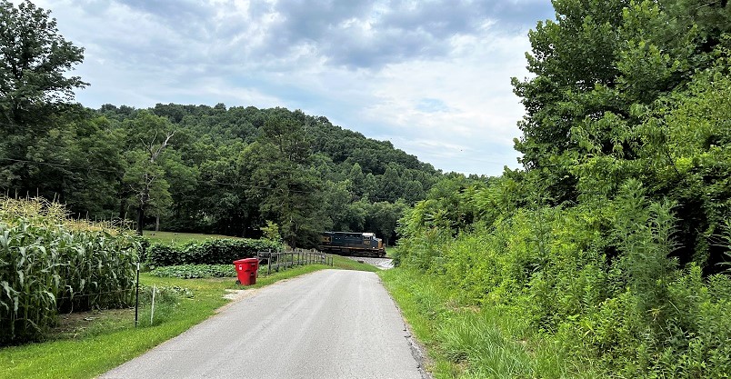
Some hikers will have the opportunity to hear and see a fully loaded train roll on these tracks. Unfortunately, if you do, you will be waiting for some time for the train to clear the tracks as the Trace crosses the rails at this intersection. Be very careful and do not attempt to crawl under, on, or over stopped train cars. They can start moving without any notice. Play it safe and look both ways before crossing. Be sure to watch your step.
Wilderness Road
The Wilderness Road was the major route used by early explorers and settlers who ventured over the crest of the Appalachian Mountains into the land known as “Kenta-kae.” In 1775, Daniel Boone blazed a trail into what is now Kentucky by using the Warrior’s Path and several large animal trails that led from Cumberland Gap to the flat lands of the Bluegrass section. Despite numerous challenges and setbacks, the first settlements in the states were established in the years that followed.

of “Daniel Boone escorting settlers through the Cumberland Gap” on the Wilderness Road.
In 1795, the Kentucky Legislature approved the creation of a wide wagon road that permitted the transportation of goods from Virginia to Crab Orchard using a portion of the old Boone Trace through Rockcastle and Laurel Counties. The roadway, when completed, it became known as the Wilderness Road. From Camp Wildcat Monument to the bridge over Hazel Patch Creek, the Sheltowee Trace follows the exact route of the Wilderness Road.

Hazel Patch, Kentucky 40729
Named for the abundant hazelnut trees that once grew in the area, Hazel Patch, Kentucky was once an important center of travel along the Wilderness Road. Animals, including squirrels and other small game as well as buffalo and elk, frequented the site to eat the nuts as they fell from the trees each year. As a result, the Warriors Path and subsequent trails into the state such as the Boone’s Trace and Skaggs Trace passed near this area as long hunters tracked and harvested game.

usually get the fruit before hikers get the opportunity.
The Hazel Patch Post Office was established in 1804 and was located 6 miles east of this location. It closed in 1836. A Post Office was established in 1867 and operated as Hazle Patch due to a clerical error. The Postal Service corrected the error in 1961. The Hazel Patch ceased operations and closed permanently in 1974.
New Half-Way Point

Since its creation in 1979, the Sheltowee Trace National Recreation Trail has evolved numerous times. Changes to the trail include numerous reroutes, improvements to creek crossings, road walk changes, and several extensions. The current trail is 343.3 miles and has not changed for several years. Work is underway to move the Southern Terminus of the Sheltowee more than 10 miles south from Burnt Mill Bridge to Rugby, Tennessee.
The addition of miles to the southern end of the trail and the establishment of a new Southern Terminus changed the location of the Half-Way point. Long-time Sheltowee Trace supporter, Billy Sherlin made, donated, and installed a new halfway sign in July 2022.
Challengers in 2023 will pass the old Half-Way Point on Parker Branch. The 2022 Class was the only class to hike past the official Half-Way Point twice in one year.
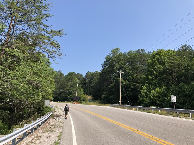
Highway 25
After passing the new halfway point, the Trace makes a right and follows Highway 25 south for .72 miles to Highway 909. Stretching from Covington, Kentucky to Brunswick, Georgia, U.S. 25 is a north-south corridor that runs through Kentucky Tennessee, North Carolina, South Carolina, and Georgia for a total of 750 miles. The road, built primarily with state funds, was designated as “US 25” on November 11, 1926, with the implementation of the United States Numbered Highway System.
The original route, constructed from 1915-1929 as the Dixie Highway was widened and improved to accommodate larger-sized vehicles. The roadway was eventually lengthened to create a route from Georgia to Michigan. In 1974, the sections of the roadway in Ohio and Michigan were eliminated and the northern terminus was established at the Clay Wade Bridge at Covington. Most of the traffic that once drove on US 25 was diverted with the construction of Interstate 75 in the late 1960s and early 1970s. Locally, Highway 25 is also known as North Laurel Road.

Interstate 75
After making the left turn onto Highway 909, the Sheltowee Trace crosses a bridge over a loud and busy Interstate 75. This major North-South roadway traverses the Commonwealth of Kentucky. The modern four to six-lane roadway stretches more than 191.7 miles in Kentucky from Covington in the north to the Tennessee border. The roadway is designated as “limited access” by the Interstate Highway System and has a speed limit (or suggested speed limit) of 70 miles an hour for most of its length.

The Interstate was one of the major highways planned for the state of Kentucky during the 1950s as a part of the 41,000 Dwight D. Eisenhower National System of Interstate and Defense Highways in the United States. The Kentucky section of Interstate 75 was completed and opened in 1970. (The state of Kentucky immediately started a widening project which is still ongoing.) The last section was officially opened in 1992 in Florida.
Millions of trucks and vehicles travel this vital thoroughfare daily, and state crews work hard to keep some form of construction going year-round to help slow down the traffic in Kentucky, especially in Laurel and Rockcastle Counties.
49er Diner
Oh, the truck stop life. Haven’t you missed the lovely sounds of idling eighteen-wheelers and the constant buzz of vehicles coming and going on I-75? Luckily you will not have to hear them for long. Located on the west side of Interstate 75 are a small gas station and cafe known as the 49er Diner. Hikers parked here on Hike one and walked back to their cars parked near this location. We will do the same on Hike Two but from the other direction.

The Diner offers a place to take a break, buy a cold (or warm) drink, or some snacks. It may be a little bit too early to order a hamburger, but some of their famous biscuits and gravy might do a good start to the day. While you are here, look around (but not too hard) and discover some of the local customs and separate world that swirls around an interstate truck stop.
We hope that you enjoy your hike and we all look forward to seeing you on the Sheltowee Trace in March.
© 2023 Stephen D. Bowling

What a rich historical area. Thanks for the information.
LikeLike