192 Trailhead to 49er Diner
Researched by Stephen D. Bowling
Well, Hike Day is here for 2023. We all signed up and registered for the 2023 Hiker Challenge, and now it is time to hit the ground running. The Trace Notes have been posted and will help you as you make your way through this 24-mile section. To enhance your experience on the Trace, we publish each month a “What To See” that will provide additional cultural and historical information not included in other sources. We hope this will increase your enjoyment of the trail.
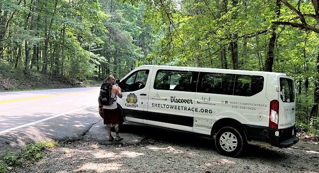
Highway 192 Trailhead
The first hike of the 2023 Sheltowee Trace Challenge begins at the Sheltowee Trace Trailhead located near the intersection of Highway 192 and Highway 1193. This trailhead, near Laurel River Lake in the Baldrock community, is easily accessible but can only accommodate about 15 vehicles. It is a very popular trailhead and is possibly the most used along the Sheltowee due to its proximity to Vanhook Falls and easy access to Laurel Lake. Additional parking locations will be announced just prior to the hike for overflow parking.

Pounder Arch
Located 1.92 miles from the trailhead, Pounder Arch is located on the hillside 50 feet on the left above the trail. The small 8-foot arch is easily missed as hikers pass by this small natural wonder. The arch was created when a wind-eroded rock shelter in the Rockcastle Sandstone layer collapsed near the base of the rock section leaving a portion of the front of the shelter intact.
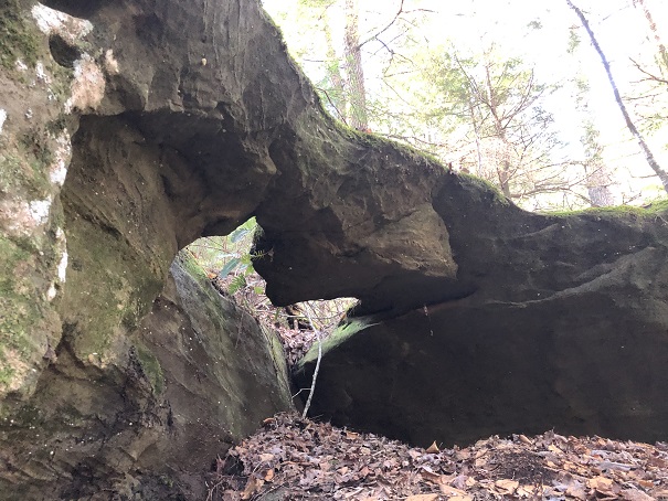
The arch is best seen during the afternoon when the rays of sunlight help define the opening in this layer of sandstone.
Pounder Cascades
A series of small waterfalls and cascades on Pounder Branch make the valley roar with the sounds of falling water. After leaving the trailhead, hikers will descend 2.30 miles to Cane Creek and pass Pounder Gorge Falls, Pounder Falls, Lava Falls, and five other smaller water drops.

A series of small waterfalls and pools of standing pools of water make for great places to stop and take a break on hot days. Several of the pools are deep enough to wade and swim in to cool off. Take advantage of every opportunity to cool down and take a break from the heat although that will most likely not be recommended for our January hike.
Cane Creek Gorge
Cane Creek is formed by the union of Cane Creek, Pond Branch, Pounder Branch, Vanhook Branch, and Grassy Branch. Over the centuries, the flowing waters of Cane Creek carved a deep gorge into the sandstone of the area. The result was a very interesting valley known as the Cane Creek Gorge. The area includes numerous waterfalls and cascades.
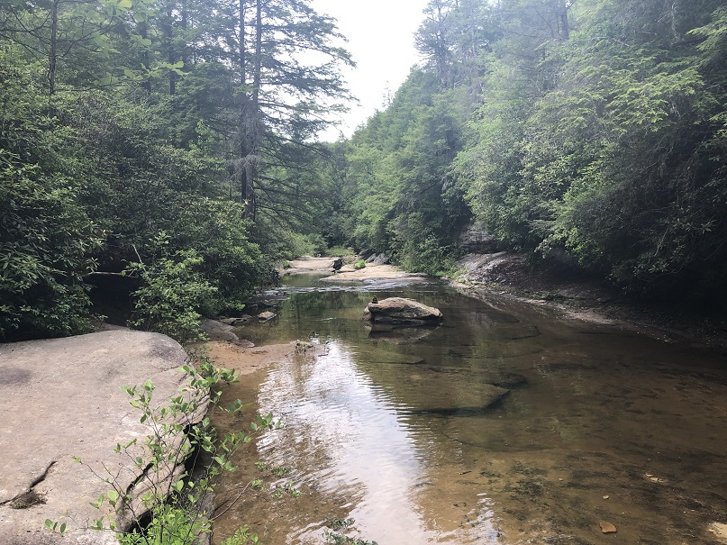
The Gorge is located in the Cane Creek Wildlife Management Area which is operated by the Kentucky Department of Fish and Wildlife Resources in cooperation with the United States Forest Service. Cane Creek flows westward and empties into the Rockcastle River just below the Rockcastle Narrows and opposite the Bee Rock Recreation area operated by the Forest Service.

Vanhook Falls
Vanhook Falls is one of the most visited waterfalls in Kentucky. At 37 feet tall and 16 feet wide, the waterfall is a popular destination for Sheltowee Trace Hikers and day hikers who complete the 5 miles round trip from the 192 Trailhead.
The falls were created when the water of Vanhook Branch poured over the edge of a solid layer of sandstone and plunged into the valley below. Vanhook Branch merges with Pound Branch about a quarter mile below Vanhhok Falls to help create Cane Creek.

Recent work near the falls has created several nice benches which make for a great lunch break and some steps to make climbing the hill beside the falls much easier.
A Healing Forest
A storm driven by high winds tore through this section of the Daniel Boone Forest on the afternoon of July 8, 1991. The winds, which were determined to be straight-line rather than tornadic, blew down thousands of trees and damaged more than 1,000 acres of the forest. Forest Service personnel estimated that the winds toppled enough wood to build more than 250 homes.
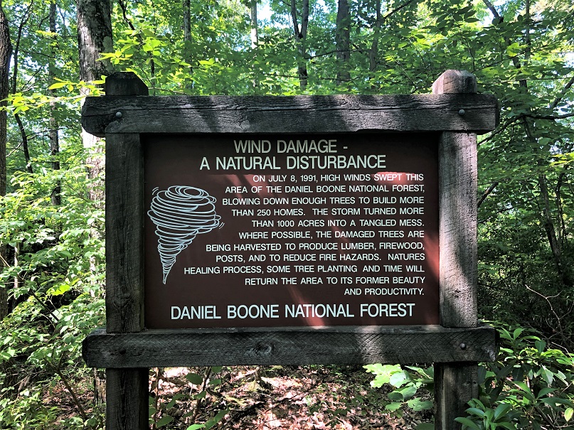
Rather than allow the trees to “rot and be wasted,” Forest Service awarded permits to local loggers to harvest the felled trees and to clear the debris from the Sheltowee Trace and other trails and roadways. According to officials, the combination of several tree planting efforts and the natural processes of reforestation, estimates indicate that the forest here will return to its pre-storm growth in 40-50 years. Many hikers pass through this section of the Trace and never notice the effects the wind had on this area and know of the damage because a sign is placed along the Trace to commemorate the event.
Johnny Mac Cemetery
As the Sheltowee drops over into Big and Little Dog Fork, the Trace passes the Johnny Mac Cemetery which is nearly hidden about 25 yards in the woods. The small cemetery has approximately 12 graves, including two marked graves for John McFadden, the cemetery’s namesake. John M. McFadden was born in 1819 and was the son of Jesse and Sally Ruth (Chesnut) McFadden.
McFadden served as a Sergeant in Company H of the 24th Kentucky Volunteer Infantry in the Union Army during the Civil War. He was married to Bartheny Young (1819-1917). He received a Federal Invalid Pension on February 6, 1893, for injuries he received while in service during the war. He died a little more than a year later on May 13, 1894.
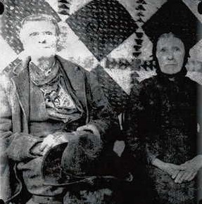
A dispute between members of the family resulted in two different claims as to the exact location of his actual grave. In an effort to settle the dispute of which grave belonged to the family patriarch, a military stone was ordered and placed by members of the family. Certain that the location was still incorrect, other family members installed a metal sign at another grave insisting that “Here Lies John McFadden.”


Take a second to step off the trail to visit this small cemetery and see if you can determine which grave is that of John McFadden.
Bunch, Kentucky
The Sheltowee Trace passes near the small community of Bunch, Kentucky. The small, rural section of Laurel County was established in the late 1800s. The Bunch Post Office opened in the Fadden General Store on December 11, 1905, with John Y. W. Fadden as the first Postmaster. The community never had more than 100 residents, and the store served as the retail, commercial, and community center.

Several postmasters, including its last Postmaster Ora Reynolds, operated the small post office, but the Postal Service discontinued delivery of mail and closed the Bunch Post Office on November 27, 1959.
Sinking Fork Wade
A high suspension bridge served many years as the only dry crossing spanning the thigh-high waters of Sinking Creek on the Sheltowee Trace. During a series of record-setting rainfalls in early 2021, a limb from a very large tree fell and destroyed a portion of the central section of the Sinking Creek Bridge. The trail now requires a slippery wade through the water rather than a crossing on the bridge above the creek. Efforts are underway to repair the span, but until then, be prepared to get your toes, legs, and maybe more wet.
Pine Creek Church and Cemetery
The Pine Creek Church was established about 1850 by members of several prominent families from the area. The church, which has services each Monday evening, was originally on the circuit. There was no permanent minister, but a traveling minister visited the church on a set Sunday of the month. As the population of the area grew, the original church was torn down and replaced with the current concrete block structure.

The cemetery beside the church is known as the Pine Creek Church Cemetery and also as the Betty Barnes Cemetery. There are currently more than 264 burials in this cemetery from several primary families who lived in the area, including the Adams, Barnes, Goforth, and Whitaker families. The oldest known, marked grave at this location was Elizabeth (Morgan) Hash who died in 1869 at the age of 35.
Camp Barbour
Several years ago, Steve Barbour purchased a tract of land along Forest Service Road 4255. He established a small camp as a place of rest and refuge for weary hikers who venture through this section of the Sheltowee Trace. Referred to as “Camp 4255″ or simply “Camp Steve Barbour” by most, the roadside camp is made available by the STA Director for hikers due to the lack of suitable camping spots along this section of the hike. All that is asked is that hikers maintain the site and respect the property by practicing all of the Leave No Trace principles.

The construction of a moldering privy by Steve and the installation of a bear-proof food storage container as a gift from the Hiking Class of 2021 helped make Camp Steve Barbour a very nice stop on the way south or north. Bears are active in 4255 and the Pine Creek area and hikers are advised to follow all food storage rules to keep the camp an enjoyable stop for all.

Highway 80
Highway 80 is a limited-access highway that crosses the Commonwealth of Kentucky from Columbus in Hickman County to Elkhorn City in Pike County. The road, which runs more than 483 miles, is one of the primary east-west connectors that crosses the state. Originally constructed in the mid-1930s, Highway 80 once saw more coal hauled over its roadways than any other route in the state.
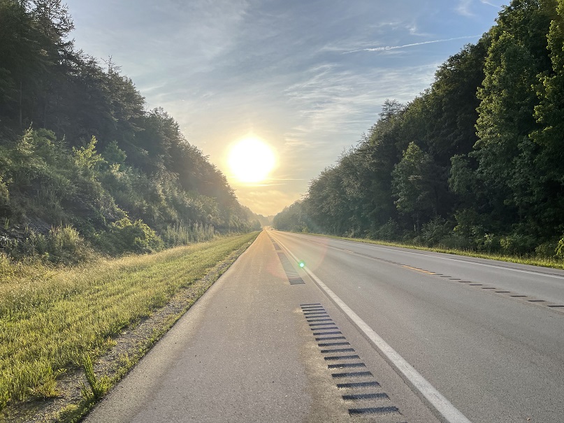
The Sheltowee Trace crosses Highway 80 at one location. Hikers will emerge from the woods and walk about one-quarter of a mile along the roadway. Being certain to check for traffic, the Sheltowee crosses the roadway and reenters the woods. The road is usually busy, and some patience and a great deal of care could be needed to get across.
Hawk Creek Log Bridge
Hawk Creek Suspension Bridge was a large bridge that spanned the knee-deep waters of Hawk Creek. During record-setting rainfall in 2021, several large trees fell and destroyed the Hawk Creek Bridge.

The trail now requires a balanced walk across a log bridge made from the tree that destroyed the bridge. a handrail made from pieces of the old bridge will aid you in your crossing. Efforts are underway to repair the span, but no timeline for replacement has been established.

Red Rocks
Between Hawk Creek and the 49er Diner, the Trace follows the remnants of an old ATV/logging trail. Over the years, abuses of this area have led to most of the topsoil being depleted from the area leaving some beautiful red sandstone exposed for the trail.

The Forest Service constructed several metal “tank traps,” deep trenches, and other obsticles to limit the use of this area to hikers only as a part of their management of the trail in his section. Be careful in this area during periods of snow and ice or if the rocks are wet as they can become very slippery.
49er Diner
Idling eighteen-wheelers and vehicles coming and going keep the ramp off and onto I75 very busy. Located on the west side of Interstate 75 are a small gas station and cafe known as the 49er Diner.

The Diner offers a place to take a break, buy a cold drink and some snacks, or order a hamburger, or some of the best biscuits and gravy in the area. It is a great place to visit to discover some of the local customs and a perfect way to prepare for the hill climb and the rugged trail ahead.

We hope that you enjoy your hike and we all look forward to seeing you on the Trace in February.
© 2022 Stephen D. Bowling

Thanks so much for taking the time to add this to our hiking experience. Really great to have some back story on where we tread.
LikeLike