Coal in McCreary County
After leaving the Blue Heron Bridge, the Sheltowee Trace follows several old coal railroad beds around the hill and climbs high on the mountain above the Big South Fork of the Cumberland River. Evidence of millions of tons of coal removed across this network of rails to the Blue Heron Tipple.
The trail bed is covered with a thick layer of fine coal dust, and the remnants of old equipment, including coal cars, can be found along the trail. According to coaleducation.org, more than 55.38 million tons of coal have been extracted from McCreary County, with 334.29 million tons remaining untouched. Time and reclamation efforts have restored some of the property in McCreary County used for coal production, still many reminders of McCreary County’s most significant industry for most of the 19th and 20th Centuries remain.

Catawba Overlook
The Catawba Overlook is high on the hill overlooking the river and just a few short yards from the Sheltoway Trace. The wooden overlook is constructed on a high cliff that provides a panoramic view of the river valley below, including the Blue Heron Tipple and Bridge during leafless seasons.

The overlooks provided one of the first real places to stop for a break from the steep and steady climb out of Blue Heron. Enjoy the view and the rest- there is much more work to do before you get to camp.
Fence Stiles
Scattered throughout the Big South Fork National River and Recreation Area are numerous fence stiles abandoned in the woods and fields. These wooden steps were placed long ago to help hikers cross the multiple metal wire and rail fences that stretch throughout the park, often marking the original property lines. Several fences have been installed in National Parks and Recreation areas to help control and slow the spread of invasive wild hogs.

Many of these fences have rotted down, rusted away, or been removed by the park service, but the stiles remain. Today, they look odd as they appear to be a random set of steps in the middle of nowhere that cross nothing. Stop and take a photo on the “steps to nowhere” as they will not be landmarks on the trail for long.
Dick Gap Falls
Dick Gap falls is a horsetail type of falls and drains more than 40 acres. The 25-f t lunge is located just off the Sheltowee Trace and is easily accessible by Challenge Hikers. The green moss, ferns, and rhododendron help conceal this natural feature and prevent many photos.
The falls run most of the year and are marked on the new Far Out app. Keep your eyes open for the falls just 1.9 miles into your hike on the left.
Big Spring Falls
A short side trail leads hikers .19 miles from the Sheltowee Trace to the base of the Big Spring Falls. The falls f med when Big Spring Branch flowed over a thick layer of Paragon Shale and cut away a section of the softer Alvy Creek shale that lay below.
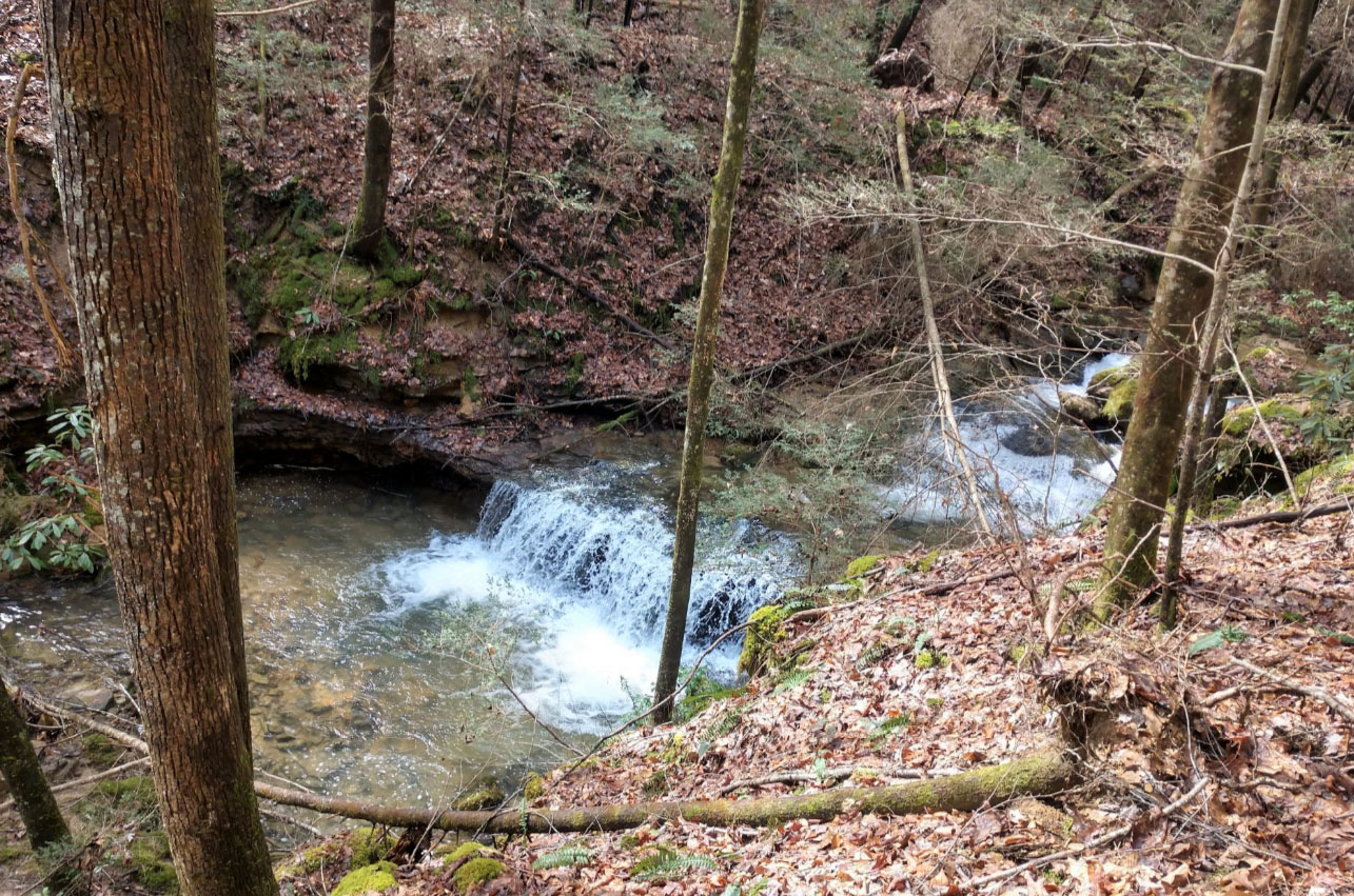
The falls has two drops and is another example of a horsetail fall. Take the short hike to see this natural beauty and enjoy all that the Sheltowee has to offer.

King Cemetery
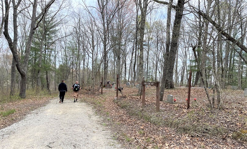
The King Cemetery is located within feet of the Shetowee Trace and is a family burying ground. Also known as the Upper King Cemetery, the family plot currently has 32 burials recorded and is the cemetery for the descendants of the King, Dolen, Boyatt, and Watson families who once lived in the area. By agreement with the National Parks Service, these family plots remain in family control and are still being used for burials. The oldest marked tombstone is for Arizona (Ross) Wilson who was born in January 1886 and died near the cemetery in 1928.
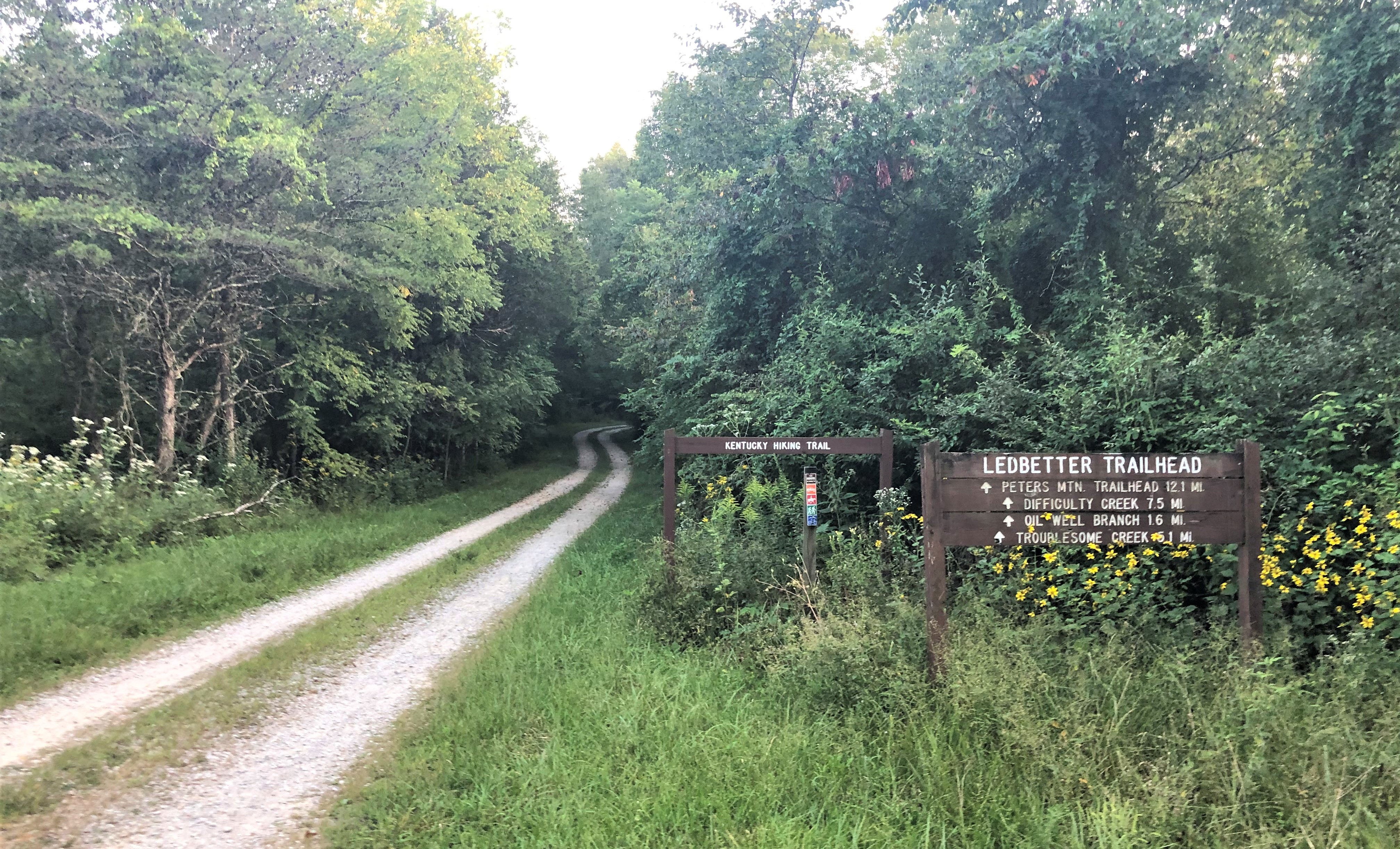
Ledbetter Trailhead
Located at the intersection of the Sheltowee Trace and the Bald Knob-Hill cemetery Trail, the Ledbetter Trailhead is approximately 12.1 miles from Peter’s Mountain. The trailhead offers parking for ten vehicles and is often a camping spot for hikers. This trail access point is available via a maintained gravel roadway and is easily reached throughout the year. Occasionally, there is some trail magic at this location, but do not count on it.
Oil Well Branch
Along the banks of the Big South Fork, the Sheltowee Trace crosses a bridge at the mouth of Oil Well Branch. This two-and-a-half-mile creek has six branches and was the site of one of the first drilled oil wells in McCreary County. A small forest service sign near the creek marks the location of this now defunct well, but the name given to this creek by locals still sticks.
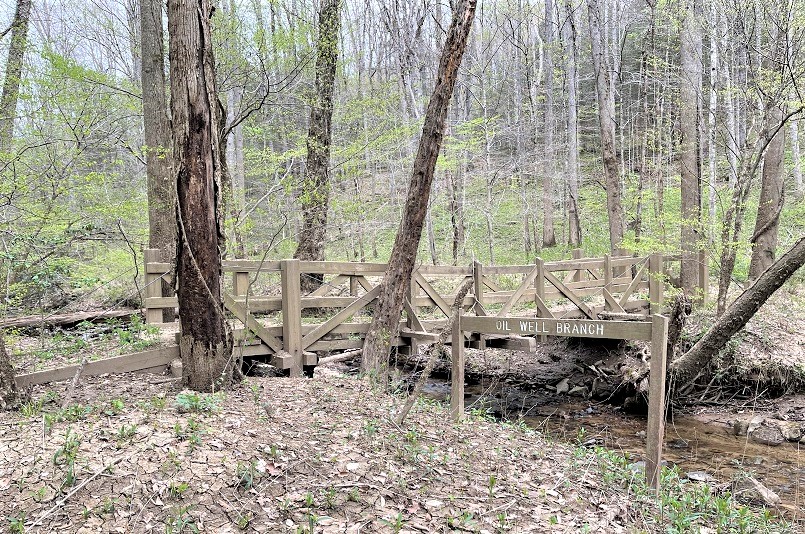
There is a small waterfall just a short distance up the creek. The Oil Well Creek Falls is five feet tall and, at normal flow, about 4 feet wide. It is a cascade-type falls with two distinct drops as the water falls over the twenty-foot rock face.
Troublesome Creek and Bridge
For many years, the bridge over the waters of Troublesome Creek has been only a memory. High waters and falling trees claimed this wet shoe saver, and no replacement has been constructed. Due to the remoteness of the area and difficulty getting materials to the sight, a creek ford is required here. There are two ways to cross Troublesome Creek- a direct through the creek ford or a slight upstream trek to find a shallow place.

While making my way through this creek, I always think of the lyrics to a famous “Troubled Waters” Simon and Garfunkle song. I change the words only slightly to reflect my sweat and pain and to include the name of the creek, but they are most appropriate:
When you're weary, feeling small,
When tears are in your eyes,
I will dry them all,
I'm on your side.
When times get rough
And friends just can't be found,
Like a bridge over troubled water
I will lay me down.
Difficulty Creek
One of the bridges in the Big South Fork that is still usable is the footpath over Difficulty Creek. The bridge has been hit numerous times by falling trees and limbs but is still intact. It bears the scars of these battles with nature.

Peters Mountain Trailhead and Tower
A large 4-legged steel fire tower was constructed on this site in 1938. The tower was manned 24 hours a day during fire season by the United States Forest Service. The area was named the Peters Mountain Observatory, and workers could watch for fires over thousands of acres. The fire tower was ninety feet high and had a large (12 feet by 12 feet) cabin at the top that held the equipment needed to spot and triangulate a forest fire. The site also had comfortable living quarters near the tower’s base and a cistern to collect water for the observer who worked high above the trees.

By the mid-1970s, firefighters used airplanes and helicopters for fire detection. The Peters Mountain Observatory was abandoned and removed after more effective and cheaper means of fire observation were introduced by the forest service beginning in 1978. The remains of the concrete foundation of the tower and the observer’s residence can still be seen at the circle at the trailhead.
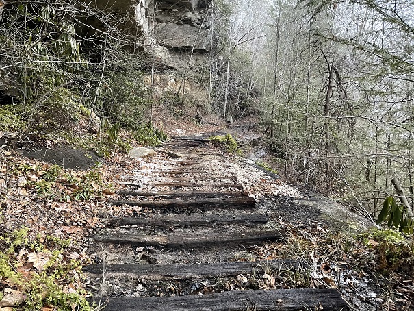
Mark Branch Falls
The Sheltowee Trace heads south from the Peters Mountain Trailhead and drops over onto Mark Branch. A short .81-mile walk down the trail brings the hiker to a steep set of steps with the sounds of falling water in the background. A trip down these stairs reveals the waters of Mark Branch Falls.

This 63-foot tall natural wonder is about three feet wide during normal flow. This plunge falls formed from the erosion of a thick layer of coal and Salvy creek shale which left a high ledge of grundy sandstone. The falls is a popular hiking destination due to its proximity to the Peters Mountain Trailhead. Enjoy this picturesque spot because you will be dealing directly with the waters of Mark Branch for the next 1.44 miles.
Creek Walk on Mark Branch
Leaving the Mark Branch Fall and heading downstream on Mark Branch, hikers will enjoy a scenic walk through the middle of the creek. This section of the trail follows the steep banks of Mark Branch, and there is no real alternative other than to place the trail in the stream.
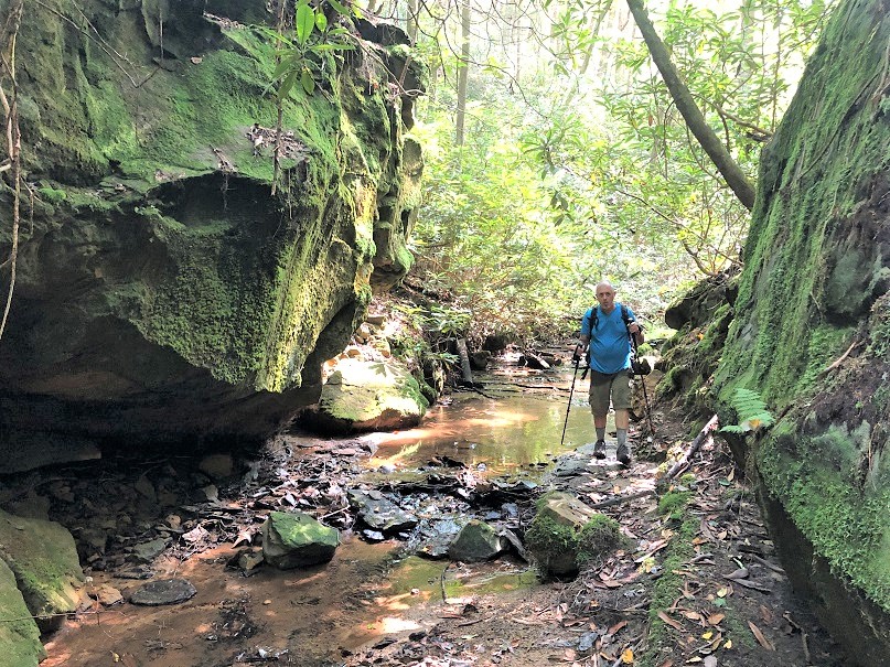
Please use extreme caution when traversing this section of the Sheltowee because the rocks are slick. The last thing you want is an early and unexpected bath.
Hemlock Grove Picnic Area
After walking down Mark Branch, a sharp left turn takes the Sheltowee Trace along the edge of Rock Creek. Across the Rock Creek from the mouth of Mark Branch is the Hemlock Grove Picnic Area. The area has a vault toilet, many picnic tables, and access to Rick Creek. Wading through Rock Creek is required for those who wish to visit the area.

Hemlock Grove was named for many giant Eastern Hemlocks that grow throughout the Big South Fork and around the picnic area. The site is a popular area for trout fishermen. Rock Creek, designated as a “wild river,” supports various aquatic wildlife and is stocked periodically with native fish species, including trout and smallmouth bass.
Rock Creek State Wild River
Rock Creek Wild River stretches from the White Oak Junction bridge to the Kentucky-Tennessee border. The run of this small river is contained entirely within the boundaries of the Daniel Boone National Forest. According to the Department of the Interior, the Rock Creek watershed “contains mixed mesophytic forests dominated by oak-hickory and oak-pine. The waters of the stream support diverse aquatic life.”
The National Parks Service, in an ongoing effort, is working to restore the natural conditions and beauty of the Rock Creek watershed by mitigating the damage from abandoned land mines and other commercial activities. Since the mines were abandoned, highly acidic water, mine blowouts, abandoned facilities, and the remnants of unsafe mining practices have killed much of the vegetation and aquatic life in the stream. That reclamation work is ongoing but showing some positive signs.
Great Meadows Campground

About two miles upstream from the Hemlock Grove Picnic Area and across the creek from the Sheltowee Trace is the Great Meadows Campground. The campground is built on 2 acres of land that once belonged to the Boyatt family. The Boyatts were the last family to live on No Business Creek. The landowner, Ransom “Ranse” Boyatt (1871-1933), lived and raised his family in a large two-story home on the property. The old house chimney still stands on the Great Meadow Farm near the family cemetery where Boyatt and his family are buried.
On April 21, 1933, Ransom Boyatt and his son, Jerome, were involved in a national news story. The Sheriff of Pickett County, his son, and others went to Rock Creek near the McCreary County, Kentucky and the Pickett-Scott County, Tennessee line to arrest Jerome Boyatt for assaulting his uncle, Albert Boyatt. They located the suspects in a railroad car and approached the door Jerome Boyatt fired his .45 caliber pistol at the lawmen killing Deputy Sheriff John Floyd Winningham instantly and fatally wounding Pickett County Sheriff George Winningham, who died the next day.
According to news reports, Jerome Boyatt ran from the scene and hid on Rock Creek near his family home. A posse of 40 officers and more than 100 men from the neighboring communities poured onto Rock Creek, looking for the murders. They arrested four in connection to the case but couldn’t find Jerome or Walter Crabtree, another suspect Officers declared it “impossible for the hunted men to escape.”

When the posse came to the home of Ranson Boyatt and arrested him for not telling officers where his son could be located. He was questioned by authorities and released after he agreed to find and bring his to the sheriff’s office. The next day, officers visited the home of Ransom Boyatt and located the old man in his bed, dead. An inquest was held and determined that Ransom Boyatt had been murdered when someone broke his neck and then placed him in the bead Ransom Boyatt was buried on the hill behind near his home on what is now the Great Meadows Campground. No one was ever charged with the death of Ransom Boyatt, but officials suspected that his son may have had some involvement.
Jerome Boyatt made his escape from the area but was arrested on May 24, about eight miles from Oneida, Tennessee. He was lodged in the Scott County Jail.
On June 9, 1933, a mob of 100 heavily armed men stormed the jail and took two prisoners from their cells. They were stripped naked and turned loose into the woods where the large crowd chased had shot at them. The bodies of Jerome Boyatt, shot at least seven times, and that of Harvey Winchester, riddled with more than 50 bullet holes.
Welcome to Tennessee
Near the mouth of Massey Branch, hikers will cross a small bridge and enter the state of Tennessee. Your first steps into a new state are in Scott County. The rest of our hike will continue in the Big South Fork National River and Recreation Area to the Burn Mill Bridge.

Tennessee was admitted to the United States on June 1, 1796, as the 16th state. It is named for “Tanasi,” a large Cherokee village in the eastern section. In 2020, the state ranked 36th in total area and 16th in population. Its capital is Nashville and is home to nearly 7 million inhabitants. The state is approximately 440 miles wide and 120 miles tall. It has 41,217 square land miles and 926 square miles of water. Tennessee’s highest point is Clingman’s Dome (soon to be Kuwohi) at 6,643 feet, but you must hike the Appalachian Trail to see that view.
The Old Trail to Pickett CCC Memorial State Park
Shortly after crossing into Tennennsse, the John Muir Trail and the Sheltowee Trace will separate. The John Muir Trail will continue on the path of the old Sheltowee Trace to Pickett CCC Memorial State Park. The Sheltowee Trace had its southern terminal at Pickett State Park for many years. The trail was rerouted and currently ends at Burn Mill Bridge, but not for long. Be aware and careful at this intersection as the path makes a sharp, uphill turn and does not continue to Pickett despite what the old signs indicate.

The Tennesse Department of Parks advertises that “Pickett CCC Memorial State Park lies within the 20,887-acres Pickett State Forest and is adjacent to the massive 125,000-acre Big South Fork National River and Recreation Area. In 1933, the Stearns Coal and Lumber Company donated nearly 12,000 acres of land to the State of Tennessee to be developed as a forest recreational area. Initial development of the area by the Civilian Conservation Corps (CCC) occurred between 1934 through 1942. The CCC constructed hiking trails, five rustic cabins, a recreation lodge, a ranger station, and a 12-acre lake. The park memorializes and preserves the unique work of the CCC who first developed the park.” Learn more about Pickett CCC Memorial State Park here.

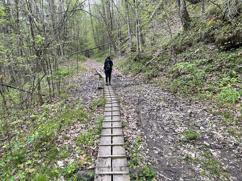
Massey Branch Coal Mines

After turning onto Massey Branch, the Sheltowee Trace follows the steep bed of a coal railroad bed as the old path makes its way up the hill. Near the head of the creek, a section of the trail has washed away the topsoil and exposed a section of old railroad ties. These wooden ties once held the steel tracks upon which the rails ran as the removed resources, including timber and coal from this area. All that remains to verify that a large-scale operation once existed here are these wooden reminds. Be careful as the algae, mud, and rotten wood make these wooden sidewalks slick.
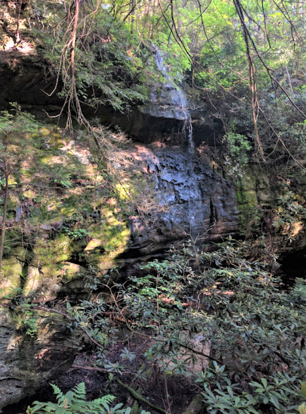
Massey Branch Falls
Massey Branch Fall is a plunge that drops more than nine feet to the valley floor below. The waterfall is beside the Sheltowee Trace and near the head of Massey Branch. Bright green algae and moss combine with the unique rock features of this waterfall attractive to hikers and those who photograph waterfalls in the National Parks Service.

Divide Road
Divide Road is a United States Forest Service Road that runs more than 10 miles from Highway 154 to Peters Mountain. The roadway marks the end of Hike Nine and the beginning of Hike Ten. Take a break from that long climb out of Massey Branch and rest while you wait for your shuttle ride back to your car.

Have a great hike and enjoy the coming fall colors as the leave have already started to change and fall along the trail.
© 2022 Stephen D. Bowling

As always, so very interesting. Your words change my perspective as I hike through what I consider “wilderness” but know other eras have left their mark. Fascinating.
LikeLike