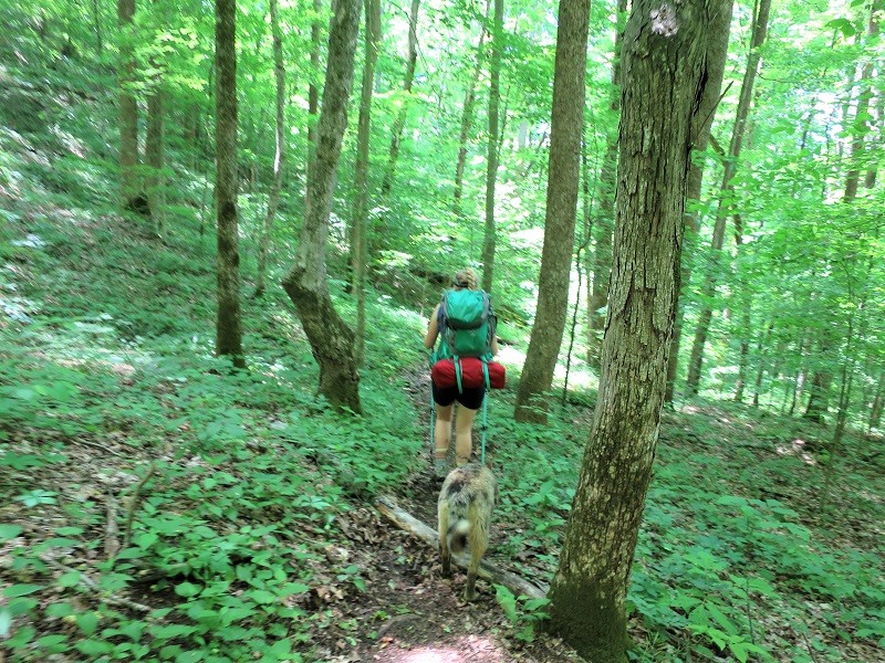
Levi Todd Road to S-Tree Fire Tower Road
Researched by Stephen D. Bowling
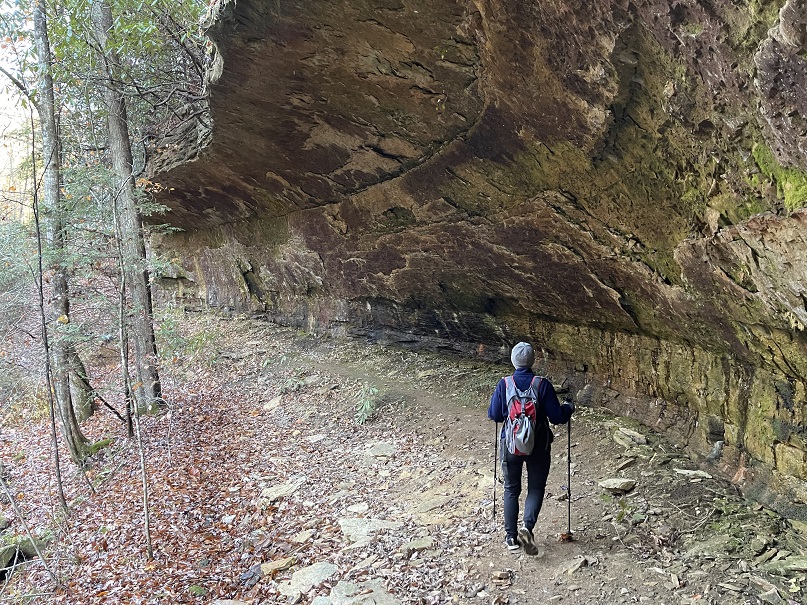
Copperas Cave Creek
Leaving Cressmont Road, hikers will travel a short distance on Levi Todd Road. Less than a quarter of a mile into the hike, the trail traverses an old bridge that must be carefully crossed over Copperas Cave Creek. Hikers will have to pass through Copperas Cave Creek a few hundred yards farther. The creek is named for the two large rock shelters found along its banks. The stream and the surrounding area were part of the 37,00 acres that the Turkey Foot Lumber company purchased in 1912.
As you make your way up and over the mountain near Hale Ridge, you will hike on both the right and the left forks of Copperas Cave Creek. As you walk, you will pass several retaining walls made of stone and several concrete structures used by the logging operation and later two strip mines that removed coal from the area. This section ends with a climb out of Copperas Cave Creek onto Farmer Ridge as you make your way to Arvel.
Old Orchard
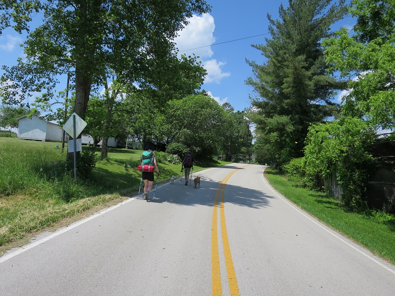
The Sheltowee Trace emerges from the wood onto Hale Ridge Road and turns left. A .5-mile walk along Highways 578 and 1209 passes through the community of Old Orchard. The community is now only a few remaining homes and an abandoned storehouse near the intersection of 578 and 1209.
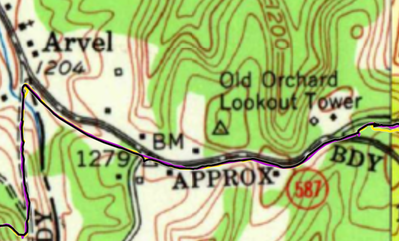
For more than 40 years, a Forest Service fire tower stood near Reece Lane. The Old Orchard Lookout Tower was manned 24 hours during fire season as an attendant watched over the area for forest fires. The tower was abandoned and removed after more effective and cheaper means of fire observation were introduced by the forest service beginning in the 1970s.
Arvel, Kentucky
Located near the corner, the intersection of Jackson, Lee, and Owsley County, the community of Arvel, Kentucky is an unincorporated portion of Lee County. The community is unusual because the post office was located in Lee County, and the other side of the roadway was Jackson County. Less than a quarter-mile away is the western corner of Owsley County.
Jackson County
When you step off Highway 1209, you enter a new county on our march south to Tennessee. Jackson County, Kentucky was established by the Kentucky General Assembly in 1858. Portions of Madison, Estill, Clay, Owsley, Laurel, and Rockcastle Counties were combined to create Jackson County.

Named for President Andrew Jackson, Jackson County is home to 12,955 people according to the 2020 census. The county seat of McKee is “wet” while the rest of the county does not permit alcohol sales. Nearly one-fourth of the county is within the boundaries of the Daniel Boone National Forest.


Flat Lick Fall, S-Tree Campground, Turkey Foot Campground, and 35 miles of the Sheltowee Trace can be found here.
Sand Gap, a small community north of McKee, was home to country comedian David “Stringbean” Akemon, a member of the Grand Ole Opry and one of the stars of the television show “Hee-Haw” before his murder in 1974.
Embry Curry Memorial

As you leave Highway 587 at Arvel, a stone monument is lying on the ground at the intersection. The monument was placed years ago to honor Embry Curry but was knocked over in an accident. The stone was placed by friends of Curry in appreciation of his hard work organizing trail rides across the state and along the Sheltowee Trace as the President of the Appaloosa Horse Club.
Curry, a proud Korean War veteran, was born on November 10, 1929, at Valley View in Madison County and was the son of Walker and Rea (Benton) Curry. He was orphaned when he was young but was lovingly raised by his uncle, Robert, and his wife, Lydia Curry. He attended embalming school and found work at Oldham, Robert, & Powell Funeral Home in Richmond.
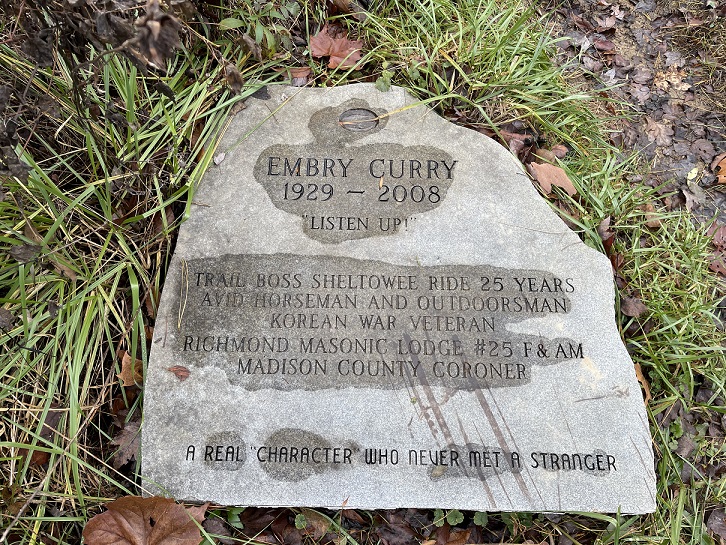
He was elected and served six terms (24 years) as Madison County Coroner. He died on June 19, 2008 in Richmond and was buried in the Richmond Cemetery. He is described on the monument as “A Real Character Who Never Met A Stranger.”
Alcorn Branch Falls
After reaching the top of the hill, hikers will cross a gravel forest service road and reenter the woods. Traveling down Alcorn Branch for 1.14 miles, you will hear the sound of falling water before you see the waterfall on your left. The waterfall plunges over the edge of the rock line and drops more than 18 feet to the valley floor below. The falls were created after years of water wearing away the shale and limestone rock that lies beneath the soil on Alcorn Branch.

The falls can be seen from a distance below the trail but can be very difficult to access the area below the falls due to steep hillsides and slick conditions. If you choose to visit this site, please be careful and watch your step. For more information, visit the Kentucky Waterfalls website.
War Fork
Alcorn Branch empties into War Fork of Station Camp Creek which ultimately flows into the Kentucky River at Irvine, Kentucky. Hikers will follow War Fork upstream for 4.53 miles to the camp spot at Resurgence. These 4.53 miles are difficult and are some of the most remote along the Sheltowee Trace. The path meanders along the side of the mountain before dropping down to Resurgence Cave.
Legend holds that War Fork was named for the constant fighting between three landowners over the exact boundaries of their property. More recent hikers have suggested that it is a battle to get through this 5 miles section.
Resurgence Cave
Along the banks of War fork is one of the nicest camping spots that we will utilize during the 2022 Challenge. The flat area near the mouth of Resurgence Cave is a cool place to sleep and refresh for the Sunday hike. Located in Jackson County, Resurgence Cave was created by the wearing away of limestone rock by years of water flow. The water funneled underground by layers of limestone rock reemerges at this point as the water makes its way downstream.
The creekbed is frequently dry and the only water source is the stream from the cave. Take some time to explore the area and look for fossils in the creek bed. Take a swim or kick off your shoes and rest your feet in the cold water- just do it downstream from the people filtering their water.

Turkey Foot Girl Scout Camp

Turkey Foot Campground is located on the banks of War Fork near Resurgence Cave. The Sheltowee Trace will pass near the campground but does not go through. The trail is often crowded near this popular spot.
Several major branches of War Fork converge at this point- Elsam Fork, Hughes Fork, Guys Branch, Lime Kiln Fork, and Steer Fork unite to make War Fork. Named for the Turkey Foot Lumber Company, which owned the land, the campsite is very popular and is full most nights during the warmer months of the year.
The National Forest Service established a campground at this spot in the 1970s with help from the local girl scouts. Facilities at the campground provide opportunities for camping with a picnic table, fire ring, tent pad, and lantern pole at each campsite.
There are no facilities for potable water or electricity at this campground. War Fork runs beside all 15 of the campsites at Turkey Foot and is stocked annually with trout. Vaulted toilets are available for use.
Elisha Branch and Highway 421
Leaving the Turkey Foot Campground, the Sheltowee Trace makes a long and steady climb up the Middle Fork of Elsam Fork to the top of the hill via a shared-use trail. The trail is often muddy and filled with large mud puddles that must be forded or bypassed. At the top of the hill, the trail will parallel and eventually crosses a roadway before following a long ridge down into Elisha Branch. The trail is rugged and should be taken at a slow pace due to loose rocks along the steepest sections.

Elisha Branch intersects Highway 421 at Birch Lick Creek. McKee, Kentucky is located 2.01 miles to the left and the Big Turtle Trailhead is about one mile in the same direction. This area is often referred to by hikers at “The Daycare” due to the children’s care facility located at this intersection. If you have some change or cash, the Pepsi machine is usually turned on and cold before the road walk ahead.
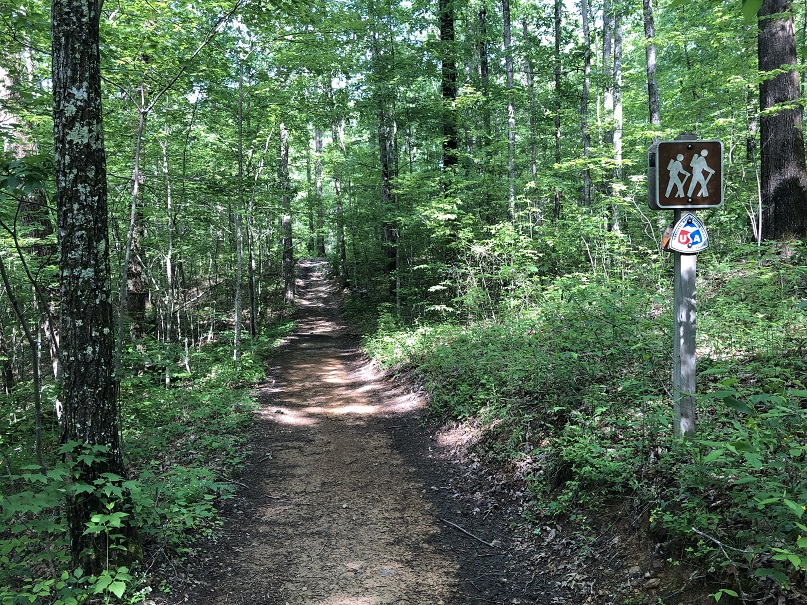
Multi-Use Trail
After walking a little more than a mile north along Highway 421, the Sheltowee Trace makes a left turn across Birch Lick Creek onto a section of multi-use trail. Along this section, the National Forest Service permits all-terrain vehicles, horses, bikes, and hikers to enjoy access to this area.
Trail maintenance and erosion abatement have not been completed on all sections in this area. Some portions have had concrete erosion tiles placed but other areas remain to be completed. Large piles of star-shaped erosion tiles can be seen at various points along the trail. Be aware of other trail users and pay attention to the Trace Notes and trail guides. Several trail markers and blazes are missing along this section.
S-Tree Campground
S-Tree Campground is located in Jackson County, just a few miles from McKee, Kentucky, and provides access to numerous trails for both hikers and horseback riders. Located on the ridge above Horse Lick Creek, the S-Tree is operated as a fee site by the United States Forest Service and provides 20 campsites on two loops.

The picnic shelter at the site is one of the few remaining buildings in the area constructed by the Civilian Conservation Corps in the 1930s. There are no facilities for water or electricity at this campground. S-Tree is named for the large oak tree that once stood near the fire tower with a large “S” scratched into the bark. The tree and the letter marked the boundary of property owned by Sidney “Big Sid” Martin. The tree was often a reference point for people in the area who referred to it as the S-Tree and the name stuck.
S-Tree Look Fire Out Tower
S-Tree Fire Lookout Tower once stood at the high point near the entrance to the campground. According to the Forest Service, towers like S-Tree were important tools in detecting and fighting devastating forest fires. Fire towers were also home to the lookouts who ran them.
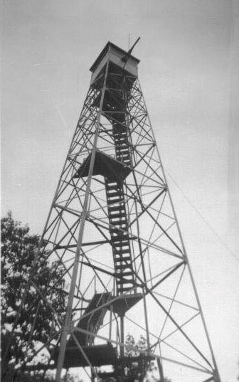
A tower cab at the top of the stairs was just big enough for a wood stove, two cots, a cabinet, a storage box, a small table, and a stool. The all-important alidade, or fire finder, stood in the middle of the room. By the mid-1970s, firefighters used airplanes and helicopters for fire detection.

Many towers, like S-Tree, were torn down because they could no longer be maintained in a safe condition. The tower was demolished in October 2019 after it was abandoned and was damaged by vandals.
Enjoy your hike and be prepared for June.
Memories of the S-Tree Fire Tower- Barefoot Memories of a Hillbilly
© 2022 Stephen D. Bowling
