
By Stephen D. Bowling
Clear Creek Furnace
Beginning in the late 1700s, Kentucky was one of the leaders in iron production in the United States. Several small furnaces on Clear Creek produced a limited quantity and quality of iron until production ceased in 1857 and remained closed during several economic downturns and the Civil War. In 1873, the furnace was rebuilt and renamed Bath Furnace.
William S. Allen and W. A. Lane operated the furnace from 1873 until its last “blast” in 1875. In 1874, Bath Furnace smelted 1,339 tons of pig iron. Like numerous other Kentucky furnaces, Clear Creek Furnace used charcoal for fuel and was purposefully constructed on a stream to take advantage of steam power.
Limonite, an abundant iron ore found in Kentucky, was frequently mined and used at this location. This specific ore was ideal as it produced an extremely durable iron. The Bath (Clear Creek) Furnace processed ore that was eventually turned into wagon wheels and railroad car wheels. The Clear Creek or Bath Furnace still stands today and is one of the best-preserved nineteenth-century Kentucky iron furnaces.
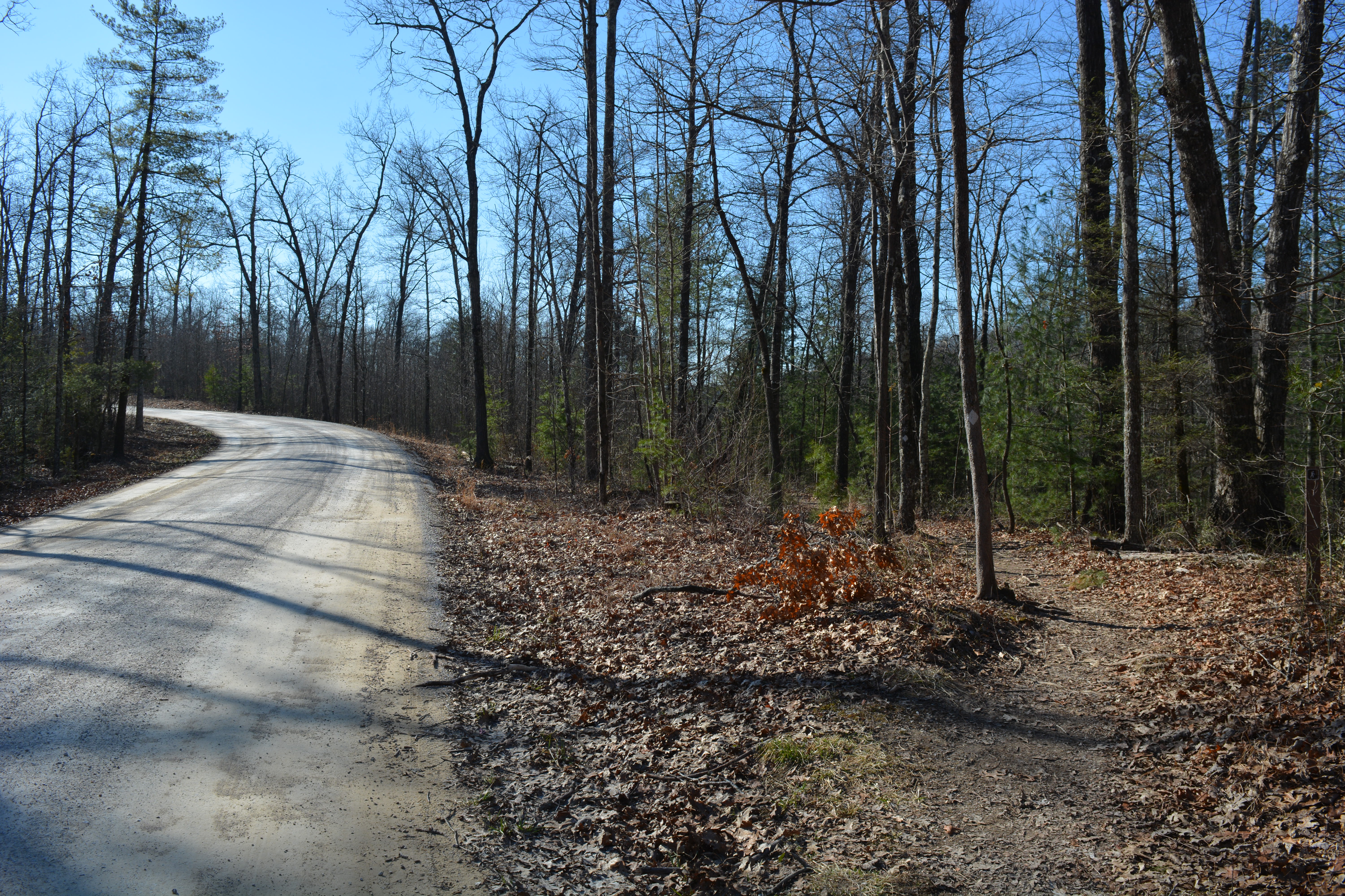
Mount Misery
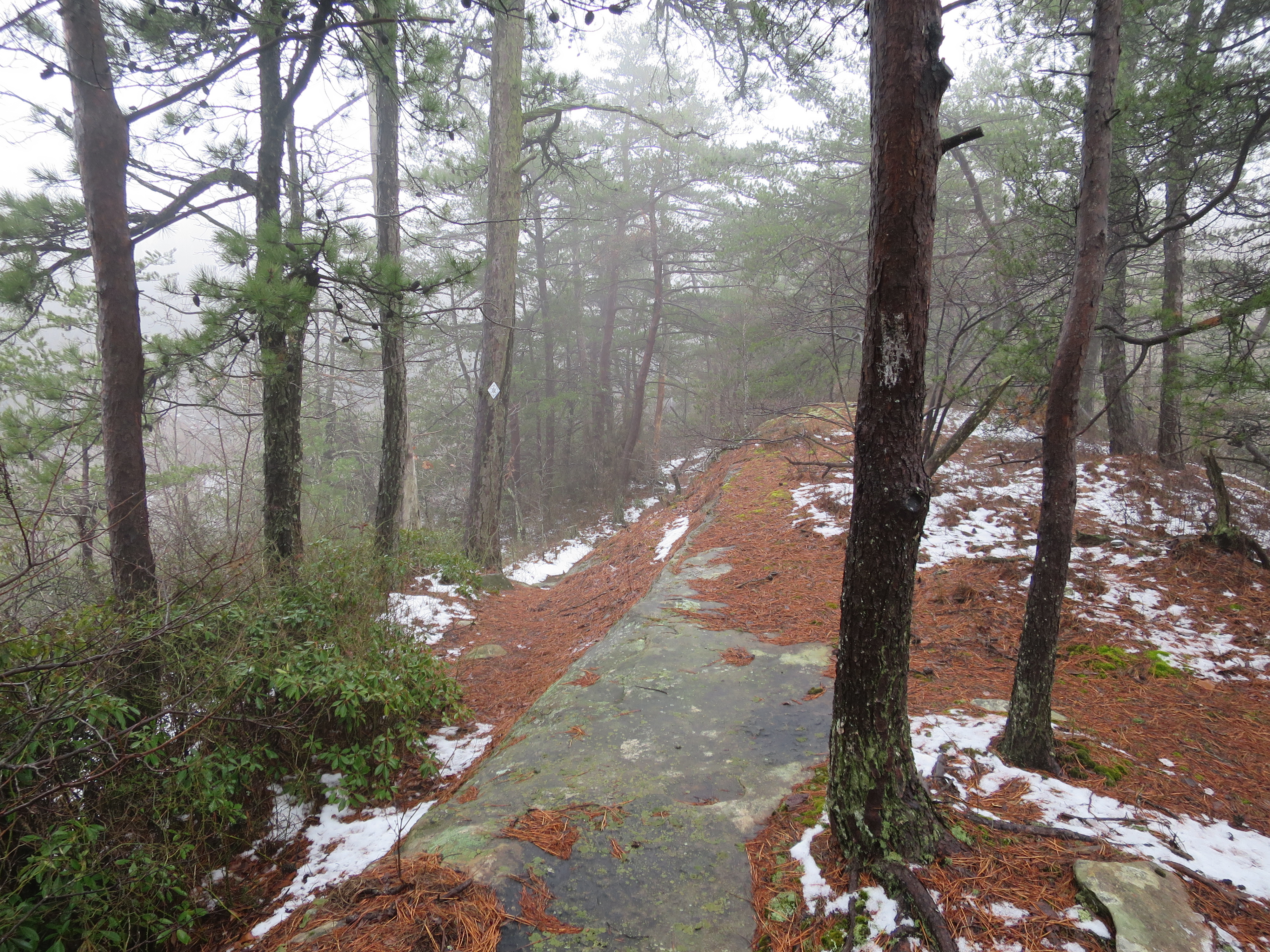
On February 28, 2019, the United States Forest Service closed and rerouted a large section of the Sheltowee Trace. A landslide destroyed a large portion of the trail from Clear Creek to the ridge near the Carrington Rock Trail. An emergency bypass was created that routed the Trace around the slide and near the Clear Creek Shooting Range. After the approval of the National Forest Service and several months of work by the members of the Cave Run Chapter of the Sheltowee Trace Association, a new path was cleared up the mountain to connect with the old trail.
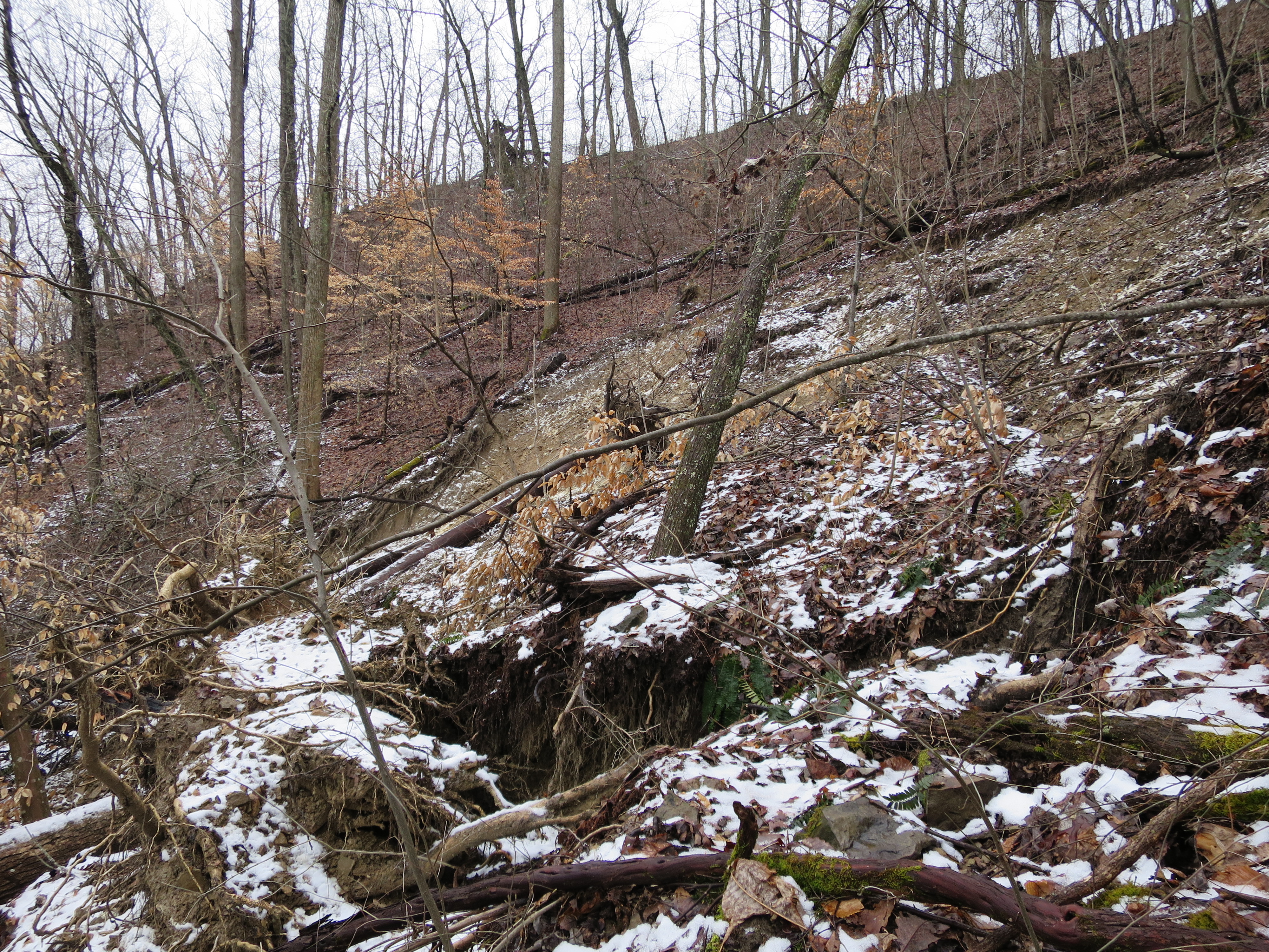
The new path created a steep and challenging climb with an elevation gain of nearly 500 feet in half a mile. The new section of trail has been given the loving moniker of “Mount Misery” by many southbound hikers who have made it to the top. Be prepared to start Hike Three with a significant challenge that will wake up the legs and back for the rest of the day. Take your time and climb slowly- Furnace Arch will make everything better. Remember- this is the Sheltowee Trace Hiker’s Challenge.
Furnace Arch
Furnace Arch is a natural opening just 20 yards off the Sheltowee Trace between Clear Creek and Highway 1274. The fifty-foot opening in the low gap between McDale Branch and Glady Hollow is one of the largest arches hikers will pass during the 2022 Hiker Challenge.

The opening was created long ago as wind and moisture on this ridge weathered away and joined two rock shelters to create this large opening in the red sandstone. Take the time to climb the 20 yards up to Furnace Arch and enjoy one of the most beautiful spots along the northern section of the trail. If you are hot from the climb up the hill, a cool breeze usually blows through this opening.
Menifee to Bath
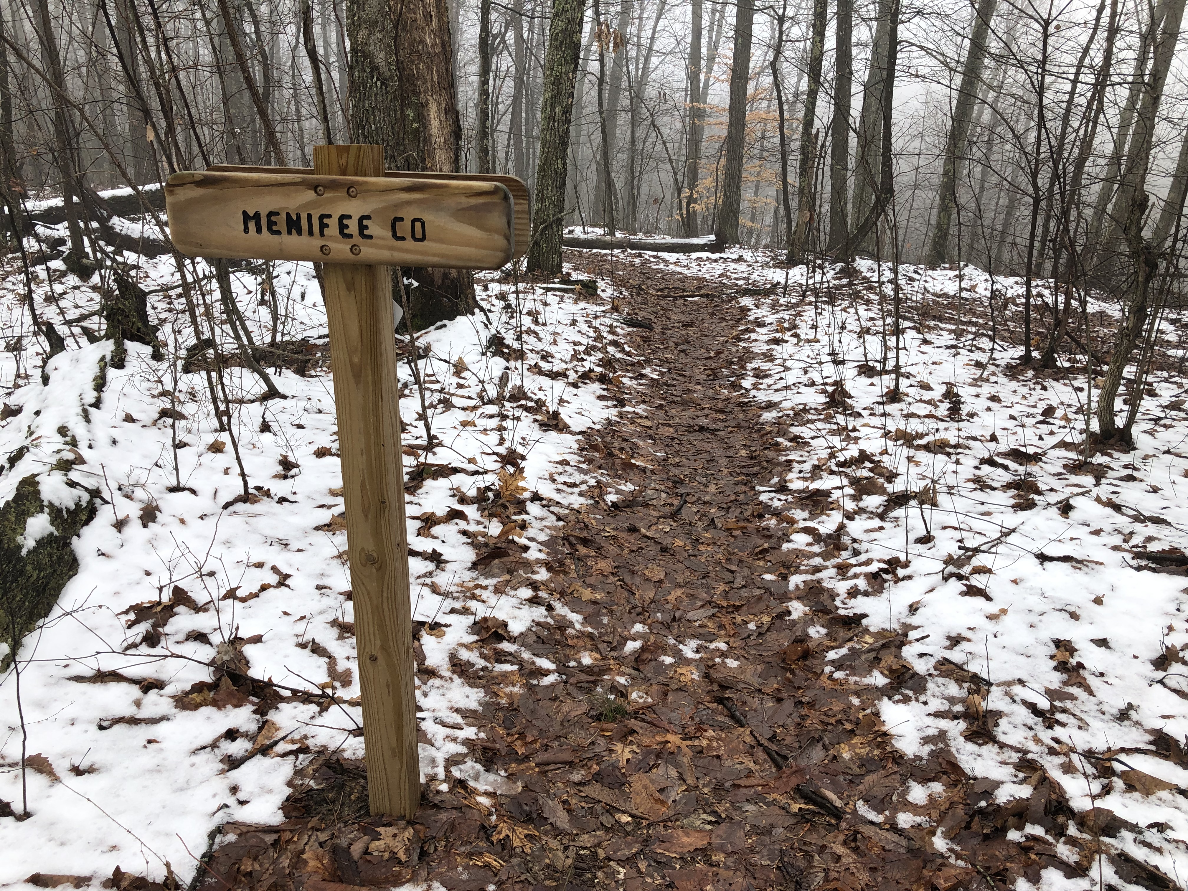
After walking 1.33 miles past Furnace Arch, a small sign welcomes hikers to Menifee County; the marker identifies the point of transition to our fourth county. Menifee County was created by an act of the Kentucky State Legislature on May 29, 1869. Named in honor of Congressman Richard Hickman Menefee, the county’s spelling was slightly changed due to an error by a state legislator.
Menifee County covers 206 square miles of which 2.3 square miles are water and remains one of the remaining Kentucky Counties where alcohol sales are prohibited. Frenchburg serves as the county seat and was founded in 1869. Menifee County is home to 6,113 residents according to the 2020 United States Census.
James T. Mullins Farm
It is important to remember the people who owned the land before the Daniel Boone Forest was established or who own the land privately and permit hikers to cross the property. After a few small climbs and walking across a ridgeline, hikers will drop over the hillside onto the former property of James T. Mullins.
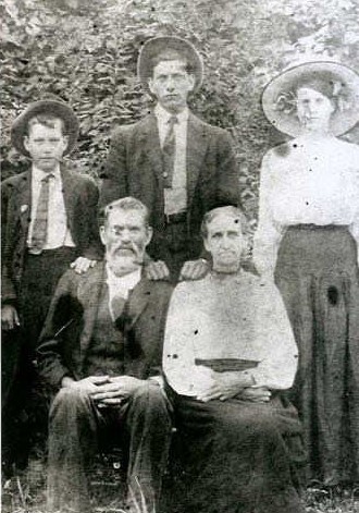
As we hike down the hill to the gravel road on Richardson (formerly Ratliff) Branch, we hike across the property that he owned during the Civil War. James Mullins was born in Menifee County in 1849. The steep hillside that you hike down was once covered in a large cornfield and a pasture for his horses. A veteran of the Confederate Army, he raised his children on this farm and it is still owned by members of his family.
Mullins married Mary Ann Lawson and he lived on the farm until his death in 1912. He is buried about 100 yards from the trail near the fallen chimney and rotting remains of this home.
The family still owns the bulk of the farm and graciously permits the Sheltowee Trace to cross the land. Please be respectful of these private landowners who support the efforts of the STA and the National Forest Service.

Gravel Pit
Near the head of Stonequarry Branch and Halfway Branch, hikers will cross an area of exposed pinkish-red stone known as the Gravel Pit. In the early decades of the 20th Century, stone and gravel were hand-quarried from this area for use on local roadways.
As late as 2020, gravel and materials were being taken from the valley below on Stone Quarry Branch. A large lake, created by the stone quarry operation, has come under some scrutiny in the last two years as some local residents worry about the dangers of the impounded water. Some area residents have been working to remove the lake but, as of now, it remains as part of the visible signs of the huge stone quarry that operated here.
Beaver Creek and the Red Barn
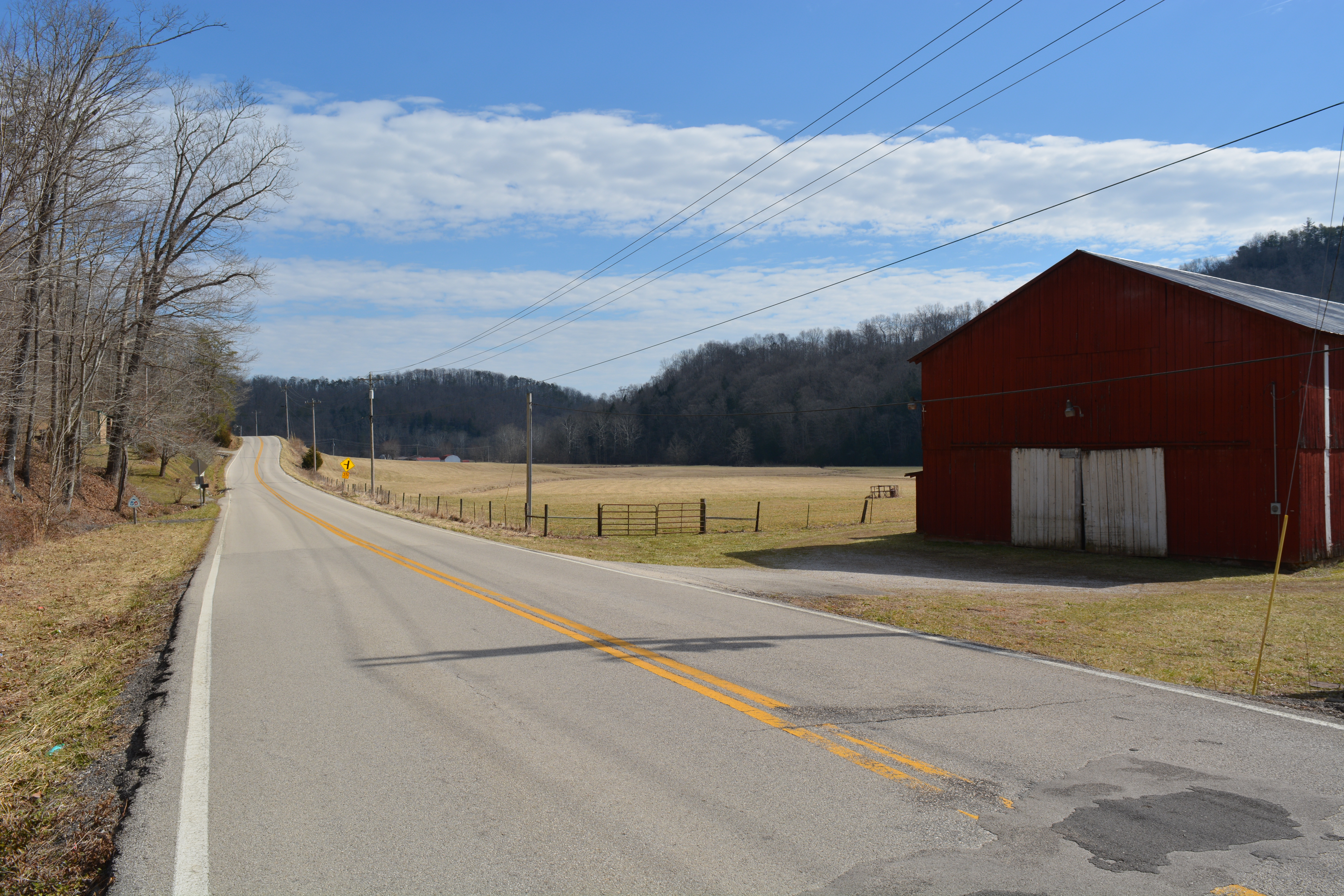
After a short 9.1-mile hike, the trail drops over the hill and down to the famous red barn on Highway 1274 on the bank of Beaver Creek. Beaver Creek drains a large portion of the Menifee County watershed and empties into the Licking River near the corner of Bath, Menifee, and Rowan Counties. The Trace follows the roadway for 1.4 miles before it turns onto Clifton Road.

Look carefully at the ridgeline across the creek from the red barn and you might be able to see one of the 10 arches on the hillside between Beaver Creek and Clifton Branch. As you turn onto Clifton Road, look to your right and you will see Kentucky Arch #122 in the sunlight. Spratt’s Arch, Devil’s Markethouse, Trace Branch, Buttress, and Rock Pile Arch are just a few of the natural wonders on this ridge.
Shrout Cemetery

The Sheltowee Trace passes by thousands of old homeplaces and abandoned farms. The Trace will also pass more than 50 cemeteries. One of the first that is very near the trail is the Shrout Cemetery, which is in the woods just after passing through the creek on Clifton Branch.
Hikers will pass by a green sign installed by the county marking the location of Shrout Cemetery. The cemetery is located approximately 250 feet from Clifton Road and is the burial location of the Henry Shrout Family.
Henry Shrout was born on October 28, 1825, in Bath County, Kentucky. In 1847, he married Elizabeth A. Clarke (1830 – 1906).

In the late 1860s, the couple moved to property on Clifton Creek of Beaver Creek. There they raised their 12 children. Henry died on January 27, 1905, at their home near the cemetery and was buried the following day.
His wife, son, Henry Richard Shrout, and several other family members are buried in this family cemetery. Of the 8 graves located here, only three are marked with readable stones.
If you choose to visit this Sheltowee Trace landmark or any along the way, please do so with respect to the memory of those buried there.
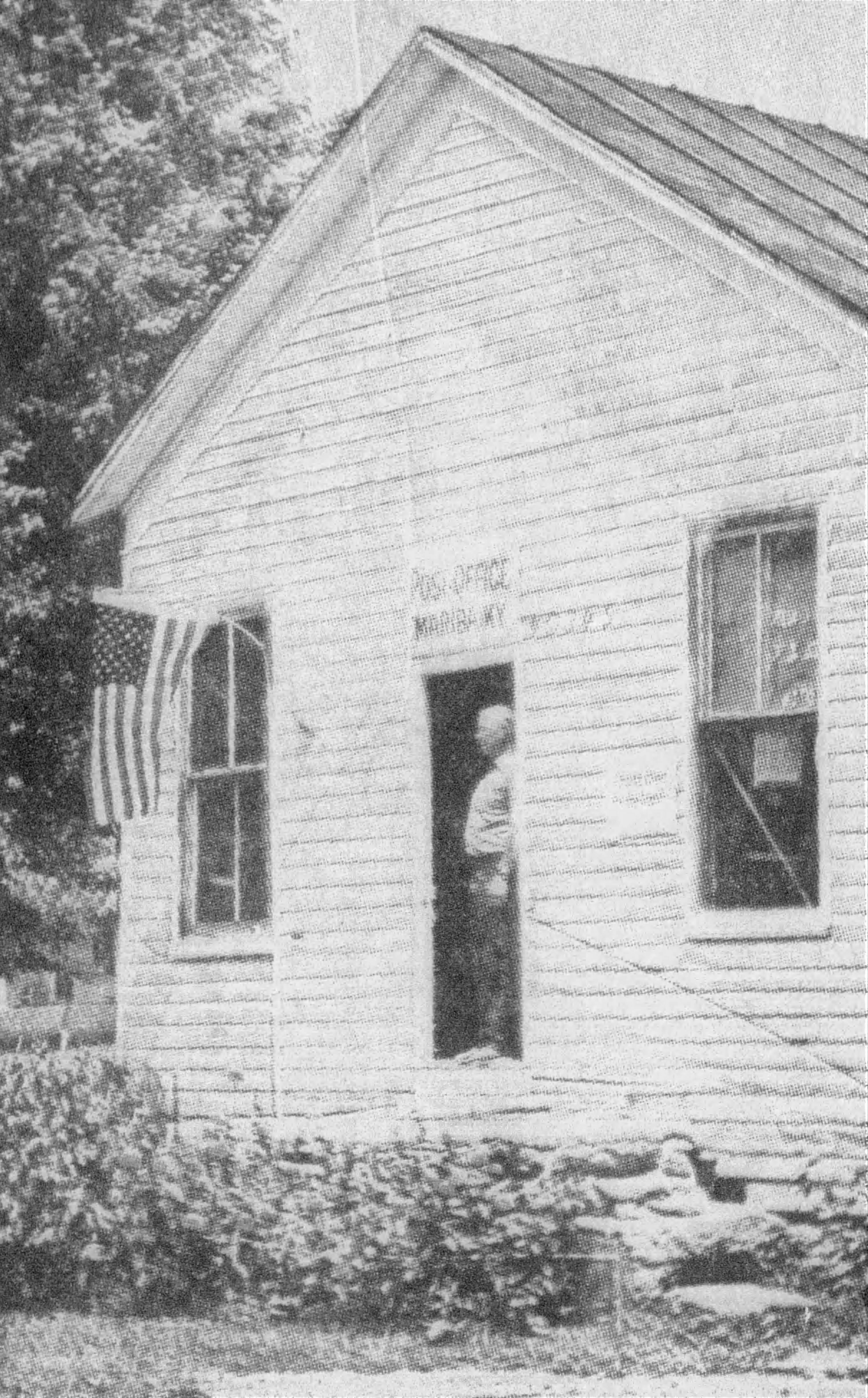
Mariba, Kentucky 40345
On May 10, 1882, Postmaster Jonathan S. Osborn opened the Hariba post office to serve the small Menifee County village of Pokeberry on Mariba Creek, a tributary of the Red River. The postal service made an error after some illegible handwriting and misspelled the intended name of the post office.
The intent was to call the new post office Mariba in honor of Osborn’s daughter Frances Mariba Osborn (pronounced Mary-Bah). After several petitions, the United States Postal Service corrected the name on March 15, 1886.

The post office operated near the present intersection of Highway 77 and 460 as Mariba, Kentucky 40345 for more than 114 years before it closed on January 6, 1996, due to Post Service cutbacks.
Mariba Osborn married wealthy lumberman and county judge William Christopher Taylor in 1882 in Menifee County. The couple later moved to Winchester and built a large home on Colby Road. She died there on May 1, 1947, and is buried beside her husband in the Winchester Cemetery. You will know you are at Mariba, when you reach the four-way intersection of a very busy highway. Frenchburg is four miles to the right.
Corner Ridge
Corner Ridge Road runs .96 miles from Highway 77 to the Corner Ridge Trail Head located on the edge of the Clifty Wilderness. The large, flat area in the woods to the right of the trail about fifty yards beyond the stones will serve as our camp for Hike Three after you have completed 18 miles today.

The Corner Ridge Trailhead is a parking area at the intersection of Corner Ridge Road and the Sheltowee Trace. It is considered the northern entrance to the Clifty Wilderness and the Red River Gorge. The Corner Ridge Trailhead is marked by a series of large stones that have been placed across the trail to prevent motorized traffic from accessing the popular area.
Clifty Wilderness
A short section of our 354-mile hike will pass through the Clifty Wilderness Area. The Clifty Wilderness is a 12,646-acre area managed by the Cumberland Ranger Station and has more than 20 miles of trails. The section that we will primarily walk follows the remnants of an old railroad bed down the hill to Salt Fork.
The Wilderness offers valleys filled with dense hemlock forests and numerous ridges with amazing landscape views. The Forest Service advertises that the “terrain is rugged and steep, offering plenty of physical challenges and adventures.” Our adventure in the Wilderness is a little over two miles long.
Clifty Wilderness supports an unusual array of more than 750 flowering plants and 170 species of moss that thrive in the area. This diversity is attributed to geographic location, topography, and glacial history. Some plant and animal species in this area are listed as endangered, threatened, sensitive, or rare, especially white goldenrod which is native only to the Red River Gorge area.
Salt Fork

Wet feet ahead!! After descending 2.5 miles from the camp at Corner Ridge Road, the Sheltowee Trace crosses Salt Fork near the point it empties into Gladie Creek on its way to the Red River. The crossing is normally ankle deep but can be waist deep and rapid during times of high water. Crossing Salt Fork marks the transition from the Clifty Wilderness area into the Red River Gorge National Geological Area.

Salt Fork drains more than 2,141 acres and receives water from Round Meadow Branch, Silvermine Branch, Green Gose Branch, and numerous smaller drains. A total of 21 arches have been discovered and mapped in the Salt Fork watershed with areas still left to search.
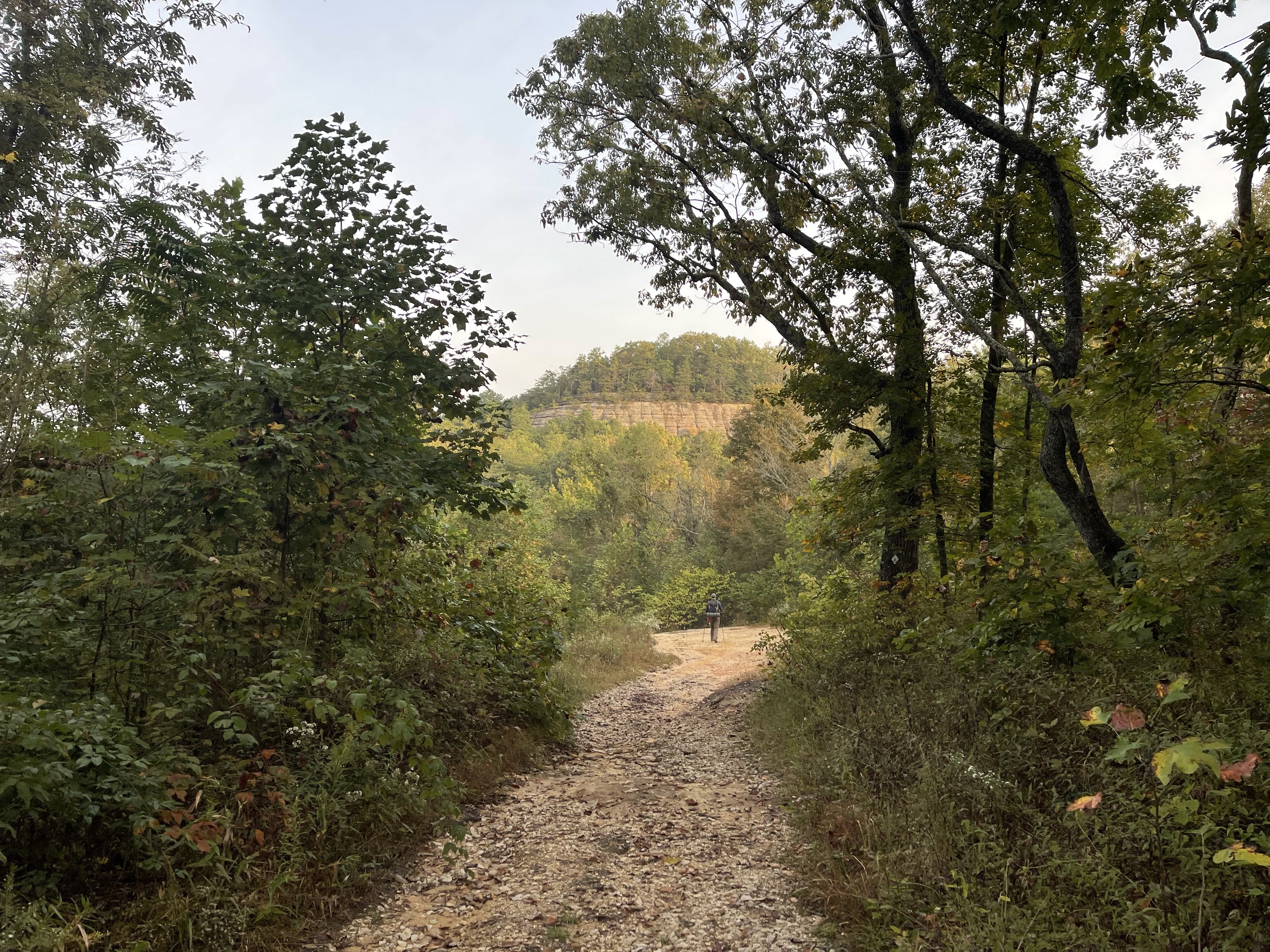
Red River Gorge National Geological Area
According to the National Forest Service, the Red River Gorge is a canyon system on the Red River in east-central Kentucky and is part of the Pottsville Escarpment.
The Gorge lies within the Daniel Boone National Forest and has been subsequently designated as the Red River Gorge Geological Area, an area of around 29,000 acres. The Red River Gorge currently carries the designation as a National Natural Landmark, a National Archaeological District, and is listed on the National Register of Historic Places. The Red River Gorge offers an abundance of sandstone cliffs, large rock shelters, and hundreds of waterfalls.
Recent explorations of the Gorge have documented more than 1,100 arches (natural opening larger than 3 feet) and windows (openings smaller than three feet but larger than one foot). The Red River Gorge and the Clifty Wilderness are home to the largest concentration of natural arches east of the Mississippi River and contain the second largest concentration in the world behind Arches National Park in Utah (but we are catching up quickly).

In the last 20 years, the Red River Gorge and the surrounding area have become one of the world’s most popular climbing destinations thanks to the efforts of the Red River Climber’s Coalition and other groups. A large section of the upper Red River Gorge was designated as a Kentucky Wild River by the General Assembly through the Kentucky Wild Rivers Program.
Hale Branch
One of the largest caves in the Red River Gorge is the limestone cavern near the mouth of Hale Branch. The Sheltowee Trace passes over the cave whose entrance lies between the trail and Gladie Creek. The cave is approximately 1/2 mile long and is reduced from 150 feet at the mouth to a six-foot opening at its head. Most caves in the Red River Gorge are closed to exploration and visitors due to White Nose Syndrome.

According to the National Park Service, white-nose syndrome (WNS) is a fungal disease killing bats in North America. Research indicates the fungus that causes WNS, Pseudogymnoascus destructans, is likely exotic, introduced from Europe in 2006. Since it was first discovered in New York, WNS has spread to more than half of the United States and five Canadian provinces, leaving millions of dead bats in its path. WNS causes high death rates and fast population declines in the species affected including the little brown bat (Myotis lucifugus), the federally listed Indiana bat (Myotis sodalis), and northern long-eared bat (Myotis spetentronalis), all of which are found in the Red River Gorge.
The Nightingail of Klaber Branch

On March 17, 1917, Lily May Ledford was born in a small home less than 300 feet from where the Sheltowee Trace now runs near the mouth of Klaber Branch. She grew up in humble circumstances and learned to play the banjo at an early age from her father.
In time, she would become one of the most influential female performers in American music and she helped establish the current music industry. Sadly, time and musical styles have forgotten her. She was the leader of the world-famous Coon Creek Girls, the first all-woman string band.

Known for her “claw-hammer” style of banjo, she also played the fiddle and kept many traditional songs alive through her performances. On June 8, 1938, Ledford and the Coon Creek Girls performed at the White House at the special invitation of President Franklin D. Roosevelt.
Her music influenced Bob Dyan, Woody Guthrie, Joan Biaz, Pete Seeger, Jean Ritchie, and many others and she was an important part of the folk music movement of the 1960s. She was diagnosed with lung cancer in 1983 and stopped performing. In 1985, she was awarded a National Heritage Fellowship in recognition of her contributions to modern radio and music. She died on July 14, 1985, at a hospital in Lexington. She is a member of the Kentucky Music Hall of Fame.
Listen to a 1938 recording of “Pretty Polly” by Lilly Mae Ledford.
Indian Staircase
Indian Staircase is one of the most visited attractions in the Red River Gorge although it is not an official trail. The climb up the side of steep sandstone rock is aided by shallow handholds and carved steps. Tradition says that the “stairs” were made by members of the Civilian Conservation Corps during their stay in the Red River Gorge in an effort to shortcut the trip back to camp while making trails in the area.

The exit to Indian Staircase is not marked by a Forest Service sign but is 5.12 miles into the hike on Sunday. It is not a part of the Sheltowee Trace and it is not advised to climb the Stairs in damp or wet conditions.

Indian Arch
Of the hundreds of arches that the Sheltowee Trace National Recreation Trail passes, Indian Arch is the closest to the trail. This large, orange and red, sandstone arch is a buttress-type arch that extends from the rock above over the hill to the cliff line below. Indian Arch is approximately 60 feet and has an opening at the top of the stairs of nearly 30.
The arch formed in a weak layer of sandstone when wind and rain weathered loose rock. The arch is very popular with Gorge visitors because of its proximity to the Indian Staircase and the Sheltowee Trace. The steps leading up the hill to the arch are steep and in need of replacement. Be careful when climbing the steps and the area below Indian Arch.
Sheltowee Twin Windows

The Sheltowee Trace makes a sharp right turn as you make your way down the point after leaving Indian Arch. A user-created trail leaves the Trace to the left and circles around behind a rock where the Sheltowee Trace Twin Windows can be found.
These two small natural openings are also called the “Cat Eyes” by hikers. They can be easily missed unless you are aware of their hidden location.
Cloud Splitter and Arch
About 7.76 miles into your Sunday walk, the Trace circles around a tall, sandstone outcropping known as Cloud Splitter. Cloud Splitter Overlook and the Cloud Splitter Arch, located about 800 feet from the trail, are two of the most popular destinations in the Red River Gorge for visitors from across the country.
A short .15 miles climb up a side trail brings hikers to the rock’s base. A climb up a rope or the side of the rock is required to visit Cloud Splitter Arch (through the crevice) or an open view of the Red River Valley from the end of the point. The Arch can be difficult to access and will require a short climb inside the large crevice on the right side of the rock. Be aware that the climb to the top is dangerous and relies on a small, unstable tree and an old rope that has been here for years. Make smart choices and do not try this climb when conditions are wet. Going up a wet Cloud Splitter is not bad, coming down can be faster than you want.
Suspension Bridge
The Sheltowee Trace crosses the Red River on a 100 plus foot suspension bridge after crossing Highway 715. The bridge, 9.94 miles into our Sunday walk, is the only means of crossing the Red River with dry feet for more than 5 miles in each direction.
The bridge links numerous trails on either side of the bridge and provides access to the Chimney Top Creek area and Hanson’s Point beyond.
County #5
As you cross the suspension bridge over the Red River you also cross into county number five on our trek. Wolfe County was created in 1860 and named for Nathaniel Wolfe, a Kentucky Legislator and lawyer. The county seat is Campton and more than 6,562 people call Wolfe County home as of the 2020 Census.
According to the Kentucky Equine Census, Wolfe County is home to more than 1,000 horses. Wolfe County had two large communities: one at Campton and one at Hazel Green. Over the years, a huge rivalry has existed between these communities after Hazel Green lost the county seat to Campton in 1861.
Chimney Top Creek
Chimney Top Creek drains thousands of acres of the Red River Gorge from the Mountain Parkway, Tunnel Ridge Road, and Koomer Ridge into the Red River. This steep valley is lined with 60-foot tall sandstone walls creating a natural gorge that has more than 50 arches and at least 12 waterfalls. Hanson’s Point, Princess Arch, Chimney Top Rock, and Half Moon Rock and Arch are all popular Gorge attractions on Chimney Top Creek.

Named for the Chimney Top Rock at its mouth, the area is filled with camping and hiking locations and is usually full of hikers during the warmer months. Sheltowee Trace hikers will cross Chimney Top creek four times and the water can be deep and swift. Please use caution in this area, especially the climb out of Chimney Top Creek through a small, steep, and often wet drain.
Rough Trail
After leaving the end of the Suspension Bridge, hikers will follow the Sheltowee Trace for 1.65 miles to a point where the Sheltowee intersects the Rough Trail #221. The trace and the Rough Trail run concurrently for 1.18 miles before the Trace veers left and the Rough Trail continues to the right. The Rough Trail (#221) crosses the Red River Gorge and is considered one of the “trunk” trails in the area. Many trails branch off the Rough trail as it makes its way east to west from Highway 715 to Highway 77.

The trail presents “challenging trail climbs from streamside to ridgetop and down again several times”. Despite the elevation challenges it presents, the Rough is one of the most used trails in the Gorge.
Welcome to Powell County
About 950 feet after passing the intersection Pinch ‘Em Tight Trail and the Buck Trail, hikers cross from Wolfe County into Powell County. No sign currently marks the transition, but you are now walking in your sixth Kentucky county. Created in 1852, Powell County is home to 12,613 and is in many ways a “bedroom” community for Mt. Sterling, Winchester, Georgetown, and Lexington. Like many eastern Kentucky communities, people in Powell County live here and enjoy the beauty but are forced to travel daily to jobs in other areas of the state.

Named for Governor Lazarus W. Powell, the county is 180 square miles and is home to the Red River Gorge, Pilot Knob State Nature Preserve, Nada Tunnel, and Natural Bridge State Resort Park. A large entertainment center and hotel have been proposed for the area around the Slade exit of the Moutain Parkway which crosses the county and through the county seat of Stanton.
Tunnel Ridge Road
The sight of the gravels on Tunnel Ridge Road means Hike Three is almost finished. After climbing up the steep and rugged Rough Trail (#221) and Pinch ‘Em Tight Trail (#223), the roadway near the Gray’s Arch Trailhead is a welcomed sight.
Tunnel Ridge Road (FS 39) is the only connection between the trails in the Grays Arch area and the Auxier Ridge area at the end of the 3.58-mile long Tunnel Ridge Road. Numerous parking and hiking areas can be found along Tunnel Ridge Road, and two overlooks have been created. Cross Tunnel Ridge Road and continue on the Sheltowee to the Pinch ‘Em Tight Trailhead and a ride to your car.
Pinch ‘Em Tight
Pinch ‘Em Tight Trailhead is one of eleven trailheads and parking areas located on Tunnel Ridge Road near the border of Wolfe and Powell County. The Sheltowee Trace passes through the edge of this parking area which is popular with hikers and climbers. The parking area provides access to several trails and climbing routes along Tunnel Ridge and is the closest parking area to Whittleton Branch.

© 2022 Stephen D. Bowling
