
March 9 and 10- Clear Creek to Sheltowee Suspension Bridge
It has been tough to concentrate on the tasks at hand since I last left the trail. There is always part of me that just wanted to keep walking and not stop at the endpoint for the hike- but life keeps dragging me back to civilization.
This trip is the closest to my home that I will have for the entire Challenge. I am just half an hour from the parking spot at the Red River Gorge. This is the one hike where I get to sleep a little later and leave later to get there. I arrived at the park and ride at Slade about 6:50 a.m. to find several of my fellow hikers already there and excited to go. I got my pack and loaded my light “five-pound drop” into the back of the red STA van. As I had suspected, I have continued to eliminate items from my pack, and the drop was getting lighter as the weather inched warmer by a few degrees.
The process of pack evolution is constant. As we hike, we decide what to continue to carry and what is needless and should be left at home. Most hikers carried less after replacing some items with lighter equipment, with many new purchases being discussed and displayed. The process never ends. At some point, it becomes a game of ounces, but that comes at a high cost.
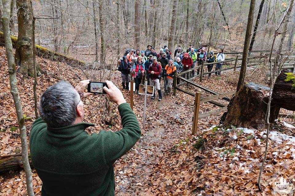
More STA Challengers arrived, and at 7:19 a.m., we left Slade headed for the Clear Creek trailhead. An hour later, we arrived and “slung up” packs. We crossed the creek and stopped for the first-day orientation. STA Director Steve Barbour snapped the morning photo, and the group headed out. The trail led up the steep path and onto a muddy and slick trail with the possibility of more nastiness over the next two days.

Not far into the hike (less than half a mile), the trail was missing. The recent heavy rains caused a large section of the trail about a quarter of a mile past the Clear Creek furnace to slide down the hill. A large switchback with the surrounding trees moved down the hill about 30 feet. The STA and the Cave Run Chapter had blazed a reroute around the slide, but it was very steep and challenging for some in our group to maneuver.
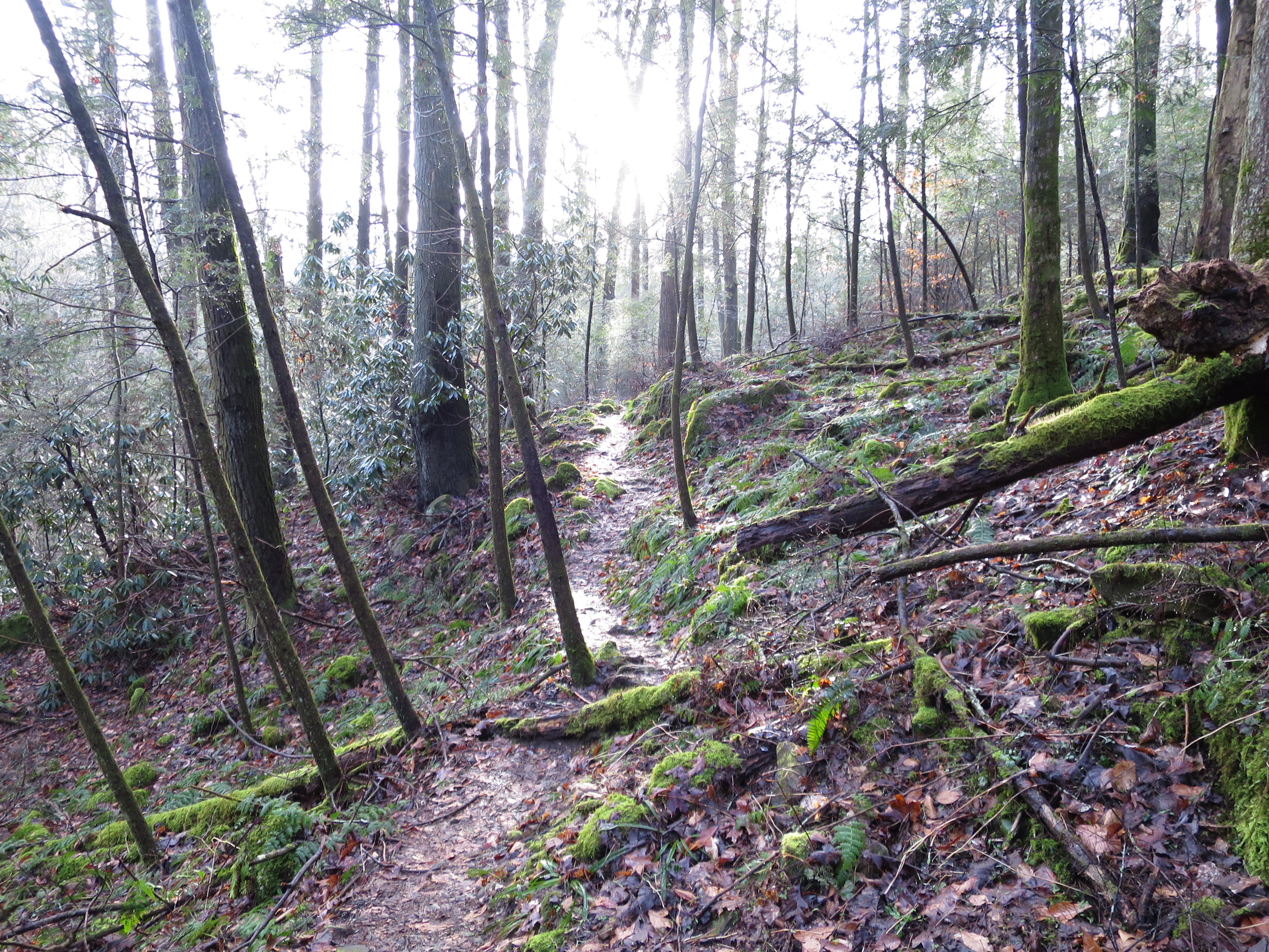
After passing the slide and stopping to help others through this tough reroute, we headed up the steep climb headed for the ridgeline. The Sheltowee Traces through this first section runs concurrently with the old Carrington Rock Trail through some beautiful, moss-covered boulders and many large trees as it snakes its way around and down to within a few yards of Furnace Arch.

At 9:48 a.m., several of us made the short (20 feet) climb off the trail up to Furnace Arch. With its wide span, this arch reflected the morning light to brighten the yellow and green colors of this formation. The site was amazingly free of litter, but someone (not true hikers) had started a fire under the arch. After complaining about the people “who destroy it for us all,” I made my way back down and continued on the trail.
On we walked until we reached Highway 1274 at 2:17 p.m. We crossed the road, rested for a moment at the red barn, and started the long road-hike. Turned right onto Clifton Road and walked up the gravel roadway to the blacktop of Highway 1242. We turned right and climbed the tall hill on the asphalt. Dodging steady traffic, we crossed over Highway 460 on our way to Corner Ridge.
For the last ten miles or so, we heard the rumble of thunder in the distance as the dark clouds rolled toward us. I did not see any lightning, but the thunder certainly made up for the lack of flash. About 2:45, a steady rain dropped on us as we walked. By the time we turned left into Corner Ridge Road, the rain had slacked but remained a steady drizzle.
An hour later, we were sitting at the parking lot at Corner Ridge Road, waiting for Steve Barbour to come with the “5-pound” drops. Several group members loaded their tents into the drops and had to stand in the rain for most of the afternoon as Steve assisted a hiker who wanted to leave the trail. I wisely carried my tent with me and set up my camp by 4:10.
We had a great time standing around the fire in the light rain or under the tarp that Stev Barbour stretched between several trees. Someone had brought some sugar cookies, so we laughed and ate until I headed to bed about 8:10. The light rain continued for most of the night, but about 9:44 p.m., the skies opened up. For almost 50 minutes, the rain blew in every direction, and the wind rattled the tents. Small limbs fell from the trees and smacked the tents around the camp. Only an easy wind and the occasional flash of lightning were seen after midnight.
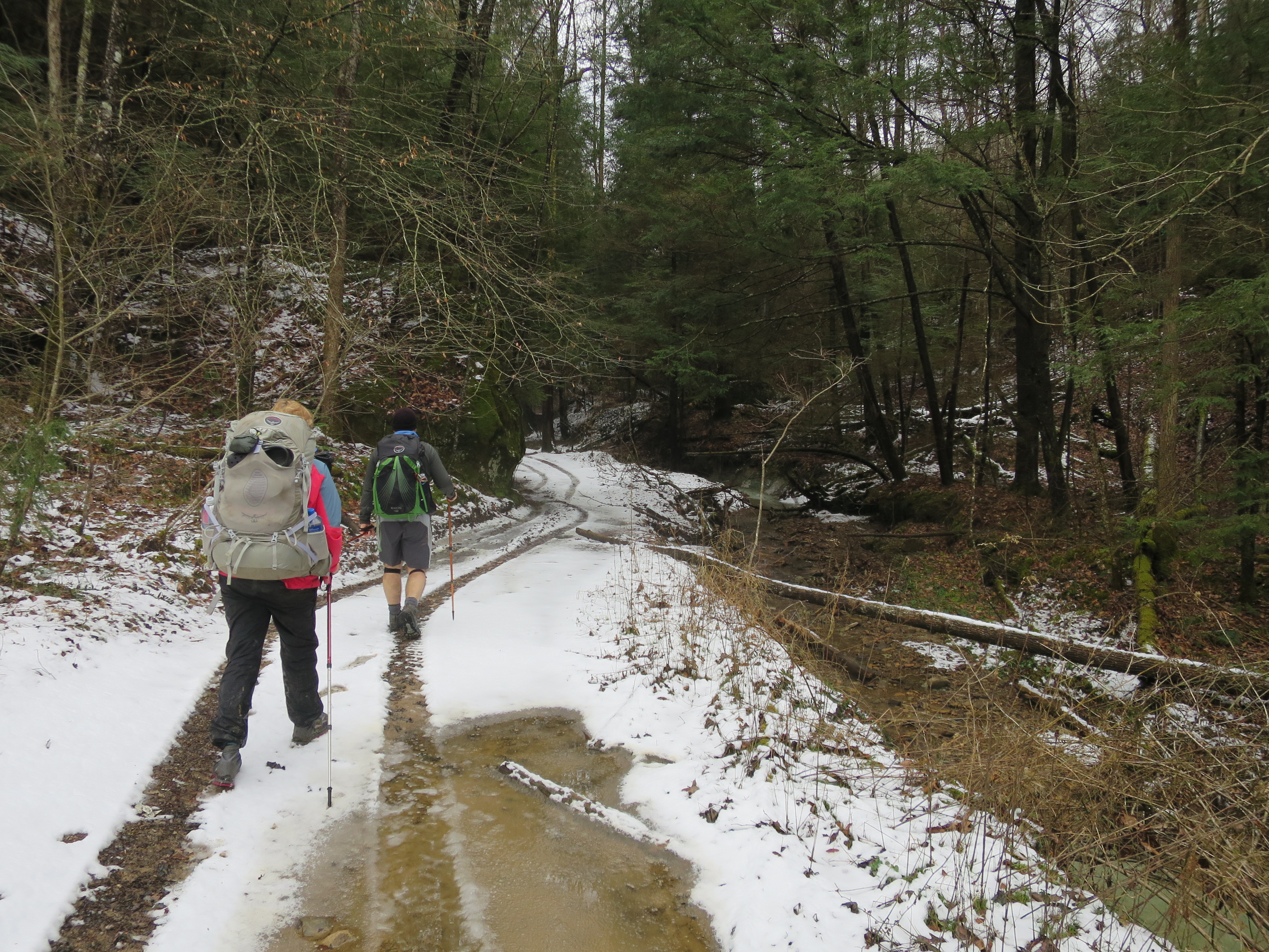
Woke up early the Sunday morning, about 5:17, after a pretty good night’s sleep. Did what needed to be done around camp and packed. I took my drop to the van and filled up my bottles with water. Left the camp at Corner Ridge just before 7:50 a.m. in heavy fog and 55 degrees. The humidity was about 200% as we hiked down the roadway toward Salt Fork. Made it to the creek and “ran” across with only a tiny amount of water, getting the top of my right sock damp.

The trail here is rough and in need of some maintenance. The creek crossing at Garrett Branch is difficult, and with any water flow, hikers will get their feet wet. After Garrett Branch, the trail goes high on the hill and is mostly dry. Stopped for some time about 9:23 at Hale Branch Cave. Left an arrow of sticks and hiked on around the trail. The creek crossing at Klaber Branch is also wet and flowing. After Klaber Branch, the trail follows a relatively flat, old sled road and is a welcomed break from the steep, rooty climbs.
Passed the intersection of the Sheltowee and Bison Way and made it to Indian Arch at 10:44 a.m. Past the Cat Eyes Twin Arches and the exit to Cloud Splitter. Most people walk right past the four arches at the Sheltowee Twin Doubles and never know they are there, but I stopped and walked up there to revisit them.
Hiked down the hill and out onto the roadway at the Sheotwee Suspension Bridge at 12:13. Climbed into the van with a few more who walked in after me, and we rode to the park and ride, arriving at 12:28 p.m. It was a good weekend, and I completed it with a cherry slushie from the Go Time at Slade. I drove home and set up my tent, laid out my sleeping bag, and set everything up to dry after the high humidity and rain. A good hike and ready for next month.
Impressions
As usual, the hikers of the Challenge have started to figure this system out. I have seen several hikers who have not been in the woods or are totally new to overnighting making significant steps forward. Several of those I estimated would never be back have been here for the last two and have done well. Several that I never considered would leave have already dropped out. I guess you can’t judge hikers by their first hike.
