
By Stephen D. Bowling
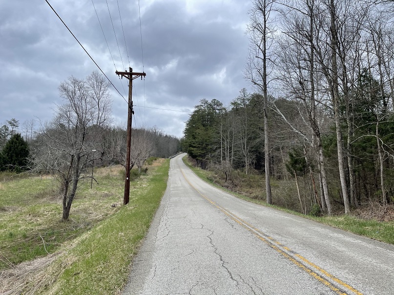
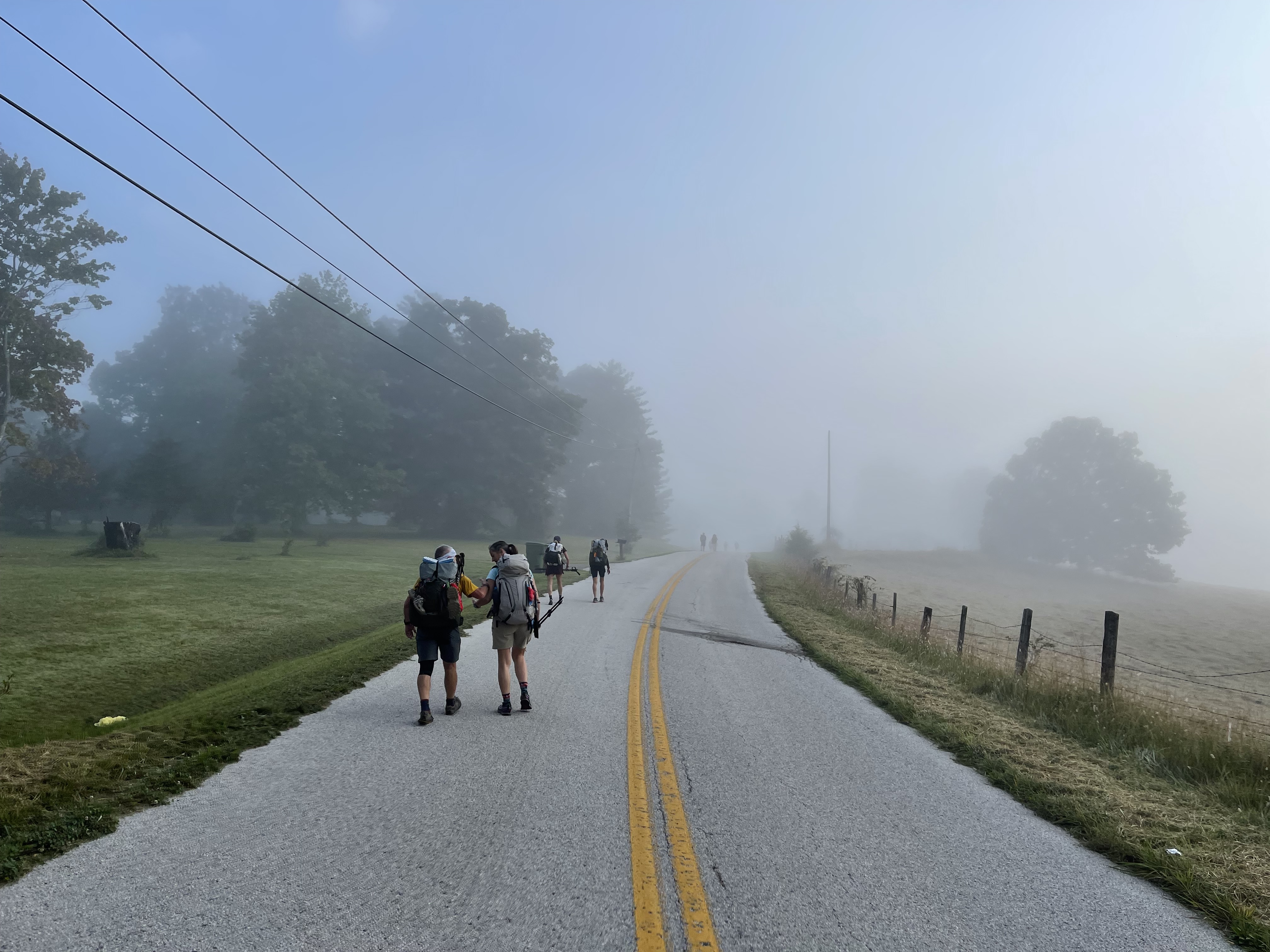
Hike Four is here, and the weather is warming up. Most of Hike Four is on the blacktop. It is hard and long, but I can assure you it is better to get it finished in March in July. The trip out of Heidelberg will, luckily, be a descent for us rather than a long, steep climb.
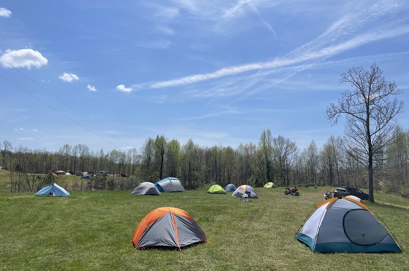
This section does have some dogs, but the plan is to shuttle around and avoid the areas where dog encounters have happened in the past. Along the way, hikers will still often hear dogs barking at you along Highway 399 and 1036. Walk in groups and work together to get to Lago Linda on Saturday night and on Todds Road on Sunday. This is a great hike to wear comfortable walking shoes on the roadway rather than hiking boots. The STA will help offset the water issues as we hike, but overall, this is not a bad hike. Smile and put one foot in front of the other.
Here is a quick view of some of the sites to see along the way or just more useless knowledge, as some may see it, to pack into your head. Regardless, here is a look at Hike Four of the 2024 Sheltowee Trace Hiker Challenge.
Natural Bridge State Park
We start our hike at the Whittletown Campground and the parking lot at Natural Bridge State Park.

Natural Bridge is a 2,300-acre forested park and nature preserve with 22 miles of trails, a 60-acre lake, two campgrounds, lodging, and dining facilities. It is surrounded by the Daniel Boone National Forest and adjacent to the Red River Gorge National Geologic Area.

Natural Bridge became a tourist attraction and a shortline railroad was constructed to the site. Opened to tourists in 1895 as a resort created by the Lexington & Eastern Railroad, the park in Powell and Wolfe Counties. Thanks to the signature of Governor William J. Fields, Natural Bridge State Park was established in 1926 and was one of Kentucky’s first four state parks. The bridge itself is the primary feature of the park, but other areas, including Whittleton Branch, Battleship Rock, Hoe Down Island, the Hemlock Lodge, and other areas, draw more than 500,000 visitors to enjoy the trails and outdoor adventures a year. Its close proximity to the popular Miguel’s Restaurant and Campground probably doesn’t hurt much either.
Balanced Rock
One of the most popular sites in the Natural Bridge State Park is the Balanced Rock. During the park’s history, there have been two Balanced Rocks that visitors have frequented. The first was a large, precariously perched boulder high on the cliff and out of view of hikers on the Sheltowee Trace. The precariously perched boulder that first earned the name has been placed out of bounds for park visitors for safety reasons and is not accessible by official park trails.
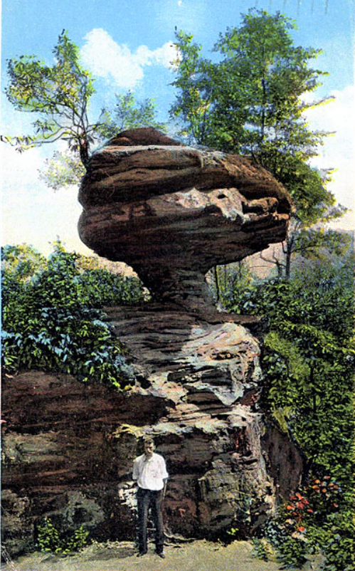
The second Balanced Rock stands less than ten feet from the Sheltowee Trace. This eroded sandstone pillar, originally called The Sphinx, has been given the new designation as “Balanced Rock.” Several benches near this spot offer an opportunity to sit and eat a snack or rest in the shade from all of the steps in this area. It also gets you ready for the next set of steps which is higher and steeper than the ones you have so far encountered. Trust me- your knees will need a rest to prepare for the coming 600 steps to the ridge.
Natural Bridge
The Sheltowee Trace does not pass through or over the natural arch known as Natural Bridge. The arch (not actually a bridge because there is no watercourse the flow below) measures 78 feet wide and 65 feet tall. It had been a popular destination for nearly 175 years. The Lexington and Eastern Railroad popularized the natural feature by scheduling daily excursion trains from Lexington and Winchester. The Historic Trail comes to the base of the arch, and a popular sky-lift also brings visitors up and down the mountain.

A left turn at the intersection of Sand Gap Trail and the Sheltowee Trace allows hikers to walk the ridge for less than a quarter mile to the top of Natural Bridge. The bottom may be accessed via the “Fat Man’s Squeeze” but is not recommended with a backpack.
The Narrows and Whites Branch Arch
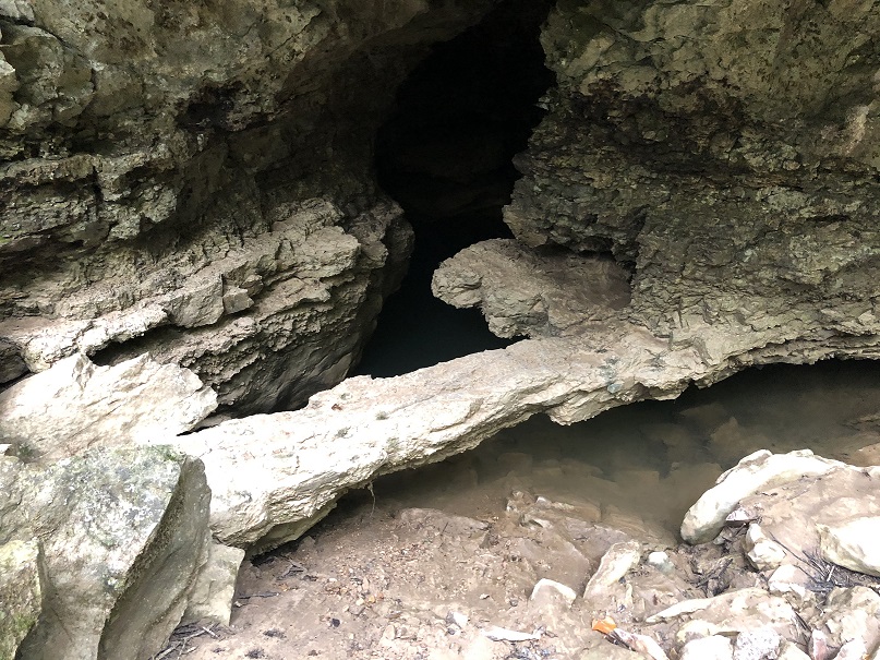
The Narrows was the name given to a thin strip of exposed sandstone that caps the ridge between Whites Branch, Townsend Branch, and Crow Drive Creek. A natural arch has opened in the underlying layers of stone and is known as White’s Branch Arch. The arch can be accessed by following a short side trail over the side of the narrows and down a precarious rope descent. The 60-foot arch is beautiful but difficult to access. Ramp Arch is also located about 75 feet from Whites Branch Arch.
The Narrows was once the only arch in America that had an official roadway over the top of the opening. The Narrows Road was a popular offroad vehicle destination and was closed following the purchase of the property by the Kentucky State Nature Preserves Commission.

Tank Traps
To protect the land purchased by the Kentucky State Nature Preserves Commission, the Parks Service, and the Forest Service dug a series of deep trenches and installed concrete pillars intended to keep vehicular traffic out to the area of the Narrows Road/Whites Branch area. Several groups protested the closing of the Narrows Road, the limitation of access to the popular Pocket Wall climbing areas, and the building of the trenches.

According to the Parks Service, the trenches and roadblocks are intended as “impassible tank traps” to impede ATV, horse, and motorcycle traffic, but they also present a difficult challenge for hikers. Be prepared to climb through and across these barriers as you make your way toward Natural Bridge.
Big Bend Road
As hikers emerge from Natural Bridge State Park and Nature Preserve, the trail makes on sharp right turn onto a gravel road and heads south. Big Bend Road runs 2.5 miles from the edge of the park to Highway 52. The gravel road crosses back and forth over the Powell and Wolfe County border and skirts the Estill County line. This gravel road is a tough hike and passes several camping spots along the way as it follows Big Bend Ridge. Big Bend Road ends at the blacktoped intersection with Highway 52 near the Standing Rock Church. Visible signs of abandoned oil wells and other oil equipment can be seen along the sides of the trail, reminding hikers of the industry that once employed thousands in the area.

Wolfe and Lee County Line
As soon as you step from the gravel of Big Bend Road onto the blacktop of Highway 52, you enter a new county- Lee County. You started your hike in Powell County. Hike Four includes visits to Wolfe and Lee and will end in Owsley. Wolfe County was created by an act of the Kentucky Legislature on March 5, 1860, and named for Nathaniel Wolfe. Many years of controversy ensued over the location of the county seat, and Campton was finally chosen. Wolfe County is 223 square miles in total area and was home to 7,355 people in 2010.

Standing Rock
The community of Standing Rock sits at the intersection of Big Bend Road and Highway 1036. This unincorporated community in Lee County and Wolfe Counties was a hub of oil exploration and production from the early 1900s through the 1990s.
Ashland Oil and the Sun Oil Company operated thousands of oil rigs and pumps in the area, and many can be seen on display along Highway 1036 as you near the headquarters for Hollerwood Park. Several homes and the Standing Rock Church of Christ are all that remain of this one heavily populated community.
Hollerwood Park
Hollerwood Park draws hundreds of thousands of ATV and off-road enthusiasts to the area each year. The 2,500 acres of land that are included in the park present adventurous drivers with a wide variety of off-road trails and challenging rock climbs.
The property is an adventure located at the intersection of Powell, Wolfe, Lee, and Estill Counties and is owned by the Powell County Fiscal Court. Hollerwood Park offers ATV rentals, camping spots, and tours of the area. The office is located beside Highway 52 and offers a General Store with a variety of cold drinks and treats.

Mount Paran School
Be ready- Mount Paran translated to “steep road ahead.” Luckily for us, we will be going down this mountain, but the hiking can be just a bad going downhill. Remember- they call it MOUNT Paran for a reason.
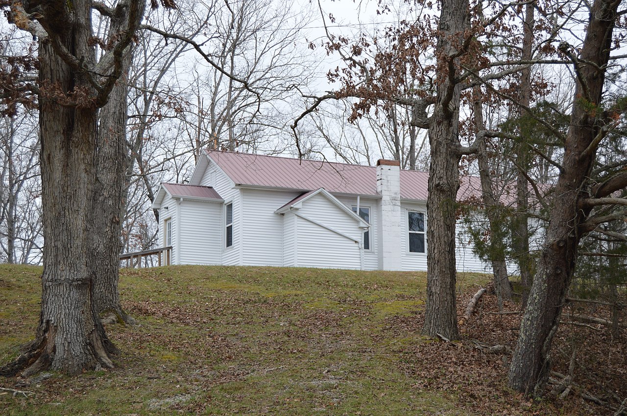
An example of a rural mountain school, the Mount Paran Schoolhouse, stands beside Highway 1036. Made of stone and native timbers harvested from the area and built by the Civilian Conservation Corps in the 1930s, the school served the children of the community for many years. In addition, the school was used by the community as a voting house and frequently as a church. Students were moved to Lee County High School and other schools when school consolidation started in the 1950s, and the school was closed. The Hobbs family saved and remodeled the structure into a residence several years ago.

Greeley, Kentucky
Very little is left of the Greeley, Kentucky community, except a large white house that sits on the opposite side of the creek from the trail and the remnants of a few old homes and the steps to the lodge. The area was once filled with families who worked the oil fields and timber woods of the area. This home was built by John M. Combs about 1902. The Combs Cemetery and this old homeplace are all that remain.

Named for Horace Greeley, the famed newspaper publisher and abolitionist, a post office was established at Greeley in 1900 and operated with a few interruptions until 1957. The general store and Masonic Lodge are both long gone from the area.
Sinking Creek
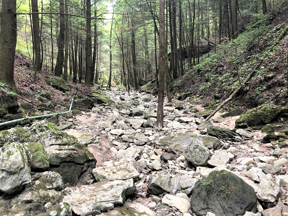
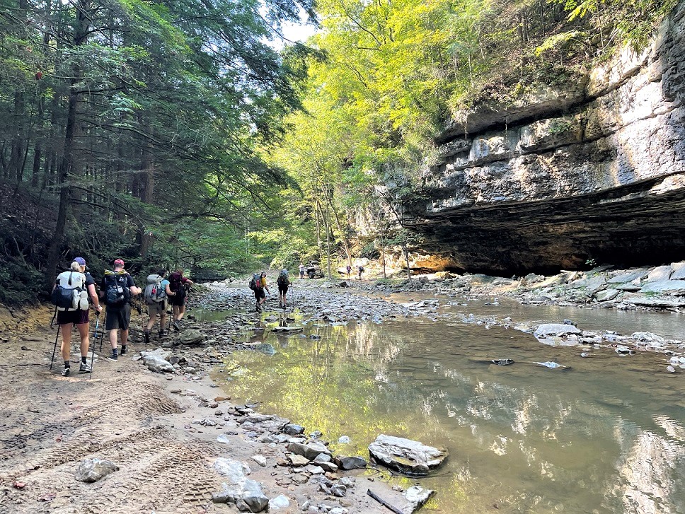
Sinking Creek is one of the natural beauties of this area and is a very picturesque section of the trail. It can also be one of the most difficult in wet conditions, and the high water route should be taken during these times. Hikers will carefully make their way over piles of limestone rocks that have filled the valley floor as you climb down Little Fork of Big Sinking Creek. After making the left turn out of Little Sinking Creek, a creek ford awaits upstream near the foundations of a long destroyed bridge.
High on the hills above the trail are numerous arches in the limestone cliffs, including the Sinking Creek Arch Complex, which is home to four arches. The Sheltowee does pass within ten feet of the Little Sinking Cave Bridge and several natural springs that feed this stream. Many of the springs drain or “sink” back into the ground, and from these sinks, the creek got its name.
After crossing the stream, the trail climbs up a steep hill to New Virginia Ridge Road and onto Highway 52.
Oil Fields
As you hike along Highways 399 and 52, you will see remnants of a once-thriving oil industry in eastern Kentucky following the discovery of oil deposits in the early 1900s. Old and abandoned rigs and pump heads dot the landscape and often are accompanied by a strong smell of petroleum. The oil and gas industry was once the largest employer of men and women in the area and accounted for almost three-quarters of the area’s economic activities. From here to the crossing of Interstate 75, hikers will see evidence of the oil and gas industry scattered throughout the fields and woods that we pass. You will also get the occasional whiff of natural gas from an uncapped well.

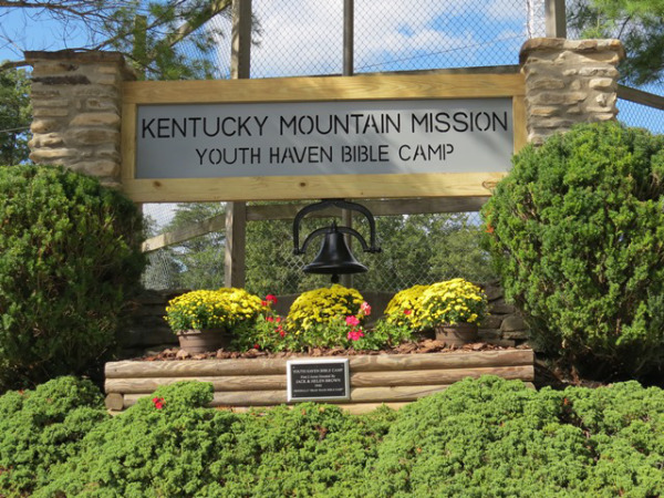
Youth Haven Camp

Just before making the left turn onto the lane leading to Lago Linda, several buildings can be seen on the hill to the right above Highway 399. The structures are part of the Youth Haven Bible Camp. The camp is owned and operated by the Kentucky Mountain Mission. The camp grew from the dreams of Miss Annie Bethke. Bethke left her German-speaking family in Minnesota to attend the Bible Institute of Los Angeles in California. After conquering certain language difficulties, Miss Bethke graduated and came to Breathitt County, Kentucky, in 1919, where she continued her Christian work until she retired.
To continue her work, the Kentucky Mountain Mission was incorporated in 1942. The Youth Haven Bible camp was established on 70 acres of property purchased in Lee County and has heated cabins, a dining room, indoor and outdoor chapels, horse and hiking trails, boating, swimming, fishing, and other activities for children and church retreats on a yearly schedule. The campus and the beauty of the facility cannot be seen from your hike on the road. Plan to come back for a visit when you can experience the campus of the Youth Haven Bible Camp.
Lago Linda Campground
In 1969, Doug and Linda Black purchased 410 acres in a remote section of Lee County as a weekend getaway. They were impressed and fell in love with the natural beauty of the area. In the 1990s, the Blacks opened their property to campers and those who love the outdoors and find their way into Lee County.
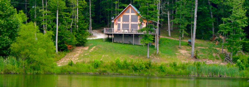
The property was purchased by Larry and Katie Frederickson, who have expanded and improved Lago Linda Hideaway. The Hideaway offers cabin, camping, trails, resupply, and wildlife viewing opportunities. It is located 16 miles from Beattyville and will be our camp for Saturday night.
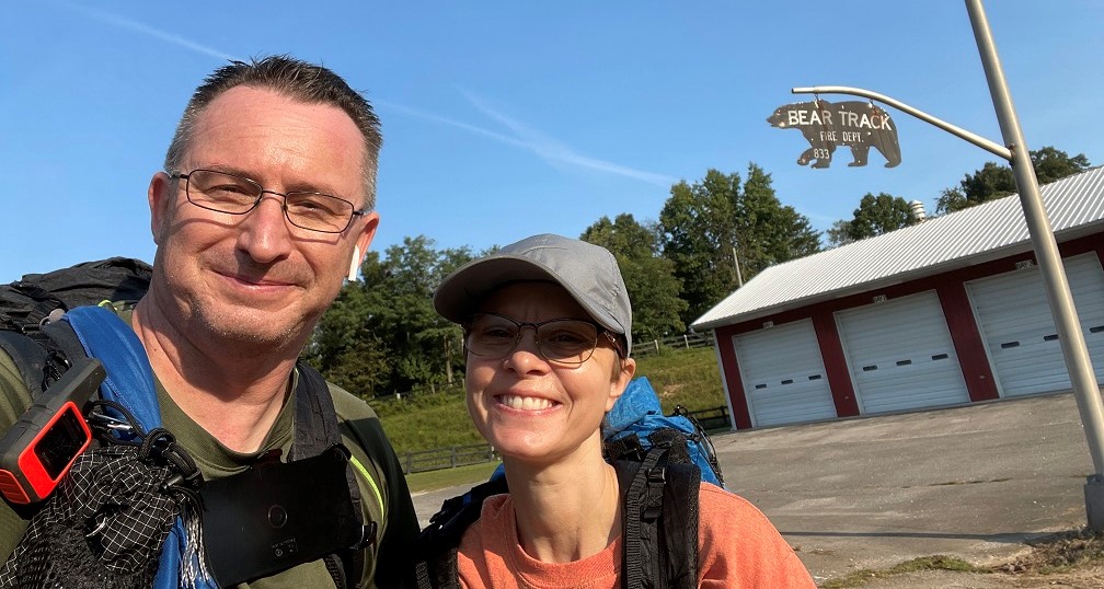
Bear Track, Kentucky

Bear Track is a remote section of Lee County in the Highway 399 and Highway 52 area. A large mission school was once located here in this community before the Youth Haven Camp was constructed. The Bear Track Fire Department continues to use the popular bear silhouette on its sign. Spotting the bear sign at the Bear Track Fire Department means you are almost to your Saturday night camp at Lago Linda Campground.
Conveniently Country
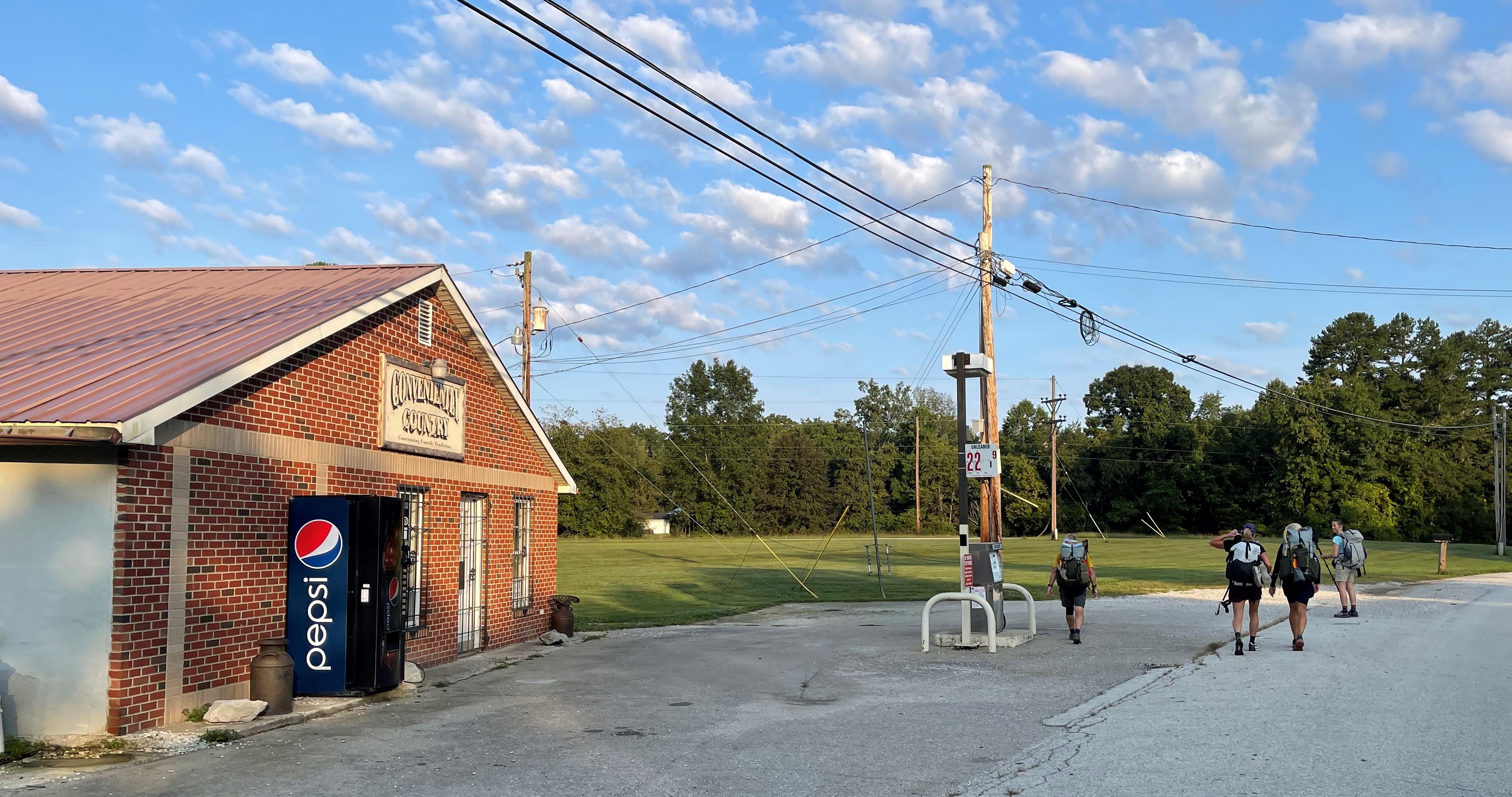
For many Sheltowee Trace hikers, a stop at the Conveniently Country store was a welcomed break from the heat of the road walk and a chance for a cold drink and maybe a bologna sandwich. A stop provided hikers with the opportunity to meet many locals and experience the kind hospitality of a rural county store. Sadly, the store is currently closed and may not reopen. The building still serves as an important landmark on Highway 399, marking the end of the major climb.
Contrary Creek
When the Sheltowee Trace opened in 1979, the section of the trail that passed through Bear Track left the roadway and ventured down into Contrary Creek. Through the years, property owners changed, and access to the old trail was reduced. The Sheltowee was forced onto a long road walk through Bear Track and onto Highway 52.
Plans are currently underway to move approximately 6 miles of road walk back into the woods. Unfortunately, for the Class of 2024, that effort will not happen by the time we pass through here in March. You will have to hike the Challenge again in 2025 to try out the new (old) section and the nice walk on Contrary Creek.
St. Theresa Church
St. Theresa Church, west of Beattyville, Kentucky, was listed on the National Register of Historic Places in 2012. It is a wood-frame church on a concrete block foundation. It was built in 1948 from materials salvaged from the Contrary Creek Settlement School Church, a previous church located about a mile away, which had been built in the 1920s. The new church was built with a different design. A kitchen and living quarters for Catholic nuns and for the circuit-riding priest were added in 1949.
Heidelberg Hill
The great joy of hikers on the Sheltowee Trace along this section is the “gentle” stroll up Heidelberg Hill. An important part of the tradition “Heidelberg Death March,” the climb up the hill is not long but exacts its revenge due to the steep ascent. That description, and especially the climb is for northbound hikers. Just a reminder- we are headed south and will be going DOWN this hill. The roadway (Highway 399) is a narrow, two-lane road that is heavily traveled. Be sure to walk on the side of the roadway facing traffic and be aware of oncoming vehicles as we head down the hill to Heidelburg.
Heidelberg, Kentucky 41333
Heidelberg, a rural community in Lee County, Kentucky, grew and prospered during the “King Coal” era. Located three miles west of the county seat of Beattyville, Heidelberg was settled in 1799 by a family of German immigrants who named the area after the city of their origin. Large farms on the flat river bottoms along the Kentucky River dominated this subsistence farming community until 1902.

In 1902, the Louisville & Nashville Railroad laid tracks through the area, and Heidelberg boomed. A post office was opened in 1904, and several stores, including the Updike Grocery Store, opened. The community remained a center of commercial activity until the decline in the coal and timber industries in the late 20th Century. Several companies loaded barges of coal at this point for transportation downriver to markets. A community park has been established here to remember the city and its importance to the economy.
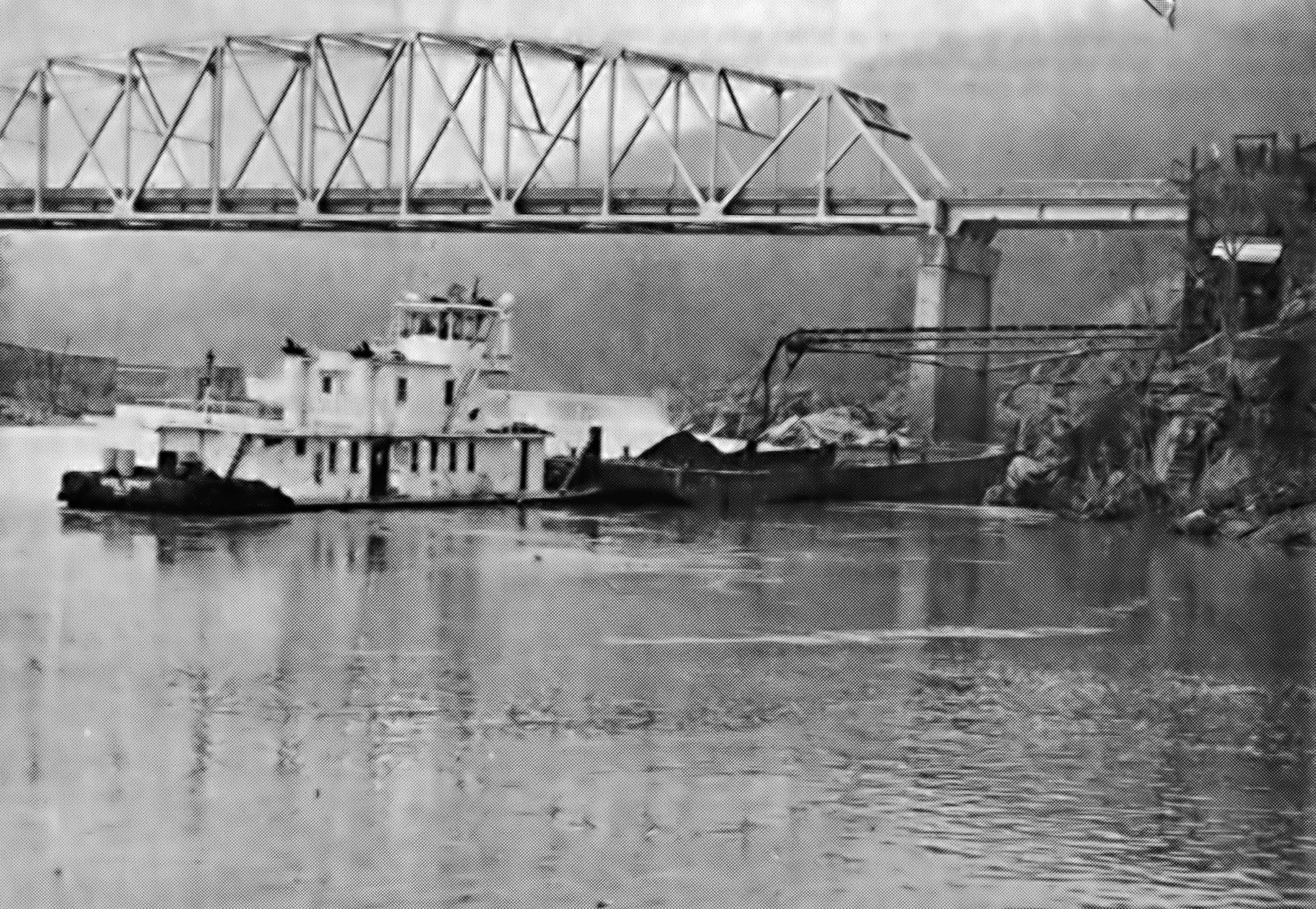

Lock and Dam #14
The lock was constructed in 1917 as part of the state’s efforts to make the Kentucky River more navigable. It is located 249 miles from the mouth of the Kentucky River. The shallow shoals and steep turns made navigation by barges and coal boats difficult. The proposed dams would hold water and raise the navigable pools between locks. The locks allowed vessels to pass from pool to pool as they made their way upstream.

Several locks and dams were proposed to float coal and timber from the mountains to the markets in Lousiville and along the Ohio and Mississippi Rivers. Heidelberg was the last of the projects to be completed. No other locks were built upstream from Heidelberg. As the coal business slowed, the lock was no longer used, and in 1999 it was sealed permanently. The Willow Lock and Dam (#13) is located about 8 miles down the Kentucky River from Heidelberg. The Lee County Fiscal Court is currently constructing a water treatment facility at Heidelburg Park to help supply clean municipal water for the southern sections of the area.
Sturgeon Creek
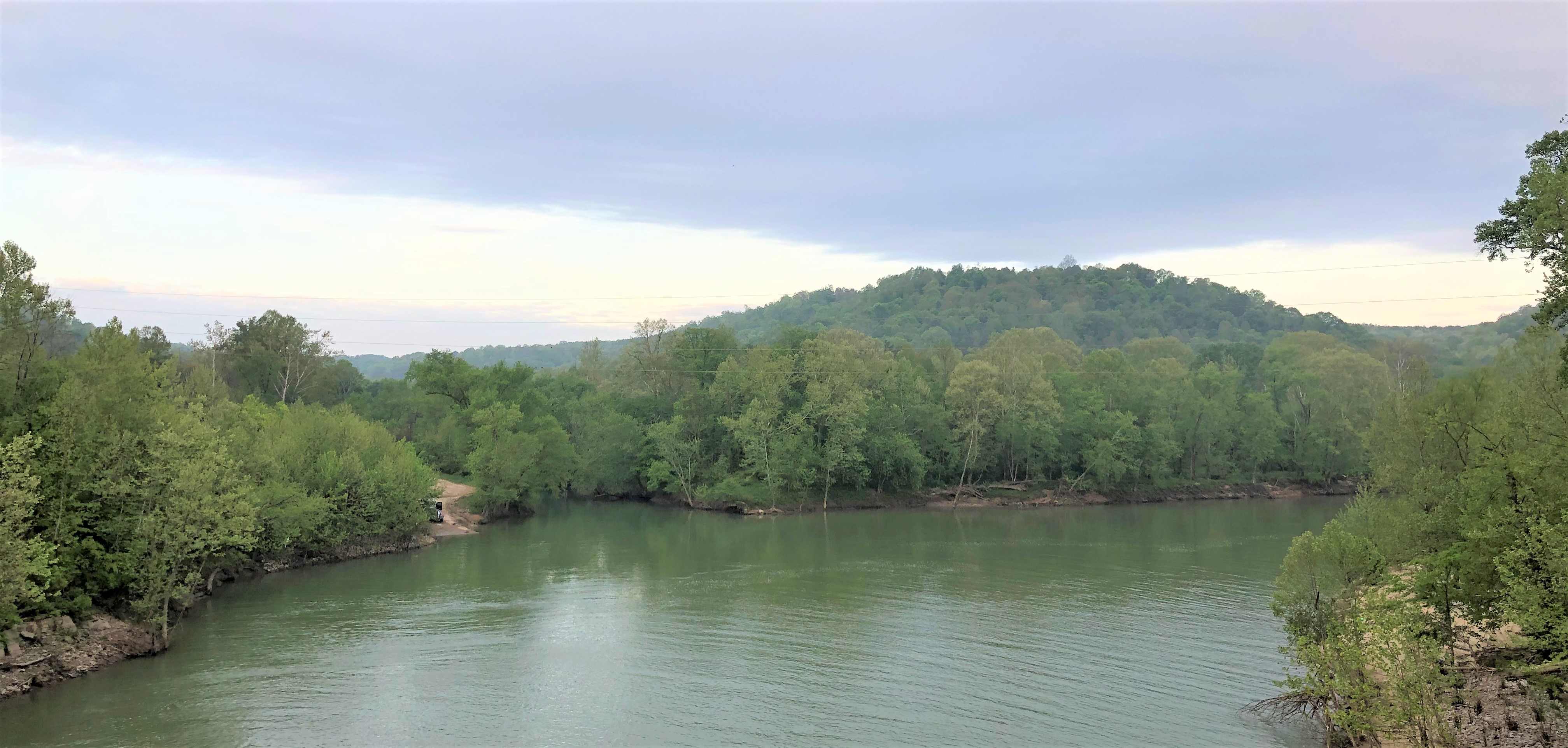
Our northbound hike begins at Virgil Todd Road and follows Sturgeon Creek to Heidelberg. Sturgeon Creek is one of the largest tributaries to the North Fork of the Kentucky River in Lee County, Kentucky. The stream is four miles from Beattyville on the Kentucky River and drains more than 106 square miles. During the earliest days of settlement, large schools of shovelnose sturgeon (Scaphirhynchus platorynchus) gathered at the confluence of the creek and the river in the warm waters each spring to spawn. Settlers gigged and seined the fish to supplement their diet of pork and wild game. The creek was also one of the earliest places in Lee County to be inhabited by Europeans who crossed the Appalachian mountains to the area.

Cressmont, Kentucky
The Turkey Foot Lumber Company moved its operation to Lee County from West Virginia in the early 1900s. The center for its operation in West Virginia was a community named Cressmont. When the timber company established its new Kentucky base of operation at Farmer’s Ridge, the new town applied for a post office with the name Turkey Foot, Kentucky. the request was denied because a Turkey Foot already existed in Scott County. The second application for a post office changed the name to Cressmont, Kentucky, which was approved in 1913.

The company constructed 28 new houses, a grade school, tennis courts, a movie theatre, a baseball field, and a large clubhouse for company employees. The company store housed the post office and served more than 400 families that eventually inhabited the area. Cressmont became the first community in Lee County to have running water, electricity in every home, and modern toilet facilities. The Cressmont Post Office closed in 1948 when timbering operations ceased, and the residents moved away to other jobs.

Turkey Foot Saw Mill

In 1912, the Turkey Foot Lumber Company purchased the rights to 37,000 acres of timberland on Sturgeon Creek in Lee County, including all of the lands on Upper and Lower Sinking Creek. Logs were hauled from around the area to the main sawmill located in the large fields at Cressmont. The large mill was 300 feet long, sixty feet wide, and three stories tall. A two hundred horsepower engine powered the belts and blades of the mill.

More than 100 miles of standard gauge track stretched up and down Sturgeon Creek, as trains brought logs to the mill and hauled millions of board feet of sawn lumber away. Cressmont Road, which you will hike, follows the original bed of the railroad tracks that served the area. A camping and recreation area would later be named for the Turkey Foot Lumber Company after the timber operations ceased and the Daniel Boone National Forest was established.
Our hike will end on Todd’s Road as Steve will designate an endpoint along the roadway before we get to the trouble spots where we have had issues with potentially aggressive dogs in past years. Again- we will not hike past these areas due to the possibility of issues. The exact end of the hike will be communicated as we get to the hike. Enjoy your hike and celebrate getting much of the remaining asphalt hiking out of the way in cooler weather.
Enjoy this truly unique section as we hike through the Limestone Crawl and through a remote section oft he Natural Bridge State Park. The camp is wonderful, accessible, and very accommodating. In all, Hike Four should be a great experience.
© 2024 Stephen D. Bowling
