
By Stephen D. “Bookie” Bowling
Twelve hikes spread over the next eleven months will make you a member of a very special club. In the next year, the average hiker will take more than 706,500 steps on this trail for the right to join this club. Not everyone will make it. Not everyone can. Based on recent years, about 50% of those who start will complete this challenge. Those who successfully complete the Sheltowee Trace Challenge will become members of an elite class that is awarded the exclusive title of “End to Enders.” With some hard work, lots of sweat, and maybe a few pains, you, too, will earn that title. It all begins in January.
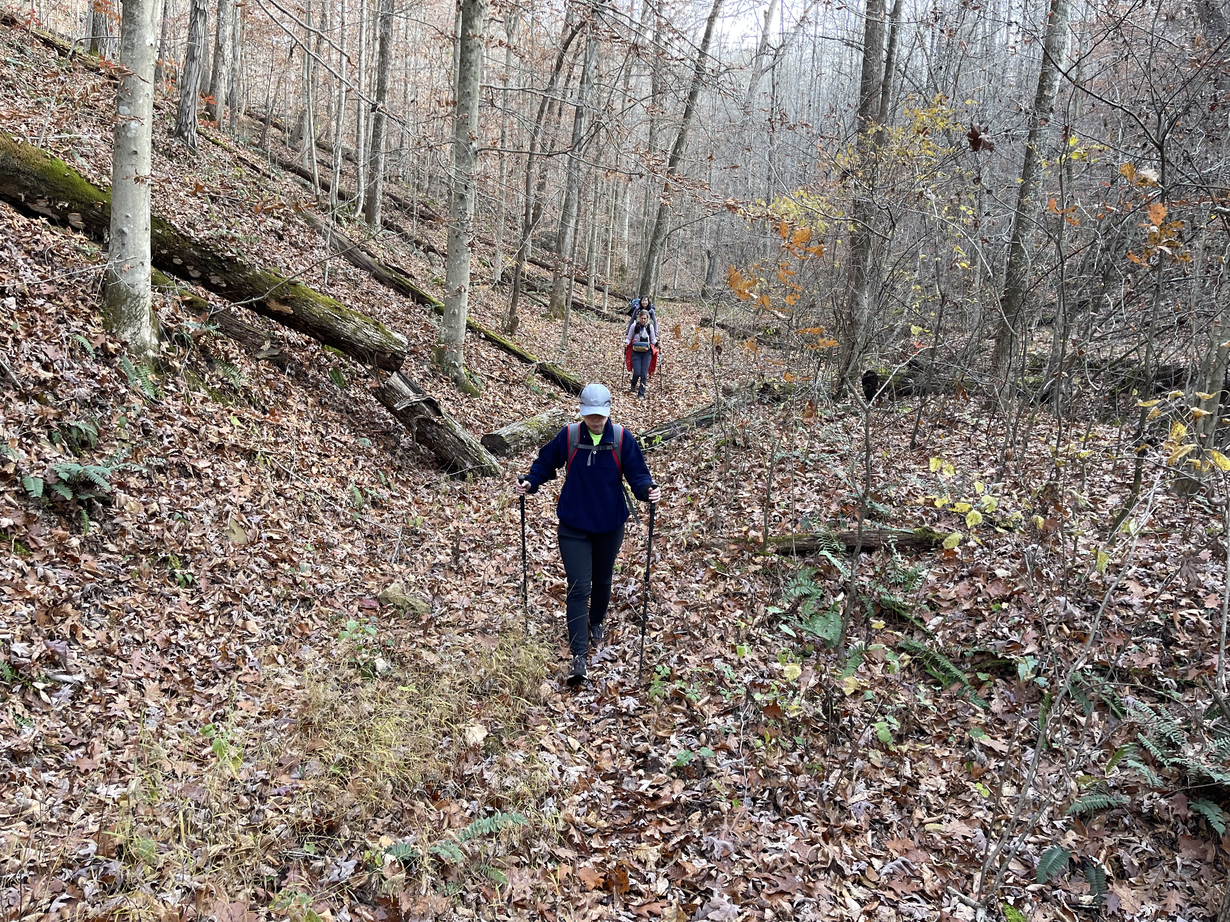
Hike One will cross many ridgetops and dip into several valleys as you make your way 25.5 miles from the Northern Terminus to Main Street in Morehead. It is a moderate hike and a great introduction to the Sheltowee. You will cross back and forth between two counties (Rowan and Lewis) as you make your way south. Along the way, hikers will pass by several notable sites.
In an effort to prepare and educate you, I present these notes on important and memorable places you will see during Hike 1. It is my hope that these brief sketches will enhance your hike, help you understand our special trail, and, as a result, instill a deep love for the Sheltowee Trace Recreation Trail, its people, and culture.
Turtle on!
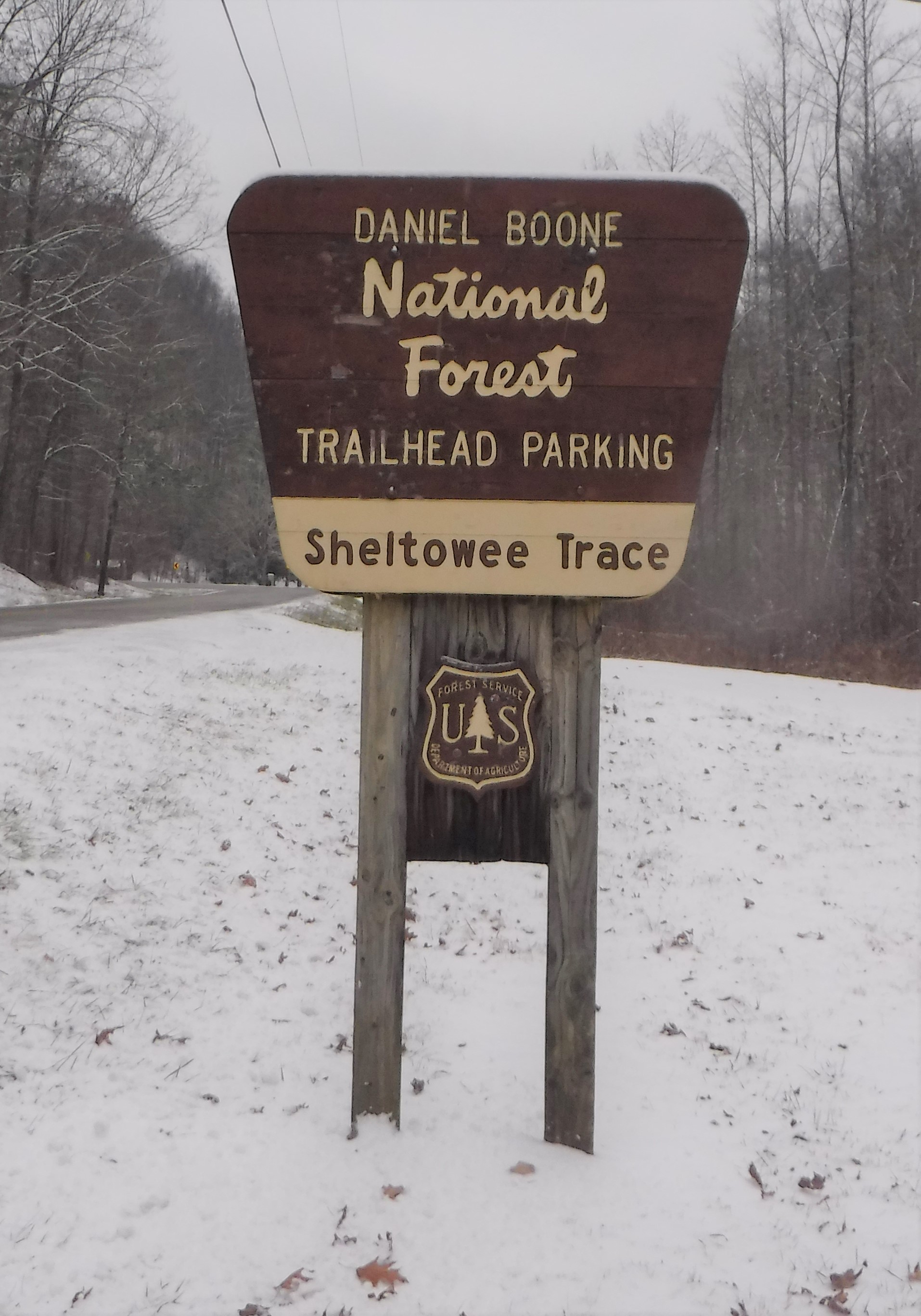
The Northern Terminus (0.0 miles)
The beginning is here. In 1978, the supervisors and officials for the Daniel Boone National Forest were concerned about the level of usage in the forest. They discussed several ways to promote the ethical use of thousands of acres of public land. The final plan included the development of a central trail that would bisect the Daniel Boone and serve as a central corridor to connect the forest’s many shorter trails.
Vern Orndorff, a veteran National Forest Service employee, accepted the challenge to develop an Appalachian Trail-like system. He hiked on foot and spent many nights in the woods to develop a proposed route that would span from Kentucky to Tennessee, highlighting the numerous recreational opportunities the forest had to offer.
Orndorff and the Forest Service assembled a patchwork of state, federal, and private land through which the trail would pass on its way to Tennessee. The final trail explores three state parks, around two Corps of Engineer-operated lakes, and through several wildlife management areas. It was eventually extended, at present, 45 miles into Tennessee.
With little fanfare, the Sheltowee Trace trail officially opened for hiking in 1979. Orndorff chose a point as far north as he could to establish the northern anchor of the Sheltowee Trace. The spot he chose was a small creek bottom across from the mouth of Henry Short Hollow, less than a mile from the top of the forest. The area was developed in subsequent years and has become known as the Northern Terminus of the Sheltowee Trace.

Daniel Boone National Forest (0.0 miles)
On February 27, 1937, President Franklin Roosevelt signed a proclamation establishing the proposed Cumberland National Forest, which, as planned, would ultimately encompass more than 2,100,000 acres within the proclamation boundary. The forest stretches from Rowan County, Kentucky, to the Tennessee border and covers parts of twenty-one Kentucky counties.
Beginning in 1937 and continuing for the next 29 years, Kentucky dignitaries and locals fought to have the name changed to honor one of Kentucky’s pioneers. Editorials and public speeches, coupled with proposed congressional resolutions, placed tremendous pressure on the National Forest Service to reconsider the naming despite nearly unified opposition from forest service managers.

The forest was officially dedicated in ceremonies at Levi Jackson State Park near London on July 23, 1966, and the Cumberland National Forest was renamed the Daniel Boone National Forest.
The DBNF is one of 155 national forests and 20 national grasslands in 44 states. The Daniel Boone National Forest is a multiple-use forest that offers hiking, biking, horseback riding, and ATV trails, along with diverse landscapes and wildlife. Timber management is a crucial aspect of the DBNF, and the forest undergoes frequent harvest activities as part of its overall management plan.
Sheltowee Trace Challenge hikers will traverse the Daniel Boone National Forest until they cross into the Big South Fork National Recreation Area in Tennessee.
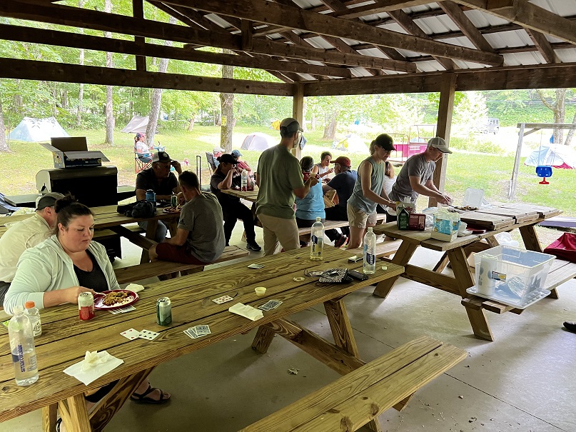
The Clark Farm (9.3 miles)
A place of rest and water lies about 10 miles into your hike and is known as the Clark Farm. County Judge-Executive Harry Clark and his wife own this 87-acre farm, which straddles the north and south banks of Dry Fork. Judge Clark is a very generous partner with the Sheltowee Trace Association and graciously allows hikers to set up camp at the Clark Farm Pavilion. All he asks in return is that we keep it clean and make sure his dog does not follow us as we hike away. He has posted several signs along the way to remind hikers that the dog will follow, sometimes great distances from the Clark Farm.

Judge Clark and his wife constructed this large shed to provide family, friends, and Shetowee hikers with the opportunity to rest in the dry and enjoy a good meal. He also helped the STA by installing a water spigot near his driveway to offset the ten-mile waterless hike from the Northern Terminus to this point, or to “water up” hikers headed north.
During his 4 years as a Rowan County Magistrate and his 3 years as County Judge Executive, Judge Clark has professionally and personally promoted the Sheltowee Trace and our efforts in this area. Please respect his kindness, close the gates, and don’t let his dog follow you.
Holly Fork (11.0 miles)
Leaving the Clark Farm, the trail makes a steep climb up to an open ridgetop pasture. Hikers will often encounter cattle grazing on this scenic ridge. The trail follows this tree line for a few hundred yards before crossing, opening, and heading down the hill into Holly Fork.
Holly Fork is a mile and a half long, limestone-based creek that drains into the much larger Holly Fork. Southbound hikers can enjoy the long downhill, broken only by numerous creek crossings that at dry for most of the year.
Near the mouth of the creek, the United States Forest Service once maintained a picnic shelter and trailhead. In the late 1970s, the location was removed due to repeated acts of vandalism. The large flat and wooded area is often used by the Sheltowee Trace Association’s Hiker Challenge as a secondary camp to alleviate crowded conditions during the first hike of the year.
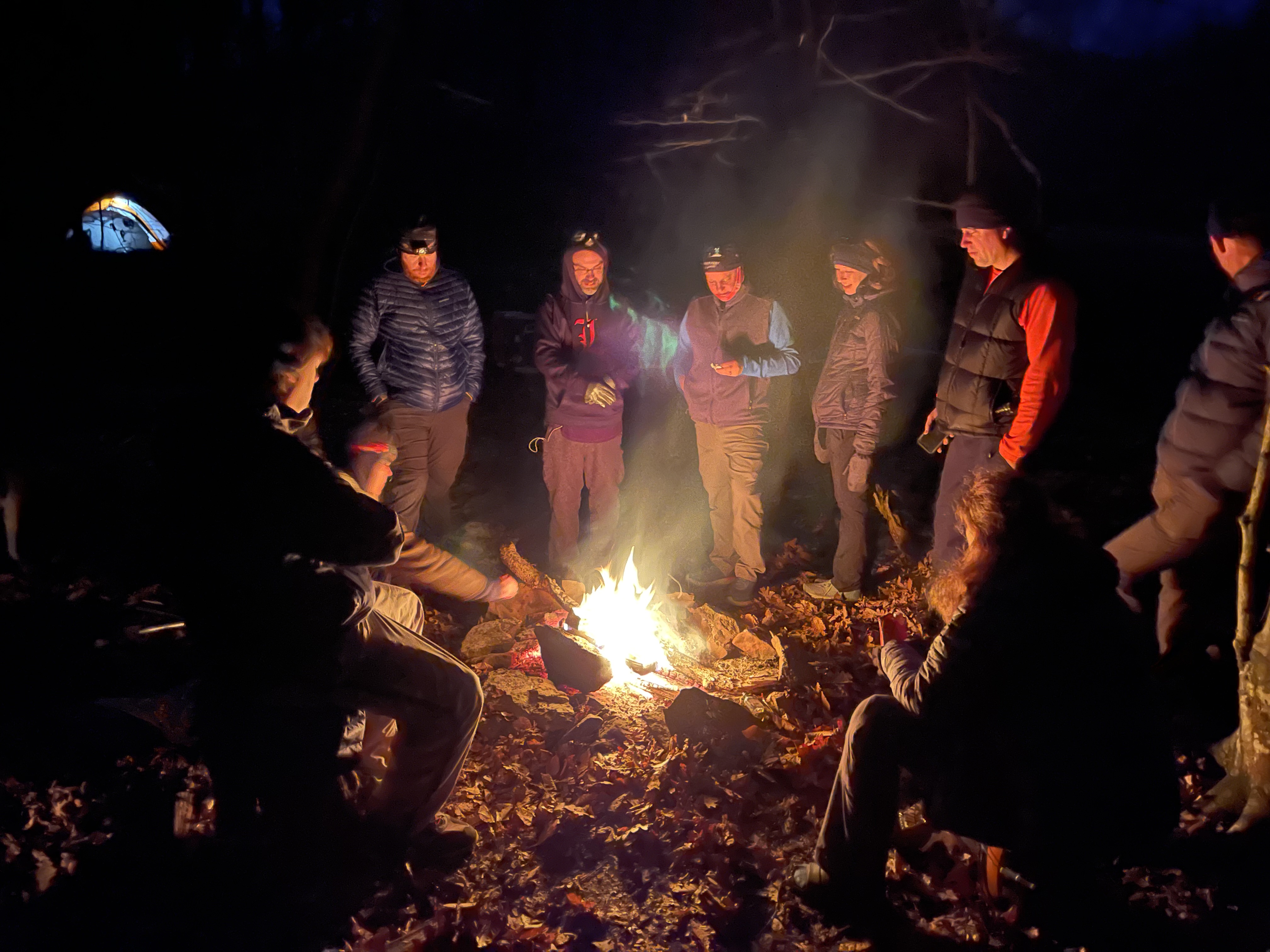
Trail magic from the Cave Run Chapter is often provided at this location. The site has a campfire and an opportunity for new Challenge hikers to chat before a good night’s rest in preparation for a new “bunny hops” as we journey on to Morehead.
The Holly Fork Swinging Bridge (11.4 miles)
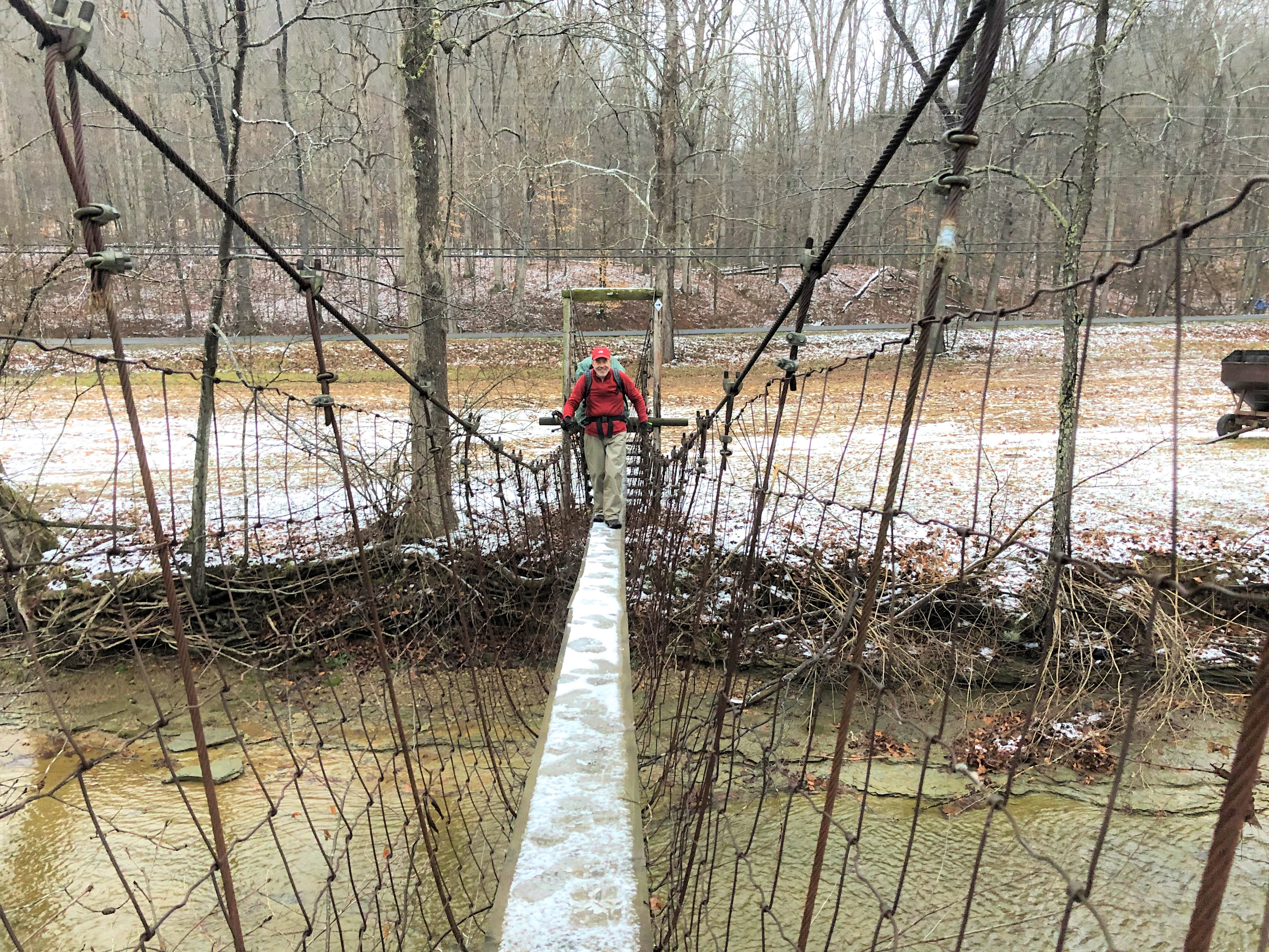
The Holly Fork Swinging Bridge is a fun a unique experience on the Sheltowee Trace. Along this soon-to-be 353-mile trail, you will cross hundreds of bridges- swinging, wooden, stone, metal, and others. None are as unique as the Holly Fork Swinging Bridge.
The Holly Fork Swinging Bridge is a narrow, 12-inch-wide, and 68-foot-long swinging bridge that adds a new meaning to the word “swinging.” Hikers enjoy the constant motion of the swaying of the breeze as they scurry across this landmark suspended more than 15 feet above Holly Fork. Dogs, on the other hand, are not always fans of the bridge, and many refuse to cross. Each year, several hikers have to wade the creek or cross and call their furry friends to the other side.
If you don’t enjoy amusement park rides, you may want to start preparing yourself now for this adventure. Oh, yeah, snow and ice make this ride even more pleasurable.
Big Tom Brown Reroute (11.6)
The trail leaves the Holly Fork Bridge and skirts a large field usually planted in corn. Hiker will then begin the ascent on Big Tom Brown Branch. The walkway often follows the creekbed as the Trace weaves in and out and across the creek. There is rarely any middle ground on this section of the hike- it is either bone dry or wet and swampy.
A large cut created by fast-moving waters and some severe trail erosion near the head of Big Tom Brown Branch caused a portion of the trail to become steep and dangerous. In 2023, the Cave Run Chapter and the Forest Service started an effort to relocate the trail. That completed reroute is open for “business” in 2024 and has added to the “elevated enjoyment” of hikers along this section. The second section of the reroute opened for use in November 2025 and eliminated more than two miles of gravel and asphalt walking at the top of the hill.
Interstate 64 (14.1 miles)

Crossing Interstate 64 marks an important milestone in the progress from the Northern Terminus to Morehead. The I-64 crosses Missouri, Illinois, Indiana, Kentucky, West Virginia, and Virginia, connecting numerous major economic centers in its 954-mile track.
Constructed primarily in the 1960s and early 1970s as part of the American Interstate system, the four-lane roadway passes near Morehead and is an important part of the local economy. Thousands of vehicles pass exit 137 at Morehead carrying products and people across the county. This section of the 191.51 miles of I-64 in Kentucky was completed in December 1976.

After crossing the Holly Fork Swinging Bridge, climbing up Big Tom Brown Branch, and a short walk across a gravel roadway, south-bound hikers will cross Interstate 64 while vehicles whiz by below. The crossing signals the beginning of a long gravel road walk as we make our way to Morehead. But it also means you are closer to your car.
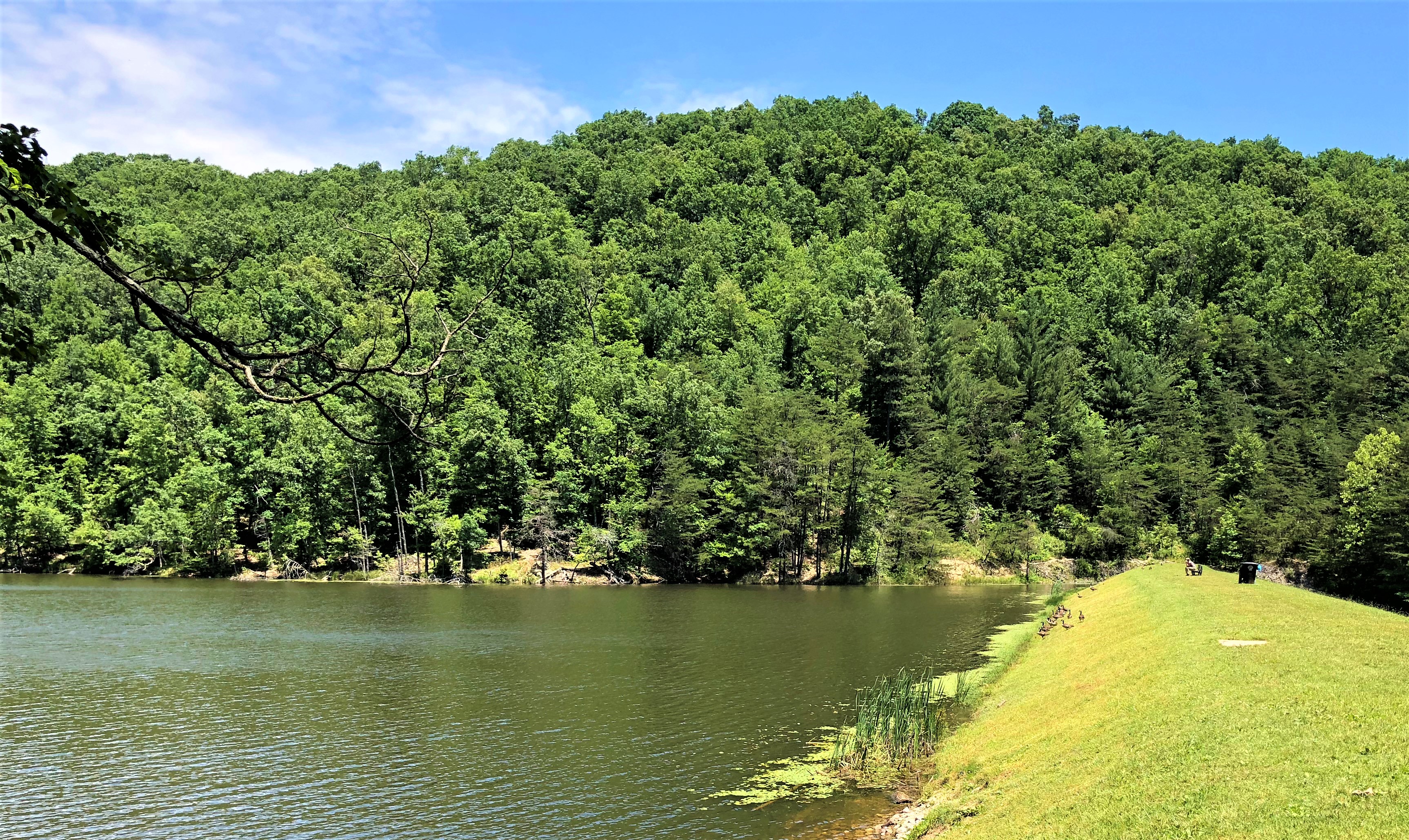
Eagle Lake (24.2 miles)

For those who survive the steep descent down the hillside at mile 23.6, Sheltowee Trace hikers encounter the tailwaters of Eagle Lake. Constructed in 1950, Eagle Lake is often seen in the distance and through the trees long before south-bound hikers ever make it to the water’s edge. This body of water was created by the impoundment of Evans Branch and named for the Morehead State Eagle mascot.
The approximately 30-acre lake is noted for its unusually clear water and excellent fishing. Trails and natural waterways have been developed by the university and are used to enhance hands-on learning in numerous classes at the school. The Sheltowee Trace passes by several Eagle Lake Wetland study areas. The Eagle Lake Loop Trail (#114) has been developed to allow hikers to explore more of the headwaters of this lake, which permits day-time fishing only as enforced by the Kentucky Department for Natural Resources. Enjoy the natural beauty but keep walking, for you have almost finished this hike.
Morehead State University (24.5 miles)

Morehead State University started in October 1887 with one student and a dream to educate the children of Rowan County. The school, started by Frank Button and his mother, Phoebe, was a private institution founded as a “normal school to teach teachers how to teach.” The Button curriculum centered on education through an emphasis on religious and moral teachings. The school operated until 1922 when the Kentucky State Legislature assumed control of the school and renamed it the Morehead State Normal School. The first class graduated in 1927.

Since its early beginnings in 1887, the school has grown from a one-room college to a state-of-the-art research and education center accepting students from across the county and around the world. In 1966, the school underwent another name change when university accreditation was achieved, and Morehead State University was born.
MSU Alumni include NFL Quarterback Phil Simms, Janet Stumbo (first woman elected to the Supreme Court in Kentucky), game show host Chuck Woolery, Olympic gold medalist Jon Rauch, NPR radio host Steve Inskeep, and others. The University is world-renowned as a center for space science.
Your hike will enter the MSU campus on the top of the hill just before dropping down Evans Branch to Eagle Lake. You will cross the campus near the Recreation and Wellness Center, Rocky Adkins Commons, the ROTC obstacle course, Baird Music Hall, and other campus buildings as you make your way to Main Street by following the turtles painted on the sidewalks.
Morehead, Kentucky 40351 (24.7 miles)
Colonel John Louis “Bally John” Hargis established the city of Morehead, Kentucky in 1856 on the banks of Triplett Creek. Hargis, born in 1802, purchased the property after moving to the area from Breathitt County. He started a small commercial center, and a town quickly grew up around his home.

He named the community Morehead in honor of his friend, James Turner Morehead, who served as Governor of Kentucky from 1834 until 1836. When Rowan County was created in May 1856, Morehead was named its seat of government over the larger and more developed community of Farmers.
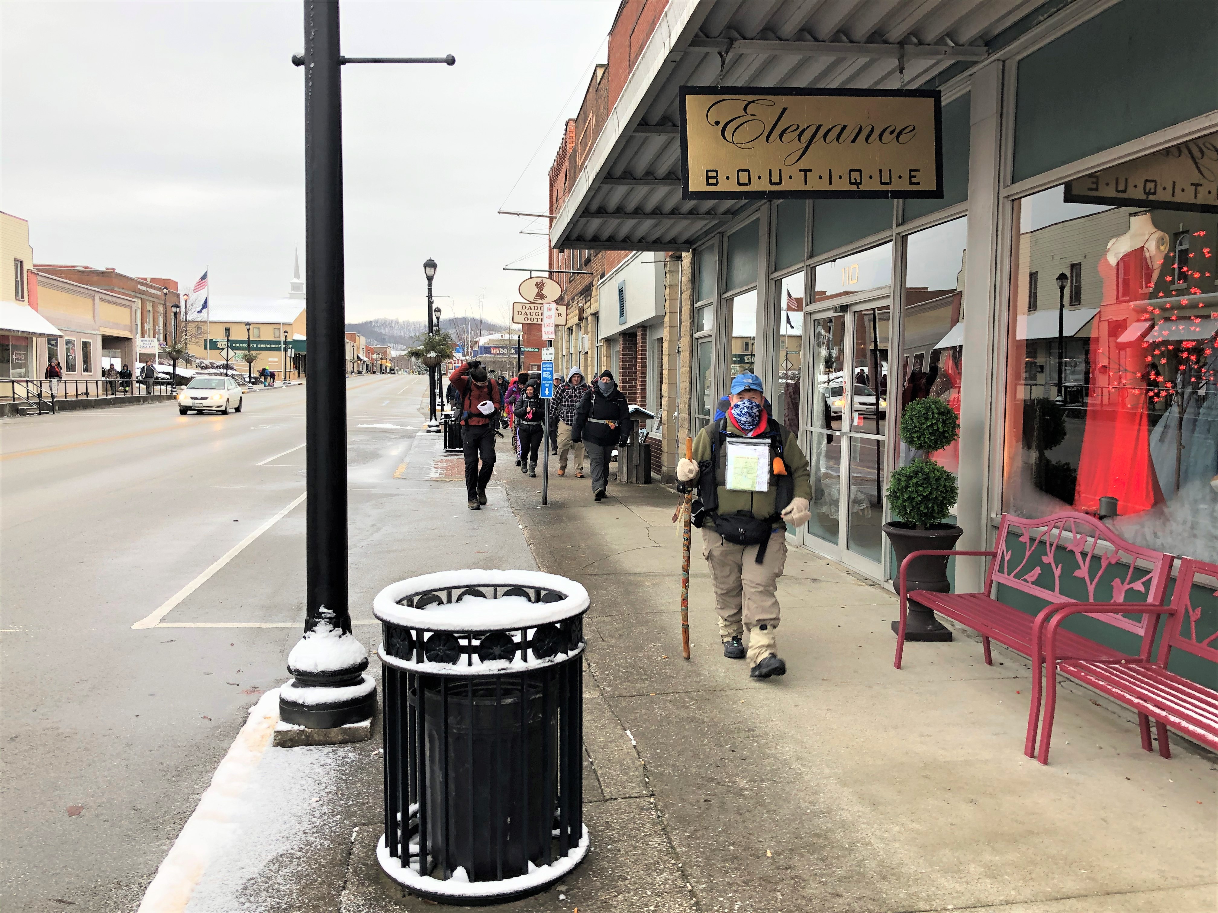
Since then, the city has grown and the establishment of the University helped Morehead develop into a regional commercial hub. Today, local restaurants and active arts communities have a wide variety of something for everyone.
The Sheltowee Trace once passed near Morehead but made a right turn, bypassing the community. In 2012, Morehead completed the certification as an officially designated Kentucky Trail Town. The Trace was rerouted through the Morehead State campus and down Main Street.
Hikers will pass numerous restaurants, coffee shops, City Hall, arts and craft centers, grocery stores, and other governmental buildings. The Sheltowee exits Morehead on the way to Clearfield and the trail beyond.
Our hike will end halfway down Main Street at the Morehead Convention Center parking lot. We will march back here in February, as we will flip that month and march North due to parking constraints at the Clear Creek Trailhead.
January is the beginning. Before us are miles of sweat, cold, rain, snow, heat, snakes, nature, and glorious beauty. It is not easy, but waiting for us are thousands of interesting and beautiful sites in the next 327.50 miles. (Just think, you will have just hiked 13.843% of the trail.)
The STA and all of us who have hiked this trail and love these trodden paths have a responsibility to help others find these and other special places. I hope to continue this series for each hike so that you can get more out of your experience on the Big Turtle.
I hope to see and visit with each of you in the coming months. Please feel free to introduce yourself and ask any questions that you might have. The time is almost here. Pack those rucksacks, and we will see you in a few days.
© January 2026 by Stephen D. Bowling
