
By Stephen D. “Bookie” Bowling
Welcome to Hike One of the 2025 Sheltowee Trace Hiker Challenge. We are glad you chose to join us on this 343-mile adventure through the woods and fields of Tennessee and Kentucky. There are several ways that the Sheltowee Trace Association helps hikers complete this challenge and have a more enjoyable time doing it. Your monthly fee supports the shuttle service and drinks and water that are often provided. It gives you access to the unlimited knowledge of the trail shared by Executive Director Steve Barbour and the cadre of veteran hikers who support the Sheltowee Trac Association’s mission.
In 2024, the STA produced a Trail Guide that provides a myriad of information about the trail to help guide you. The small, lightweight book also contains historical and cultural information to add to your knowledge of the geology, terrain, history, and beauty of the places we will visit in the next eleven months. Get your copy of the Trail Guide at the Sheltowee Trace Association website.
Each Wednesday before the first hike of the month, I will produce a “What To See” blog post to add a little more flavor and history to the Sheltowee Trace. Many people can identify “What To See” pictures to help them stay on the trail. I hope my little writings keep you on track and add to your enjoyment of our little walk in the woods.
Here is some information about things you will see on Hike One in January 2025.
Burnt Mill Bridge
The 2025 Sheltowee Trace Hiker Challenge begins at Burnt Mill Bridge near Robbins, Tennessee. The Burnt Mill Bridge spanned the Clear Fork River for over 110 years. On the night of March 28, 2021, the eastern section of the bridge was washed off its pillar and collapsed into the river during record-high flooding. The river crested at 20.61 and was the second highest level on record after numerous rounds of heavy rain dropped more than 8 inches of rain on the area. At its peak, more than 36,000 cubic feet of water flowed under and over the bridge before it fell. The smaller western section of the bridge survived the flooding.

Built in 1911, the bridge carried vehicular traffic across the river until 2003. The span was constructed with a Pratt Through-Truss section on the east side of the river and a smaller Half-Hip Pratt Truss section on the west. The Tennessee Department of Transportation inspected the wooden planked bridge in 2003, and the TDOT condemned the crossing. The state constructed a new concrete bridge to handle the traffic in the area. The new crossing opened in 2006.
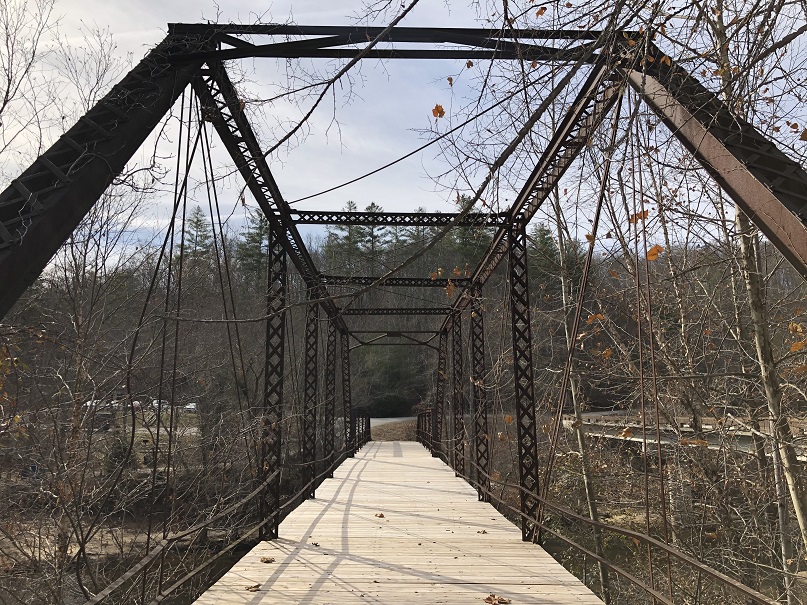
The Burnt Mill Trailhead is the official beginning of the 2025 Sheltowee Trace Challenge, but many make their way to the remnants of the bridge as the symbolic end of the trail when headed south. Take the time to celebrate the beginning of your journey. Be proud of what you will accomplish with sweat and hard work over the next eleven months!

New Trail Coming Soon (Maybe)
When headed south after crossing Honey Creek Loop Road, the Sheltowee Trace makes its way down the hill toward the Clear Fork River and turns toward Burnt Mill Bridge. The Sheltowee Trace stopped at the Trailhead at Burnt Mill Bridge for many years, but soon that will change. The new trail will spur off the current Sheltowee Trace and head south past Joe Branch and the Gentlemen’s Swiming Hole. The Sheltowee Trace Association has worked with the National Parks Service and the leadership team at the Big South Fork to extend the trail another 11 miles to the new southern terminus at Rugby. The historic R. M. Brooks Store will be an important stop.

Several miles of the new trail were completed in 2021, but heavy rains and flooding negated that work. Crews have been working to complete the new section, but sadly for the 2025 Challenge is not finished yet. Only about 3 miles remain to “dig in.” Plans are in the works to someday extend the Sheltowee Trace to Wartburg, where the Sheltowee will eventually connect to the Great Eastern Trail/Cumberland Trail.
Ice Castle Falls

Ice Castle Falls is the largest of the four waterfalls that hikers will pass in a short .3-mile section of the Sheltowee Trace along Honey Creek and its tributaries. Boulder House Falls, Secluded Falls, and Honey Creek Falls round out the four falls in this beautiful sandstone gorge.

Honey Creek
Named for the abundance of natural honey found in hollow trees along the bank of the creek early settlers provided this creek’s name. The honey bees can still be found in the area drawn primarily by the abundance of wildflowers, tulip poplars, and other flowering trees. Honey Creek is described as the “most challenging hike” in the Big South Fork Park. The trip through Honey Creek includes “steep, narrow trail sections, numerous creek crossings, slick boulders, and confusing trail junctions,” according to Big South Fork literature.
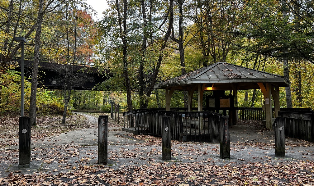
O&W Overlook Picnic Table
At the top of the ridge overlooking the O. & W. Bridge is a single picnic table on the trail’s edge. The picnic table was placed by horseback riders who frequent the trails that occasionally cross and are often shared with the Sheltowee. A very nice overlook is located just a few hundred yards away.
The O. & W. Overlook provides a view downriver to the Oneida and Western Bridge and an upstream view of the Clear Fork River. There are plenty of places to hang a hammock and flat ground for tents in this area.
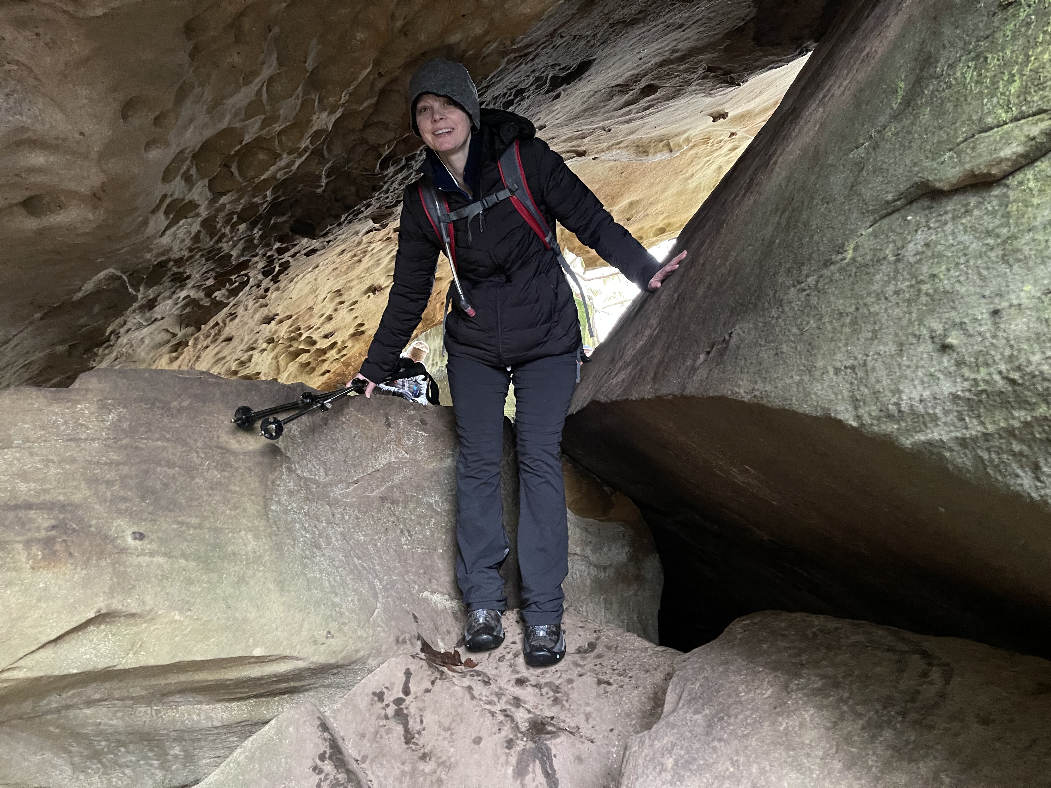
The Devil’s Den
After leaving the picnic table and walking a short distance down the steep hill, the Sheltowee passes a large sandstone rock shelter on the left side of the trail and about 50 yards away. This yellow and orange sandstone opening is known as the Devil’s Den.
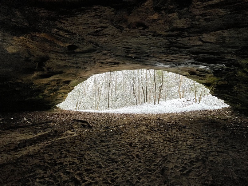
This natural feature has been used by Native Americans, early hunters, and hikers to shelter from the rain. The evidence of campfires can often be seen in the open but is highly discouraged and is illegal. Stop by the Devil’s Den for a rest and a few pictures on your way down the hill.
Jake’s Falls
Before dropping over the hill for the steep descent to the O&W Bridge, a large but seasonal waterfall can be found on the left side of the trail. This plunge waterfall is known as Jake’s Falls. Its proximity to Jake’s Hole, a large and deep pool in the Cumberland River, helped provide this natural wonder with its name. The waterfall can be heard long before the weary traveler comes face-to-face with its beautiful spot, and it is one of the few places to get clean water in this section.

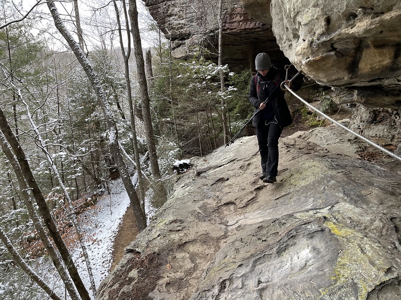
The Climb (or The Descent)
It’s never the distance that gets you- it’s the elevation. The O&W climb will get you- that is, if you are heading south. For us, the “The Climb” section becomes the “The Descent.” The steepest section of the trail can be found from the picnic table to the end of the O. &W. Bridge. Over the next .92 miles, the trail will drop nearly 700 feet into the Clear Fork River Valley. This section of the trail is often muddy and slick.
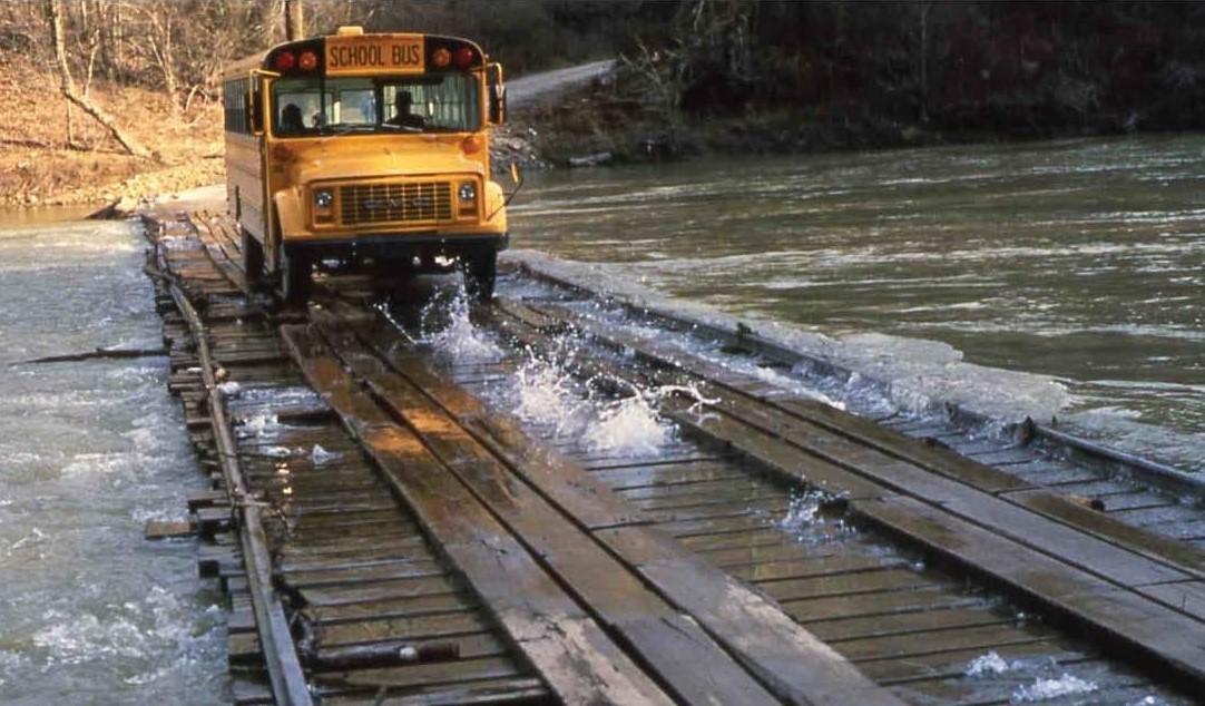
O & W Bridge
The Oneida & Western Railroad started construction in 1913 of a new line to harvest the virgin timber along the Big South Fork of the Cumberland River. By June 1915, the line had extended from Oneida, Tennessee, to the river at this point. Construction started on a Whipple Truss bridge across the river. The structure, built by the Nashville Bridge Company, opened in 1915 and provided a crossing for the railroad’s extension to Jamestown.

The railroad prospered in the 1920s and added passenger service for the residents of Fentress and Scott counties. Following the economic collapse of the economy in the 1930s and a reduced demand for coal following World War II, the railroad was scheduled to be closed. It was saved and purchased by the Jewell Ridge Coal Company in 1946. Jewell operated the rail line until 1953, serving the communities of Jamestown, Pine Haven, Zenith, Speck, Toomy, Verdun, and Oneida. Jewell Ridge operated the railroad at a loss until the last train crossed the O&W Bridge on March 31, 1954. Since then, vehicles, horses, and hikers have regularly crossed the bridge.

Leatherwood Ford Trailhead
The trail follows the Big South Fork of the Cumberland River from the O. & W. Bridge north to Leatherwood Ford. The well-used trailhead at Leatherwood Ford provides access to numerous trails. The parking area includes access to the Angel Fall Trail, restroom facilities, and drinking water, available here for most of the year. In recent years, record-breaking floods have covered this area.
Leatherwood Ford Bridge

A slight bend of the Big South Fork of the Cumberland River allowed rocks and debris to create a natural ford. Early settlers utilized this shallow crossing, and the Civilian Conservation Corps later constructed a bridge on the site. Through the years, floods and high water blocked the crossing. Scott County officials had to refloor the bridge following every major water event. Highway 297 also crossed here in later years. The remnants of the metal low-water bridge can be seen at the site of the original river ford. The Sheltowee Trace once crossed the river at Leatherwood Ford but was moved to the large, plate-girder highway bridge, which replaced the old crossing in 1983.
Angel Falls
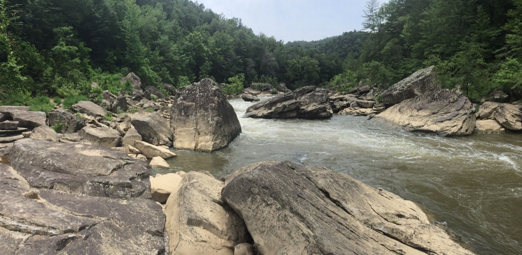
The Angel Falls is located nearly a quarter mile in the valley of the Big South Fork below the Overlook. The roar of Angel Falls can be heard from the Overlook as the water pours over and through the large boulders, but it cannot be seen. Angel Falls was a 10-12 foot split current waterfall in the Big South Fork River. The exact date is unknown, but before 1954, when the park was established, dynamite was used to clear the large boulder that slipped down into the stream’s course. Local legend has two stories for the blast: a fisherman who wanted to open the river and a story about jammed logs headed to market. The result is the same regardless of the reason.

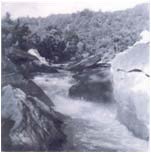
The blast cleared one stone and created “a dangerous class III-IV rapid with a bad undercut,” according to the National Park Service. The Service recommends that paddlers port around these technical rapids. The Falls are not located along the Sherlowee Trace but can be accessed from the parking lot at the Leatherwood Ford Trailhead. According to the National Parks Service classifications, the Angel Fall Rapids Trail runs 2.0 miles and is considered an easy trail. The Rapids trail passed evidence of numerous coal mines near the mouth of Anderson Branch, downstream from Leatherwood Ford.
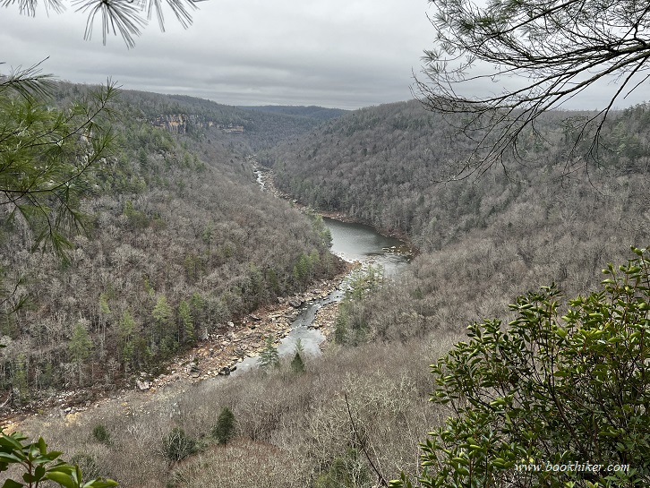
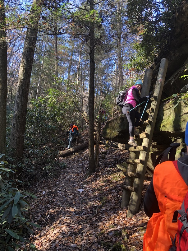
Angel Falls Overlook

Angel Falls Overlook is the name given to a large sandstone outcrop that towers over the Cumberland River near Angel Falls. The sound of the water rushing through the Angel Fall Rapids below can be heard through the trees from this high vantage point. The overlook is located .15 miles off the Sheltoweet Trace and is marked by Forest Service signs. It is well worth the short walk. At the top of the steps after the cliff walk, make a right and follow the trail. Reverse the walk to come back to the Sheltoewee Trace. This overlook provides the iconic view of the Big South Fork, which is most often used for promotional materials.

Archie Smith Grave
The Sheltowee Trace passes by a single grave on the long ridge after leaving the Angel Falls Overlook. Little Archie Smith died in October 1932 and was buried near the family home. Today, his grave is visited by thousands each year, and they wonder who he was and what happened.
Read the complete history of Little Archie here.

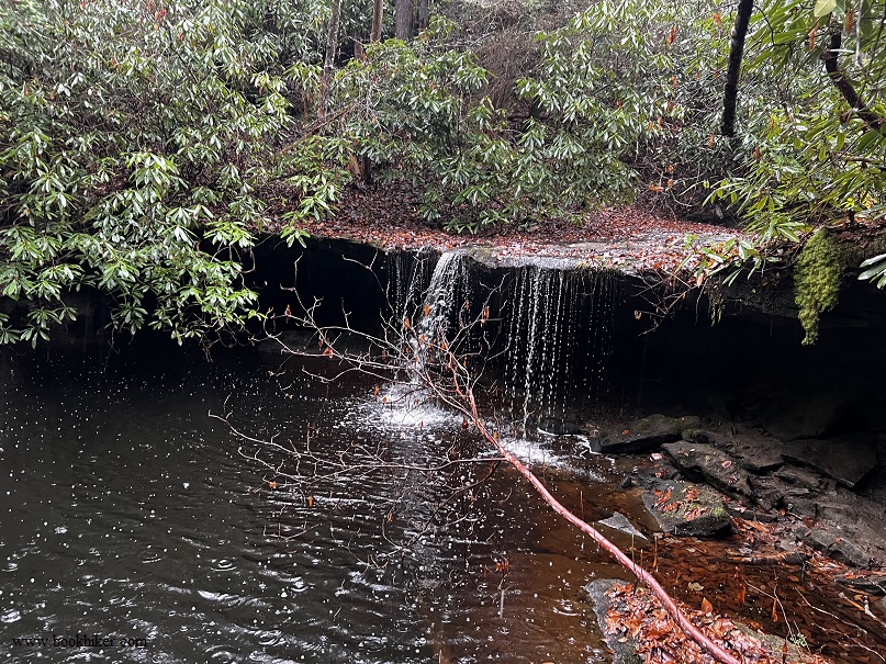
Falls Branch Falls
Just 1.7 miles south of Bandy Creek Campground on the Sheltowee Trace, Falls Branch Falls is a ten-foot, single-plunge waterfall near the trail. The Fall Branch Falls is one of the hundreds of waterfalls in Scott County, Tennessee, as documented by the Tennessee Landforms website.
Scott State Forest
As you climb Falls Branch, hikers enter the 2,826-acre Scott State Forest. The state of Tennessee purchased the largest portion of the forest in 1938 after the property owner failed to pay his taxes. The Forest is located in northeastern Tennessee, in Scott and Fentress Counties, and is named in honor of General Winfield Scott, the hero of the Mexican War. The Scott State Forest is completely surrounded by the Big South Fork National River and Recreation Area.
The forest is used for research, including tree improvement studies, where various strains of native species are grown and tested. The forest comprises large stands of hardwood trees, with many of the stands near “rotation age” or maturity for harvest. The Forest once had vast stands of eastern white pine, but thousands of these trees have been lost to the invasive southern pine beetle since the outbreak in 2001. It is difficult to determine the number of trees killed by the 3-millimeter beetle, but it is estimated that as many as 85,000 pine trees are killed yearly in Tennessee.

Bandy Creek Campground
Bandy Creek Campground is located 16 miles from Oneida, Tennessee. The site offers 181 campsites, including 96 with trailer hook-ups and 49 tent camping sites. Picnic tables and fire rings are also provided at each, and bathhouse/restroom facilities are within easy walking distance. A large swimming pool is popular with summer campers, and Bandy Creek Visitors’ Center is nearby. The Sheltowee Trace and numerous other trails in the area are easily accessed. A stable nearby offers another way to enjoy the Big South Fork on your trip.
Fentress and Scott County Line

From Charit Creek to Bandy Creek, the Sheltowee Trace parallels the Scott and Fentress County, Tennesse line. At one point, the Sheltowee Trace passes within 150 feet of the Fentress County line but never crosses it. Fentress County was created on November 28, 1823, from portions of Morgan, Overton, and White Counties. The county seat at Jamestown is home to about 2,000 residents.
A Tennessee State Park is a popular tourist destination in Fentress County. The Sgt. Alvin C. York State Historic Park in Pall Mall, Tennessee, is the family home of Alvin York, the most decorated American soldier of World War I.
York was awarded the Congressional Medal of Honor in 1919 for leading an attack on a German machine gun installation where he and a few other men captured 35 machine guns, killed 25 German soldiers, and captured 132. The attack was part of the offensive that finally broke the Hindenberg line and led to the German surrender.
He returned to Fentress County and lived at Pall Mall for the remainder of his life. He died on September 2, 1964, and is buried in the Wolf River Cemetery in Fentress County.

Time Zone Change

Hikers might notice strange electrical changes to their telephones and watches along this section of the trail. Sheltowee Trace hikers often report that the time changes back and forth and often jumps forward and backward an hour. It is not a supernatural area, and you are not likely to be abducted by aliens (despite what Floyd Shanz might tell you). There is a perfectly good reason why this anomaly occurs.
For much of this walk, hikers are about 75 yards from the diving line between the Eastern Daylight Time Zone and the Central Daylight Time Zone. The trail passes very near the line for about two and a half miles- close enough to drive your electronics crazy. Don’t worry; the trail never crosses into the Central Time Zone on our hike. The Rugby Extension will eventually cross that line between Mount Helen and Burnt Mill Bridge.
Charit Creek Trailhead
Hike One for 2025 ends at the Charit Creek Lodge Trailhead. This large trailhead and adjoining horse trailer parking area serve the many trails in this area of the Big South Fork National Park and Scenic River. The trailhead is also the parking area for the Charit Creek Lodge, which requires a one-mile hike down the hill for an overnight stay. That means a one-mile hike back out to return to your vehicle for those who journey down the mountain. We will see the Charit Creek Lodge on Hike Two, but for now, you are finished.
Go home and rest. A good soak in the tub with some Epson salts does wonders for the body and legs. Dry out your gear. Store everything away and get ready for Hike Two. Look through your gear and decide what you did not use and do not need to carry. Take it out of your pack for Hike Two.
Until then, have a great rest of January, and we will meet again on the trail in February.
© 2025 Stephen D. Bowling
